Yesterday it was really nice outside for a while. We had fair skies in the afternoon with high temps in the 60s. It was still dry, and the pollen wasn’t too bad yet. Over the next 2 days the pollen levels will be up, the winds will be strong, and the temps will rise big time! Today we started off in the upper 40s to low 50s over much of the region. We had partly cloudy skies.
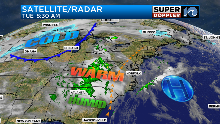
It was very nice out. Today we still have high pressure offshore. there is a strong cold front affecting the Midwest.
We’ll have a mix of sun and clouds through the early afternoon. Then in the late afternoon we’ll have some scattered rain showers.

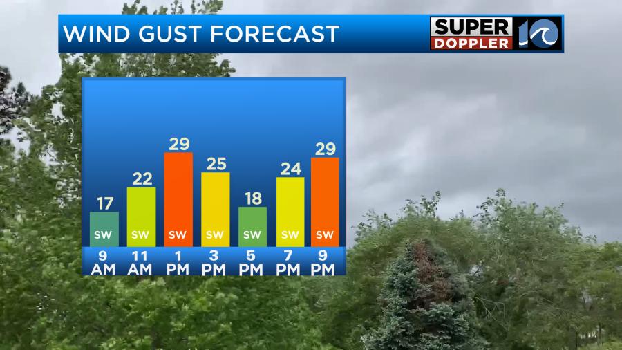
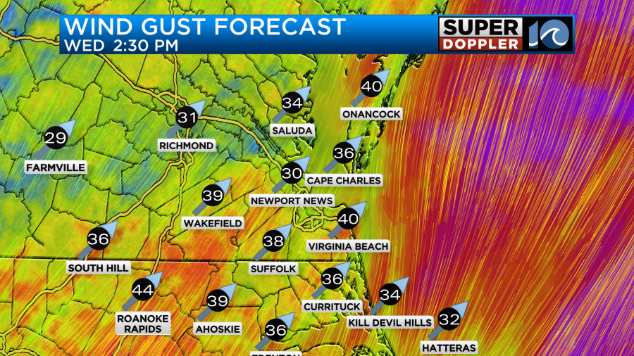
The wind will be gusty out of the southwest. Gusts will be up to 25mph, and could even reach 30mph in some spots.
These conditions will push our high temperatures up to the low-mid 70s later today.
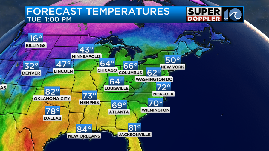
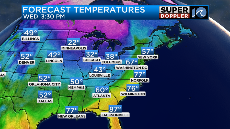
They will likely be breaking records off to our west and northwest. It will be in the 80s and 90s over parts of the deep south. It will be in the 60s and 70s in the Midwest. However, cold air will pour over Montana and the Dakotas. Tomorrow that cold air will slide to the southeast. We’ll still be warm here. In fact high temps could reach a record. The forecast temperature is in the mid-upper 70s. The record is 79 degrees (2011).
The wind will be stronger tomorrow. We’ll have southwest winds blowing at 15-20mph with gusts up to 40mph.
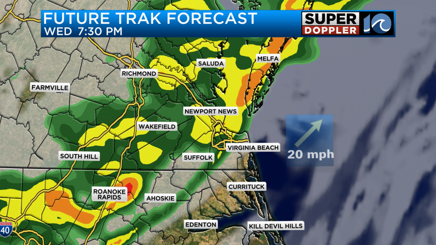
We may have a few spotty showers early in the morning. Then we’ll have a long stretch of dry weather. We’ll likely stay dry through the late afternoon and early evening. However, by the time the evening commute comes around a line of rain and isolated thunderstorms will move into the region.

This will be a fast moving system. So the line of rain looks to move in by about 7-9pm.
There will already be wind gusts to 40mph. So if any thunderstorms do form then they could have briefly contain even stronger winds for a time. Also, heavy downpours could briefly occur as the fronts slides in. Winds will turn out the north. Much drier air will return behind the front. Also the wind will turn out of the north, and temps will crash. We’ll drop down to the upper 30s to low 40s by Thursday morning. Wind chills will be in the 20s and 30s. Wow! We’ll have clearing skies at least. However, even with some clearing we will have a much colder day on Thursday. High temps will only be in the upper 40s in the afternoon.

We’ll be dry on Thursday and chilly. Then we’ll have some decent weather on Friday. High temps will return to the 50s with partly cloudy skies. I’ll talk more about next weekend in tomorrow’s weather blog.
Meteorologist: Jeremy Wheeler


