We just finished out January, and it was a mixed month for temps. There was a cold week followed by a warm week followed by warm week. It went on like that all month.
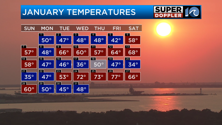
In the end (if I read it right) we finished about 2.8 degrees above average. It was a wet month. However, there were a lot of days with rain, but many days the amounts were light.

So we actually ended up about 0.2″ below average. Remember…You can have drizzle all day, but most of the time it will only add up to 1-2 hundredths of an inch.
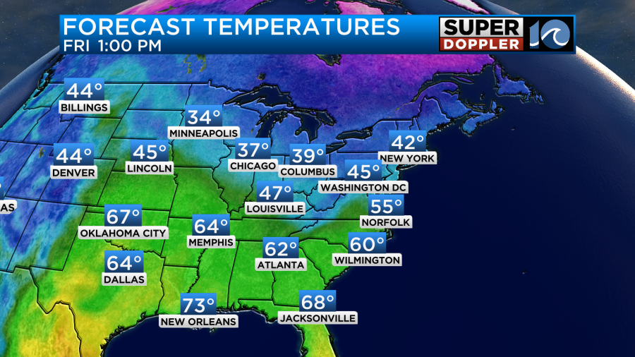
Yesterday we had high temps in the 40s as expected. Today we’ll warm up a bit. We started with temps in the 20s and 30s. It was cold, but there wasn’t much wind.
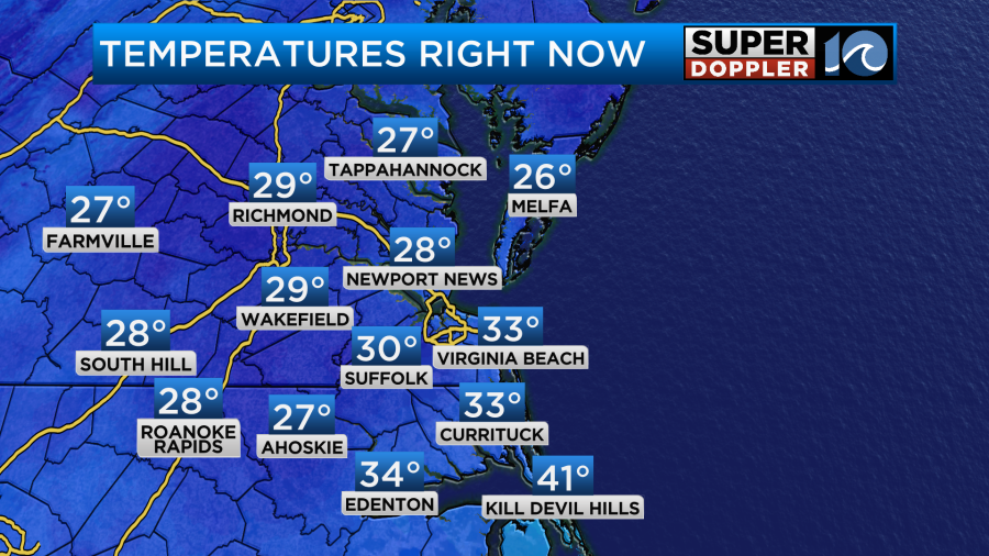
Thing is…. We also has some patchy fog this morning. So there were a couple of spots where freezing fog may have tried to form. Luckily the soil temps are above freezing. So I think these were limited.
Today we’ll have lots of sunshine back in the region. The large area of low pressure is moving farther away from our area. High pressure is building in from the west.
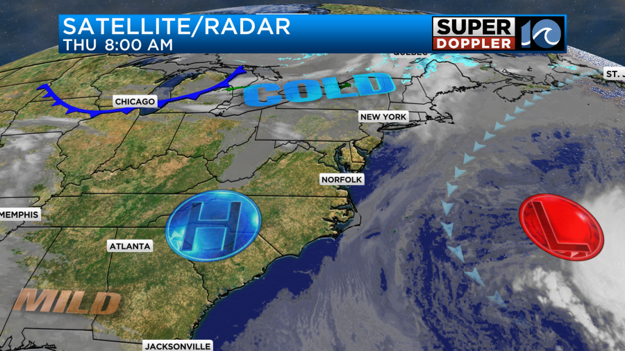
There is a cold front in the Midwest that will stream down our way by tomorrow. More on that in a moment.
We’ll have a light and variable wind today. Along with the strong sunshine we should be able to warm to the low-mid 50s this afternoon.
It should be pretty nice out later today once we get past the morning chill. Tomorrow we’ll have that cold front quickly slip through the region. High temps will make it to the mid 50s around midday. However, temps will likely fall to the 40s by the later afternoon.

We’ll have a mix of sun and clouds. There will be some isolated showers or sprinkles after the front passes. Winds will pick up out of the north.
We’ll dry out by tomorrow evening. Then we’ll be chilly and dry on Saturday. High temps will drop to the 40s.
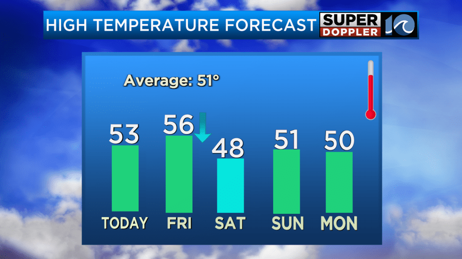
We’ll be dry on Sunday with highs returning to the low 50s. At least we’ll have sunshine this weekend. Monday will probably be dry, quiet, and cool. However, Tuesday and Wednesday of next week could get interesting. The models are calling for a large area of low pressure forming offshore. It should be pretty far from us, but it could be huge. It also could sit for a while. If this happens then we may not see much precip. However, we could have 2-3 days of windy conditions with some possible tidal flooding and beach erosion. The recent GFS model runs have been a little more bullish on this. The Euro has it going more out to sea. There’s still plenty of time to talk about it. We’ll have more information in tomorrow’s weather blog.
Meteorologist: Jeremy Wheeler


