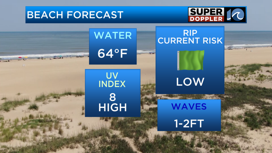
I’ve decided to stop showing the pollen forecast as the season has pretty much wrapped up. It’s time to start showing the beach forecast. Keep in mind that the air temperatures are heating up nicely over the next few days. (maybe too much tomorrow). However, the water temps are still rather cool.
The cool air temps over the last couple of weeks have not only stopped the water from warming, but there has actually been some cooling. Having said that… Today our air temps will warm quickly. High temps are aiming for the mid 80s this afternoon.
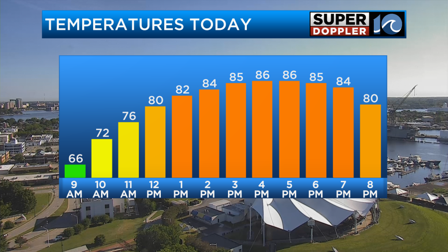
There will be some upper 80s inland, but it will be cooler near the shore. We’ll have lots of sunshine through the day. We have high pressure in the region with a cold front far to the west.
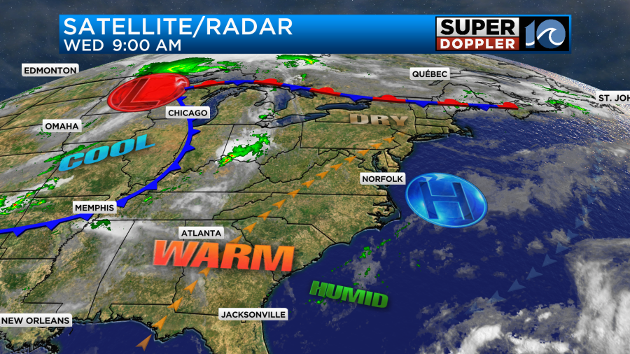
That cold front created some more severe storms and tornadoes over the Midwest yesterday.

Unfortunately, the storms were deadly. There was also one tornado that tore up part of a large wind farm in Iowa.
We’ll have quiet weather here today. There will only be a light southwest wind. Tomorrow we’ll heat up even more. We’ll have lots of sunshine again through most of the day with a little more clouds late in the afternoon. High temps will heat up to near 90 degrees.

The humidity will be up a little bit too. So the heat indices will be in the low 90s. There will be a bit more of a southwest breeze at 8-12mph. Our bodies are used to cooler weather. So be sure to stay hydrated over the next couple days. Especially tomorrow. There will be some isolated showers and storms later in the afternoon, but most of the day (and the area) will be rain-free during the day.
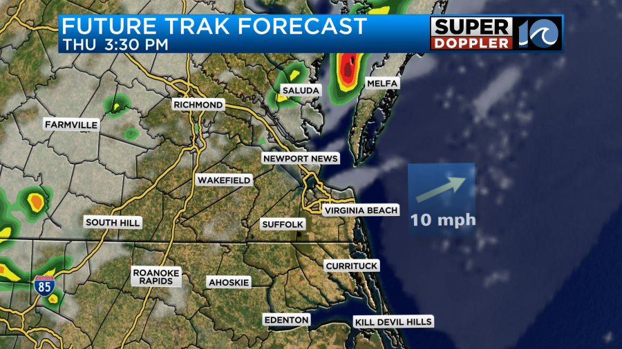
By the evening there will be a few more scattered showers and storms in the region. The models have backed off of the coverage for this time. However, there could be a couple of strong storms between about 5 and 10pm.
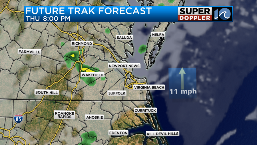
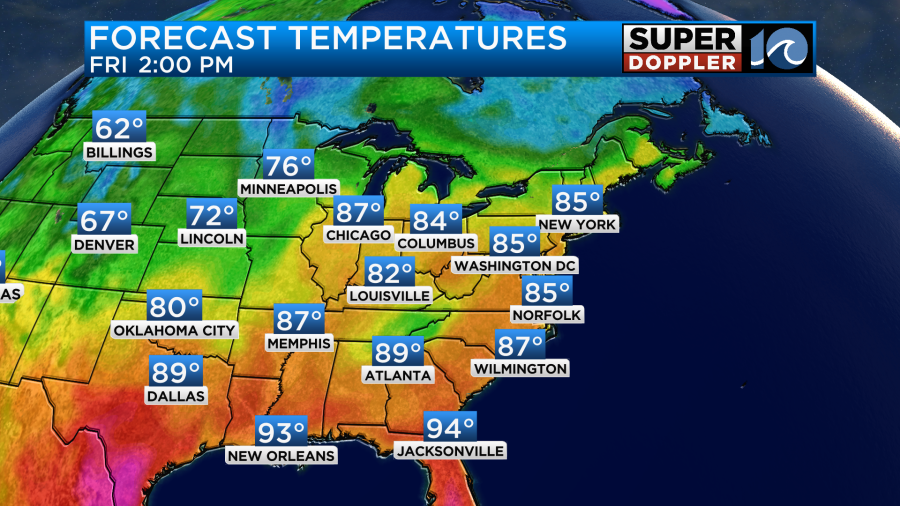
We’ll have to watch this carefully. The cold front to the west will be moving closer to us during that time, and it will (probably) stall out to our north. But if it stalls out a little sooner or later, then it could change the forecast. While it won’t pass through the area, it should be close enough on Friday that we’ll have some slight cooling. High temps will be in the mid 80s.
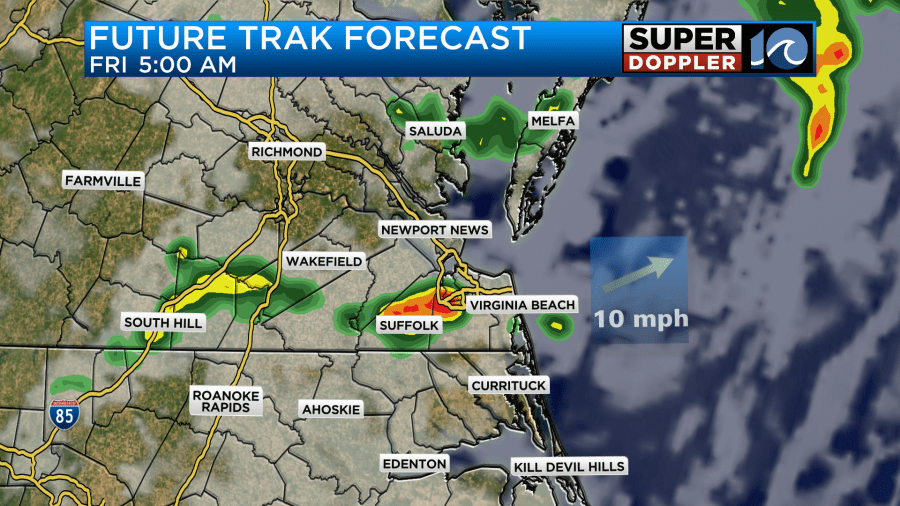
Part of this will be the increased cloud cover (partly cloudy). There may be a few showers in the morning. Then we’ll have a few more showers and storms in the afternoon. It will definitely not be a washout.

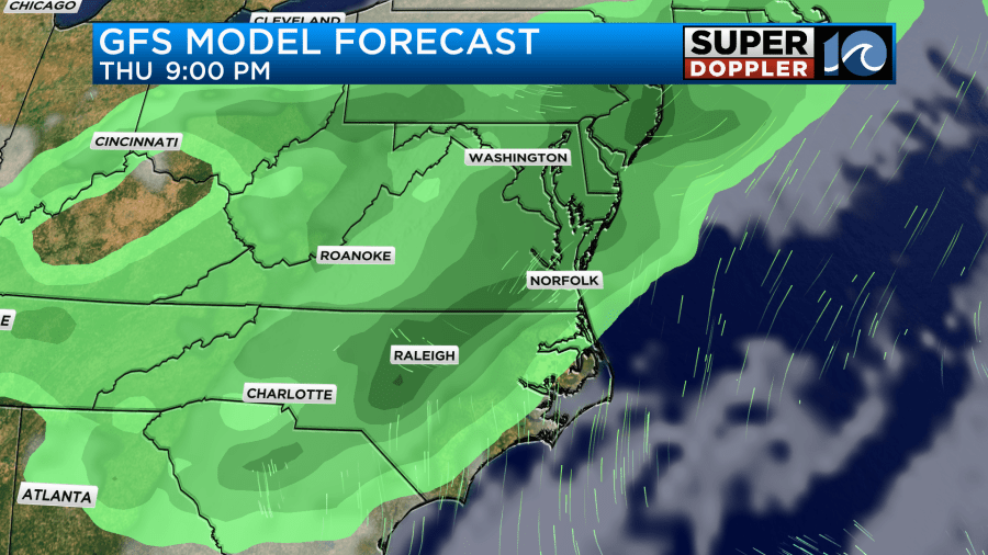
The forecast for Saturday has already changed once. It’s due to these weak fronts stalling and changing speed. For now the GFS has a mix of sun and clouds with a few showers and storms.
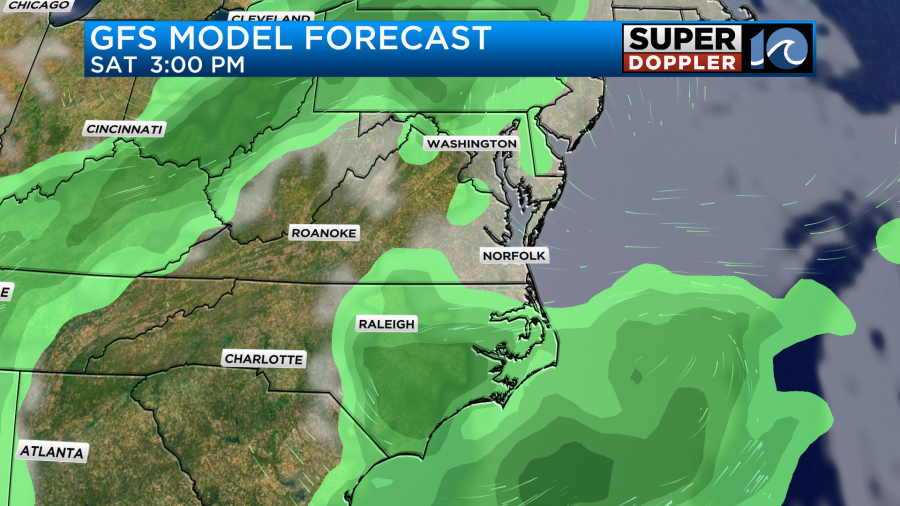
However, just yesterday it had a lot of rain in the region kind of on and off through the day. So I don’t have a lot of confidence in the drier trend yet. Stay tuned. Either way it will stay warm. High temps will be in the 80s. We’ll be in the 80s on Sunday. At least the models haven’t changed their tune about that day. They show partly cloudy skies with only some isolated showers or storms during the afternoon.
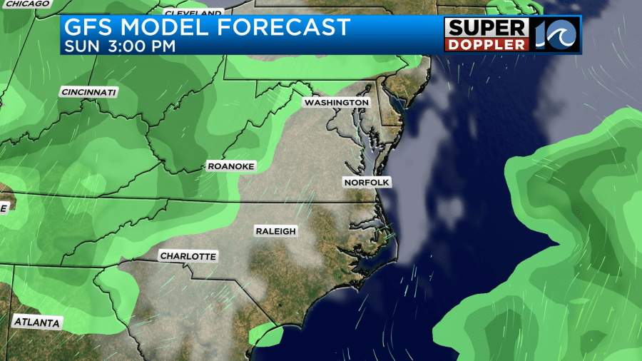
They do show some scattered storms in the evening. I’m gonna hold off on the Monday forecast for now. Let’s just say that for now it looks like some typical Summer weather with highs in the 80s and a few pop up PM storms.
The trends are solidifying, but the specific details are still coming together. We should be able to really start refining the forecast by tomorrow for the weekend. Enjoy the warmer weather!
Meteorologist: Jeremy Wheeler


