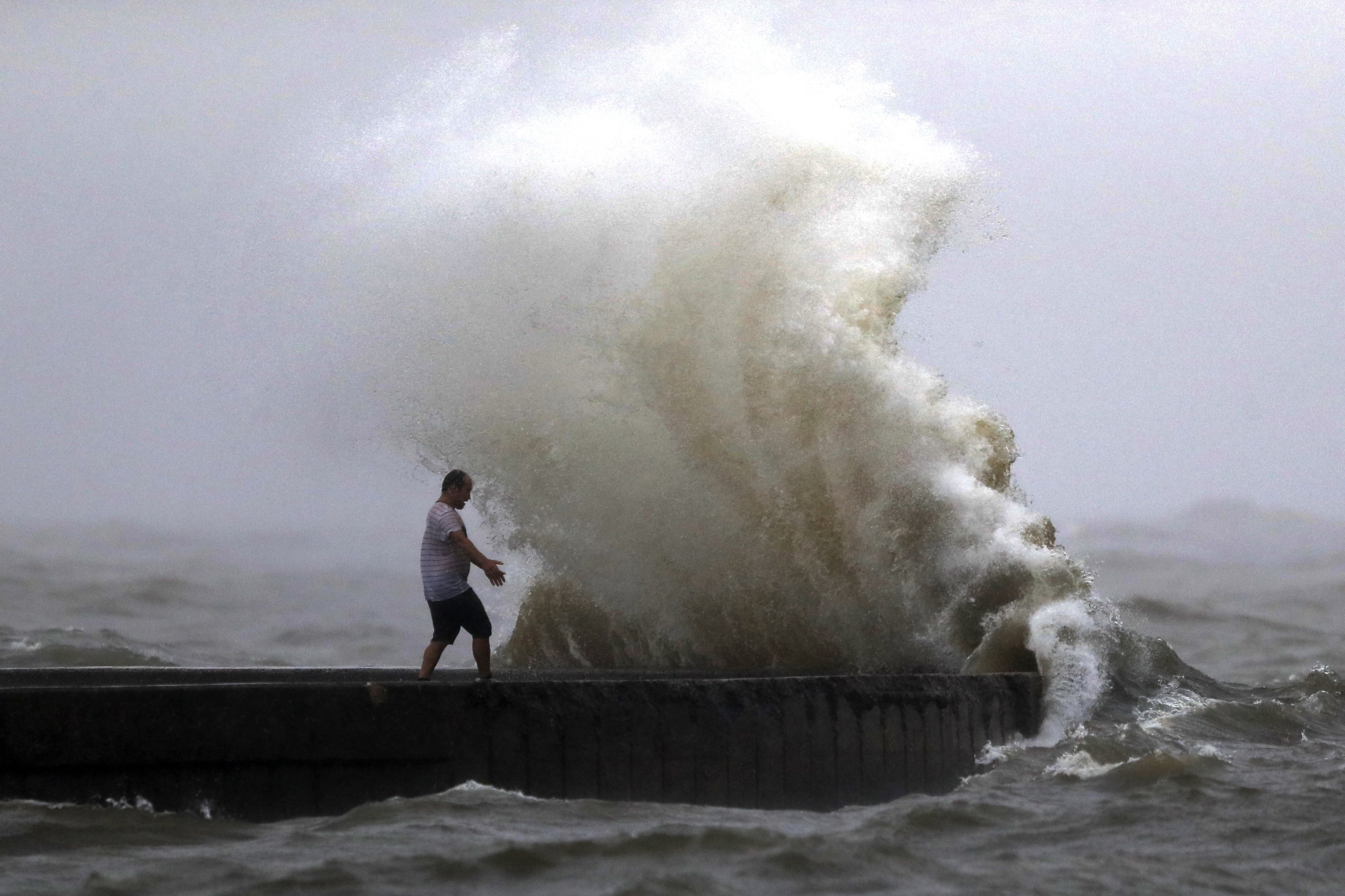
Cheers to the first day of Meteorological Fall, September 1, a sign that cooler days are on the horizon but a reminder that peak hurricane season is upon us. What was once a Category 4 hurricane is making a mess for thousands from the deep south to now those in the northeast. Ida’s leftovers will race by today and for us locally we’ve got a lot to talk about.
Update:
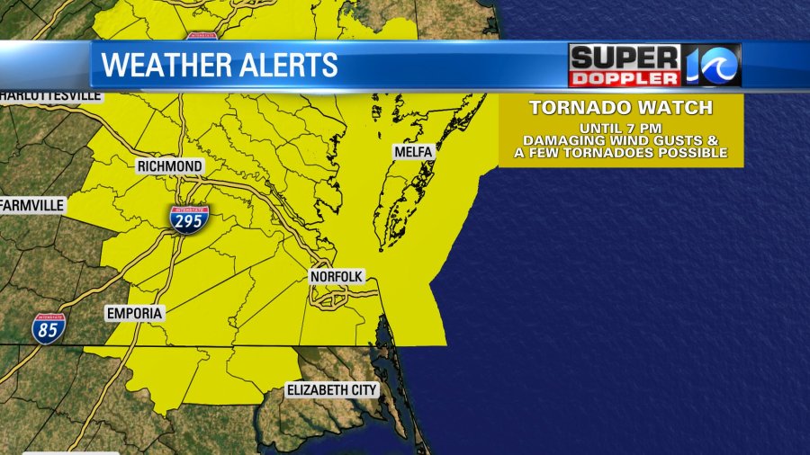
A Tornado Watch is in effect until 7pm for most of the Hampton Roads area. Within the thunderstorms that develop, damaging wind and a few tornadoes are possible.

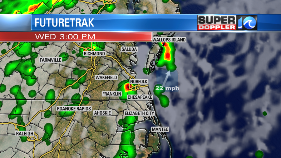
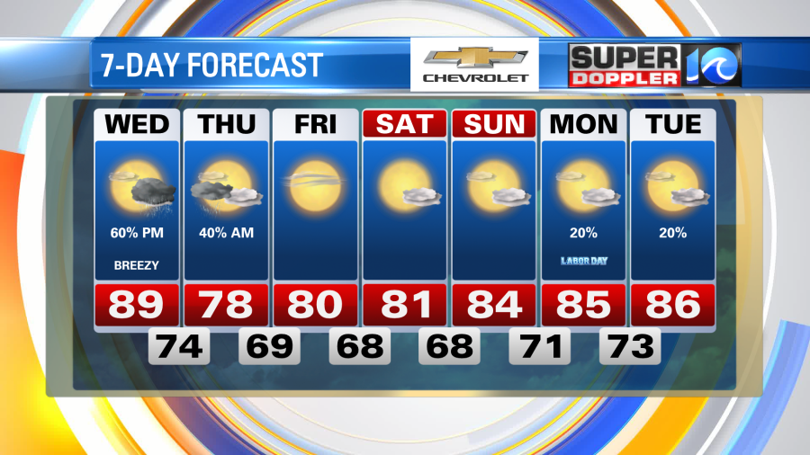
Most of the rain, flooding, & severe weather from this mess of a system will stay to our north. However, that’s not to say we’re out of the woods, we’ll be on the southern fringes of this system so we will see scattered thunderstorms. Today will feature a balmy breeze to take our high temperatures near 90°; the clouds will slowly increase into the afternoon when scattered showers and thunderstorms spark across the region.
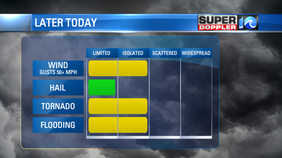
Some of these will be strong to severe, so be sure to have a way to receive alerts and stay weather aware. Damaging wind and an isolated tornado or two is possible within these thunderstorms. Most of which will be developing after 1 or 2 o’clock this afternoon, then taking us into the evening. It won’t be a total washout, so some of us may not see any rain at all, but those of us who do it could be dangerous.
By the late night hours the severe weather threat should die off and we’ll be left with scattered showers taking us overnight. A northerly breeze sets up and will be the source of an eventual beautiful Labor Day weekend. But a few rain drops will linger Thursday morning before clouds slowly depart the region later in the day. That northerly breeze will hold high temperatures in the upper 70s!
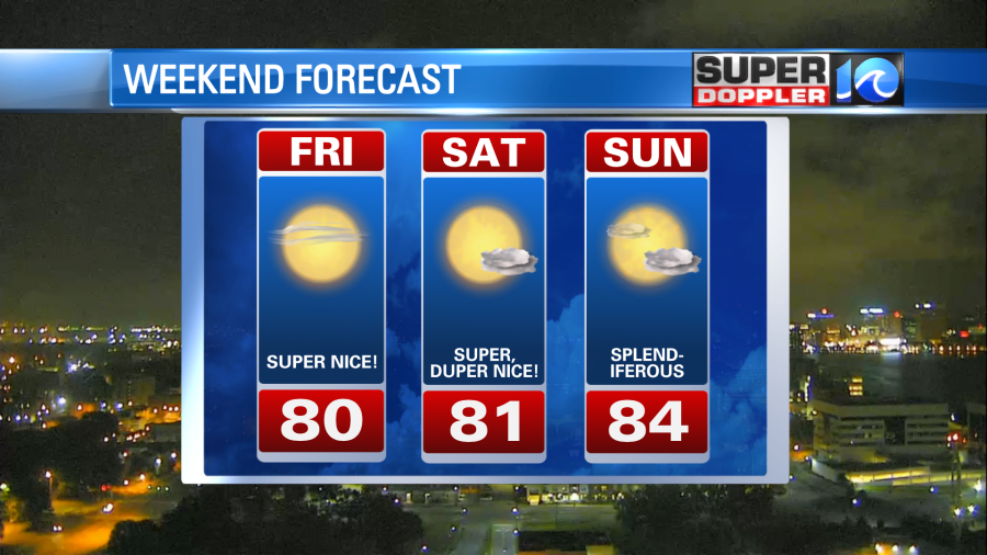
Lower humidity values, bright sunshine and highs only near 80°?! Does it get any better!? Labor Day weekend is looking fantastic. There is an outside chance of some rain on Labor Day itself, for now I’m keeping it isolated, but be sure to take advantage of the beautiful weather leading up to it.
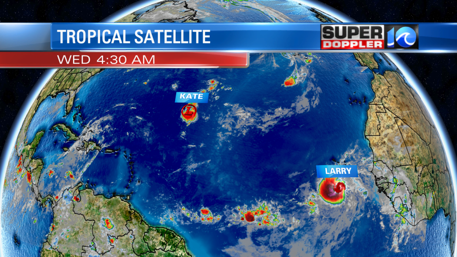
Elsewhere in the tropics, the 12th tropical cyclone has developed, Larry, way out in the eastern Atlantic. It’s expected to become a hurricane, and potentially a major hurricane, in the coming days as it meanders into the central Atlantic. This will be a long lived tropical cyclone and one we talk about for days, so there’s plenty of time to monitor it’s forecast. Also, Tropical Depression Kate will stay out to see, staying east of Bermuda. So we have no concerns tropically, just check back for updates after the weekend.
Stay weather aware this afternoon and take advantage of the weather this weekend.
Meteorologist Steve Fundaro

