(Update: Tropical Depression 13 has formed in the Atlantic. See the update below.)
As kids head back to school today they will hopefully be prepared for some hot weather. After the 3 cool days recently we started to heat up again over the last 2 days.
We have also had a lot of sunshine for the last few days. It’s been nice at times. This was from a big area of high pressure that is now locked-in to our southwest.
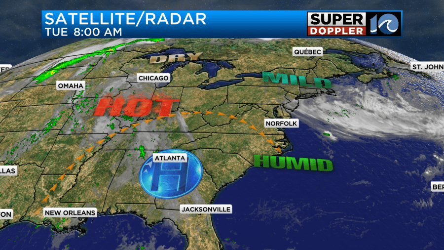
It will bring us more sunshine today. The way it’s lined up we’ll have a light north wind. So high temps will be down a degree or two from yesterday. This still puts us in the low 90s with some mid 90s inland.
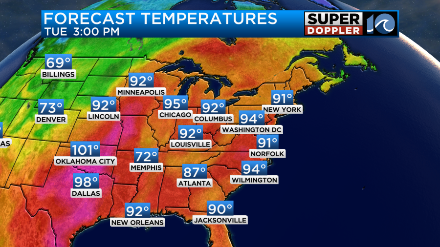
So it will be hot at those afternoon bus routes.

Keep in mind that the heat indices will be in the mid 90s in the metro and in the upper 90s inland. It may even hit 100 in a couple of spots.

Tomorrow and Thursday will be about the same. We’ll have lots of sunshine with high temps in the 90s. The heat index will climb to near or over 100 degrees for most of the area.
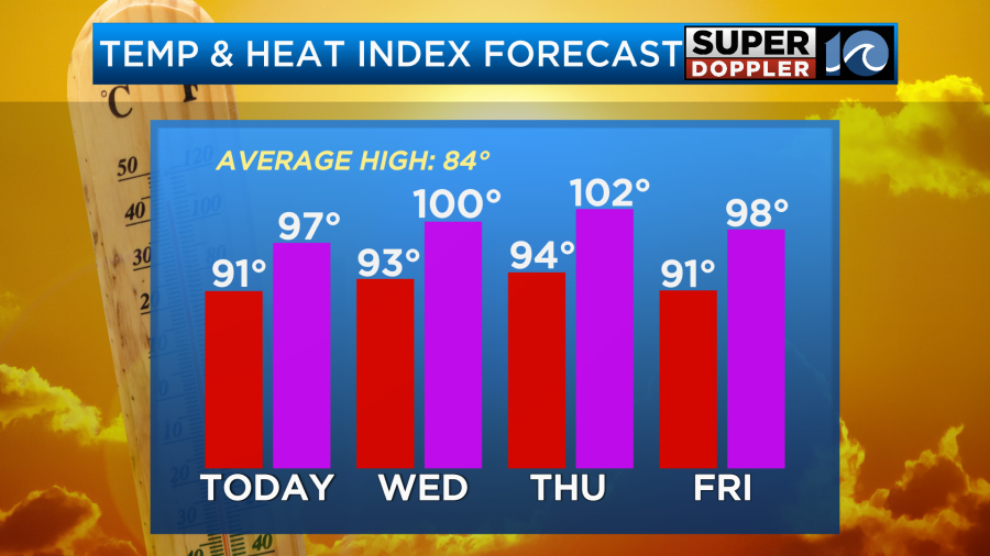
We’ll stay hot on Friday, but a few showers and storms may develop in the afternoon. A cool front will be edging closer on Friday, but it won’t come through until Saturday. High temps will be in the 80s next weekend, but it will still be humid. There may be some scattered storms each day, but the chance is not huge. I’ll have an update on that tomorrow.
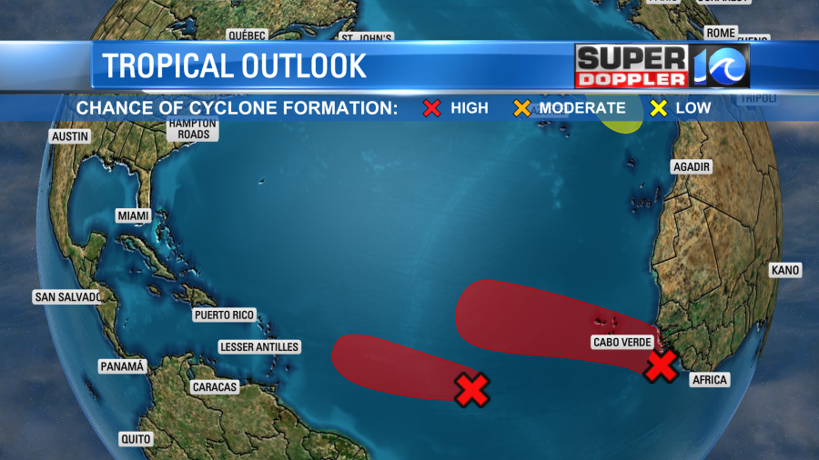
Meanwhile in the tropics… As of this writing there were no named systems in the Atlantic.
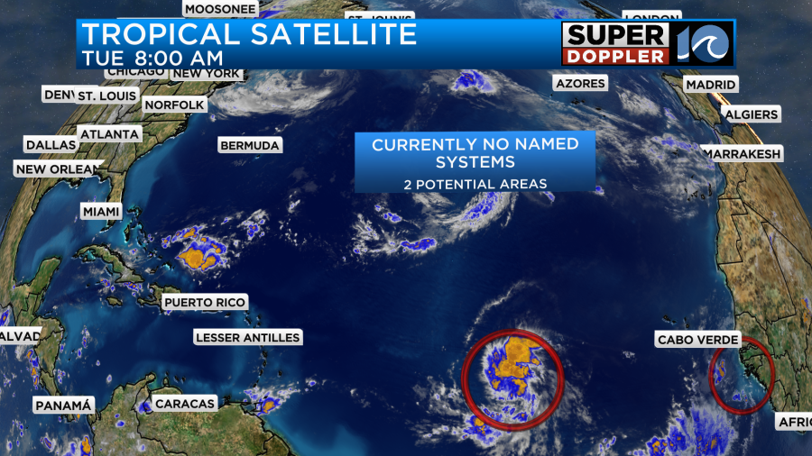
However, there is one area that we are watching closely. It’s called Invest 95-L, but I do like to stay away from that terminology. It’s basically a tropical disturbance in the middle of the Atlantic. This feature is moving west. It has a very high chance of formation in the short and long term. In fact it could become a tropical system by later today.
(Update: Tropical Depression 13 has formed in middle of the Atlantic. It is forecast to become a tropical storm, and then a hurricane. The name will be “Lee”. We have plenty of time for updates, but here is the track):
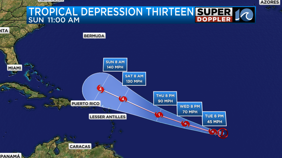
The models tend to take it to the west, then northwest. Then the model consensus rolls it up to a little west of Bermuda.
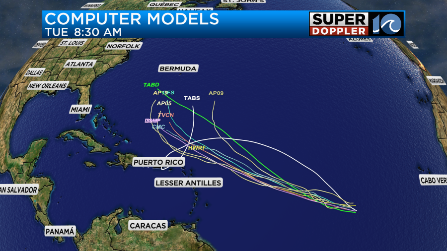
However, A. It’s still early, and the models could easily still change track. Also, B. there are several indications that this could become a major hurricane. It will most likely be “Lee”. So we will have to watch this one carefully. Even if it does stay offshore it would still send more high waves our way, and we could possibly get some extended beach erosion. We’ll see. Stay tuned.
Meteorologist: Jeremy Wheeler