Monday Afternoon Update:
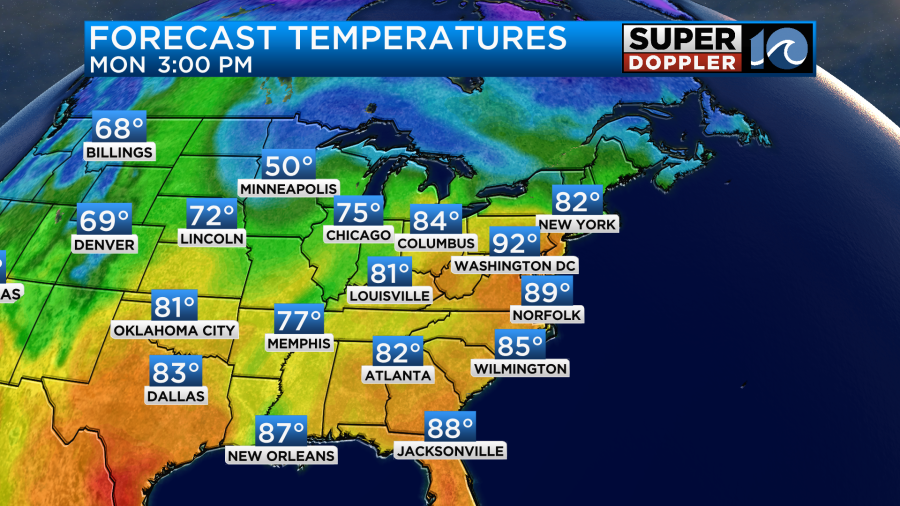
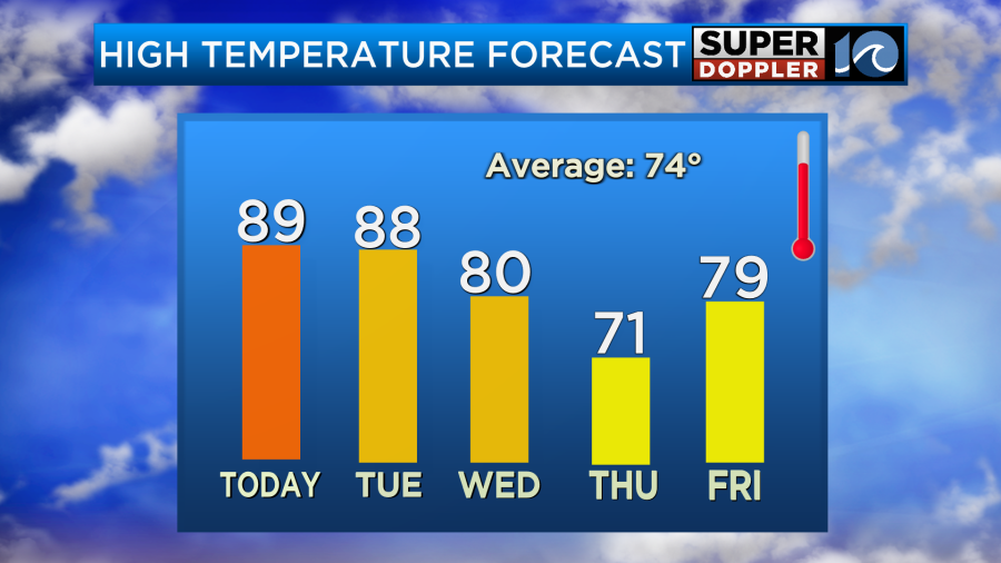
The big spring warmth will continue for another day… take advantage of it! High temperatures Tuesday should return to the mid 80s at least, with upper 80s possible as sunshine takes over.
A few high clouds drift in tomorrow evening/night ahead of a cloudier day on Wednesday. By midweek we’ll welcome some changes as a weakening cool front drops into the region. As it stalls across Hampton Roads, look for a cloudier day with scattered showers and a few thunderstorms.
The breeze behind the front shifts out the northeast, so temperatures will dip down into the 70s from Wednesday through the remainder of the week. More rain chances likely return by the weekend.
-Steve
______________________________________________________________________________________________________
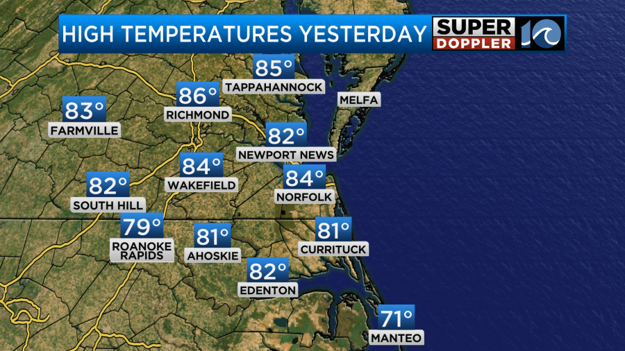
The cool streak was last week. Right now we are in the middle of a hot streak. Yesterday we flipped the switch from cool to warm. High temps made it into the 80s with looooots of sunshine.
While we enjoyed nice weather here, there were more severe storms over the Midwest and deep south. This after 2 days of multiple tornado reports. People have taken some of the most incredible (and scary) videos of the tornadoes that I’ve seen in years.
Luckily, we won’t be dealing with anything like that anytime soon. We have high pressure to our south.
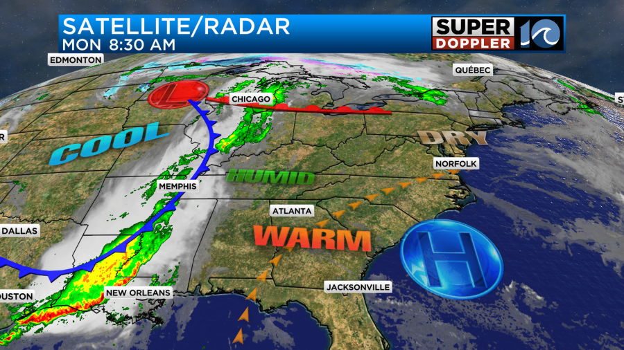
We’ll have lots of sunshine today. Winds will be out of the west/southwest at 5-15mph. These conditions will push our high temperatures up to the upper 80s to near 90.
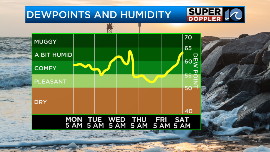
At least the humidity isn’t bad. I would say it’s low-moderate. Dew points are in the 50s. The humidity will go up a little later today into tomorrow, but it will rise more by Wednesday.
We’ll have more clouds tomorrow (partly cloudy). However, they will only take away a degree or two for the high temperatures.

We will start to cool down on Wednesday as a cold front sinks into the region. High temps will be in the upper 70s to low 80s. There will be more clouds and scattered rain showers. There may be a couple of thunderstorms as well. The models are handling the timing of the rain differently. Our Future Trak model has the rain starting up in the morning and continuing into the afternoon.
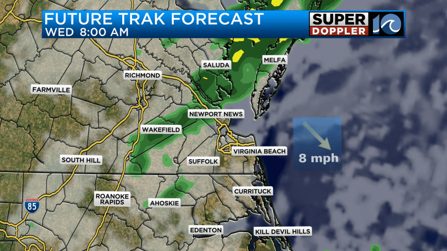
However, the GFS and European models have the rain more in the afternoon and evening.
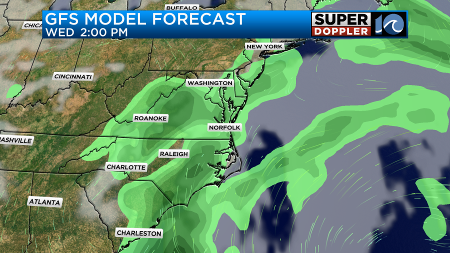
This difference in that timing will also dictate the afternoon temperatures. So check back tomorrow for updates on both.
Either way we will cool down a lot more on Thursday. High temps are aiming for the low 70s. We’ll be partly cloudy. We’ll be partly cloudy on Friday with high temps in the upper 70s.
Next weekend there may be some more rain. I’ll tackle that topic in tomorrow’s weather blog.
Meteorologist: Jeremy Wheeler