9:30 PM Update from Jeff Edmondson
The rain/snow line is slowly pushing south, I have seen a few reports of light accumulations in Gloucester, but right now our roads remain just wet. Overnight snow covered roads will be possible across the Eastern Shore and Middle Peninsula. The forecast appears on track with the information below written by Casey Lehecka.
Original 3 PM blog from Casey Lehecka
This seems like a reoccurring trend! Another storm moving through with the rain/ snow line that will be sitting across our area. Depending on where you live, you’ll either see all rain or a good amount of snow.
The rain continues for everyone through the rest of the evening, but the changeover to some snow will start to happen late tonight for the Northern Neck/ Eastern Shore and then move southward from there.
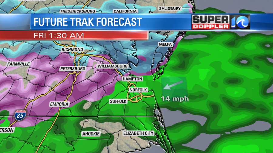
The image above shows a lot of purple which is more of a wintry mix, which is why there will be some ice accumulation in that area. For much of the Southside and NE NC this will be an all rain event.
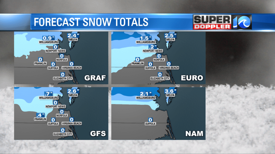
The models have finally started to come into agreement on how much snow will be falling. It looks like the Eastern Shore will be the “winner” on this storm ranging between 2″-3″ and Williamsburg will be 1″-2″ and Newport News looks like it will mainly be rain.
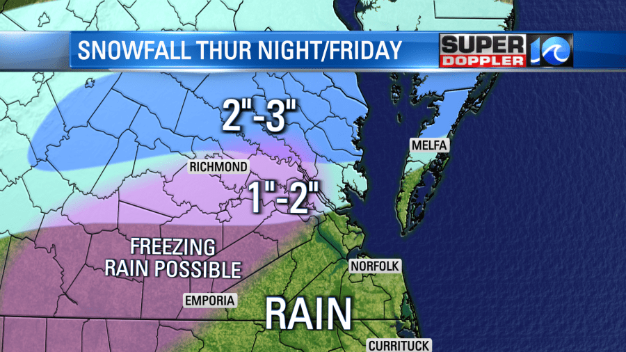
As of Thursday afternoon, here’s how the snow totals will pan out. For most it won’t be a huge concern but for the Northern Tier it could be a messy commute heading into work Friday morning.
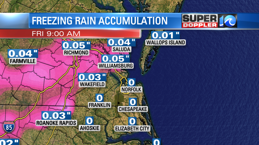
Ice is another factor that we’re keeping our eyes on. Because we will be hovering around the freezing mark, this will be something to watch out for.

For the areas shaded in purple, that’s a winter weather advisory for late Thursday into Friday issued by the National Weather Service.
We’ll keep you covered through the duration of the storm and update blogs as needed. Stay tuned!
– Meteorologist Casey Lehecka

