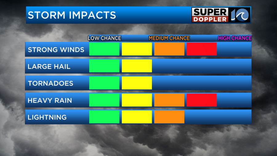
Feeling like summer again on this Memorial Day and that means another round of thunderstorms for our afternoon and evening hours. Some of these today could be strong to severe, so we’ll have to stay weather aware!
Cloud debris from last night brings us a nice sunrise to kick off Memorial Day, expect a mostly dry morning with a mix of sun and clouds. Feeling muggy, too.

By late morning, an isolated shower or downpour could develop across the region. But it’s not until this afternoon and evening we see a better chance for isolated to widely scattered showers and thunderstorms.
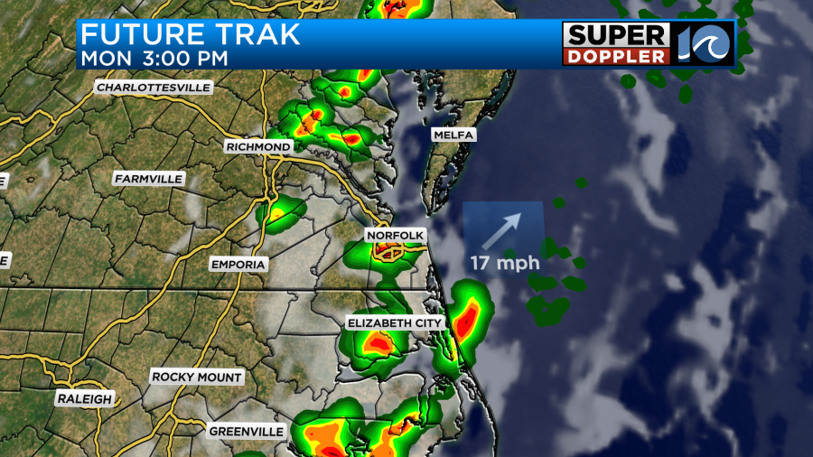
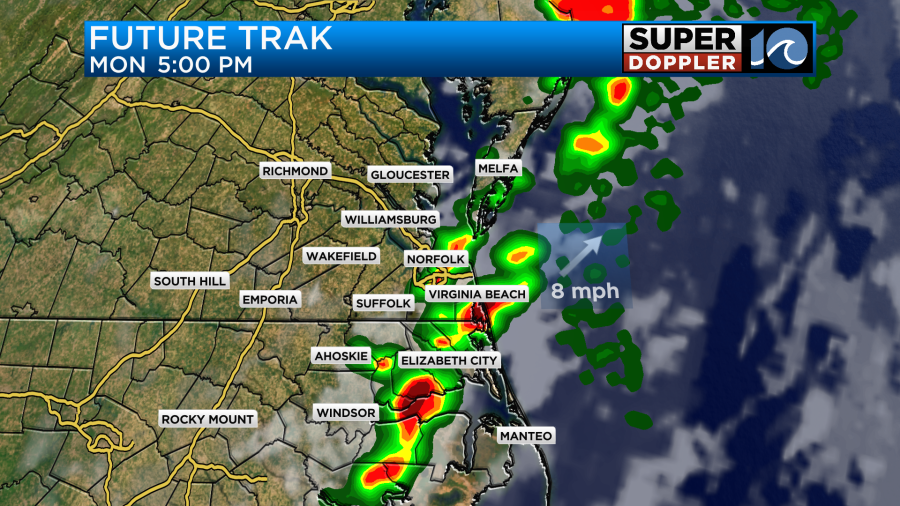
They’ll come from an approaching cool front working in from the west – unlike yesterday, these should be faster moving so we do not expect flooding. However, similar to yesterday, hail and damaging wind could be a factor. There’s a slim tornado threat as well, so again, make sure we’re staying weather aware this afternoon.
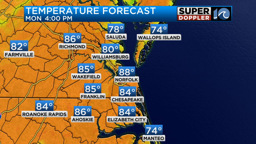
Temperatures today will easily reach the mid and upper 80s with elevated humidity levels.
After the front pushes through tonight, any leftover rain or thunderstorm activity will move out and drier weather moves in. Expect mostly sunny skies tomorrow with a stray afternoon shower. Highs will be in the 80s, and then low 80s and upper 70s Wednesday.
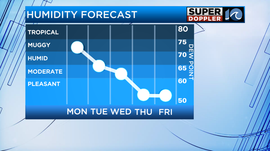
As the week goes on though, we’ll really notice the drop off in humidity. Refreshing weather truly takes over by the end of the week with highs in the 70s. Enjoy!

-Steve