Yesterday didn’t feel too bad outside to me. However, it was hot and humid for this time of year. High temps were mainly in the mid-upper 80s, and the humidity was moderate. Today the humidity will increase and the temps will rise a little more. One cool front is falling apart offshore. A stronger cold front is gaining strength over the Midwest. High pressure lies in between.
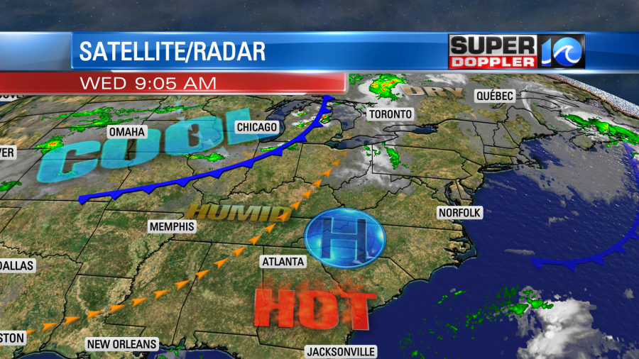
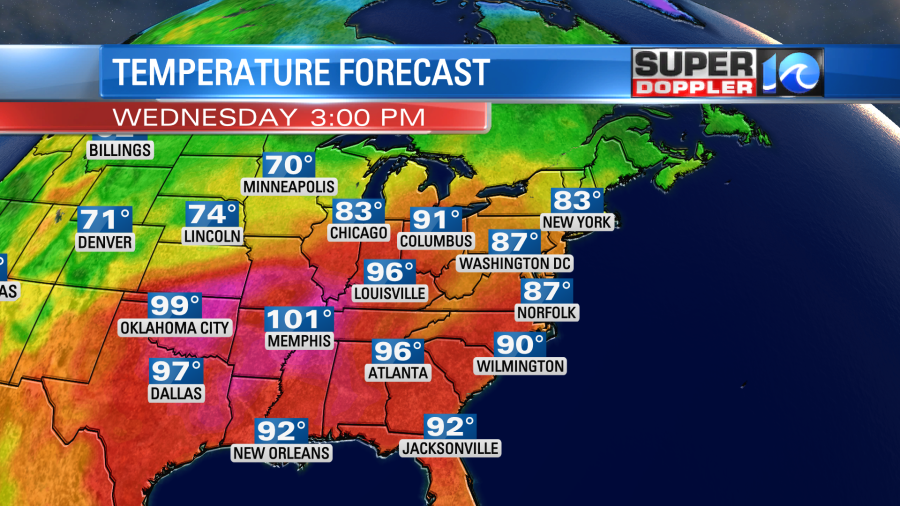
We’ll be mostly sunny today with a light and variable wind. So high temps will run up into the upper 80s with a couple of 90s inland. The heat index will be near 90 for many.
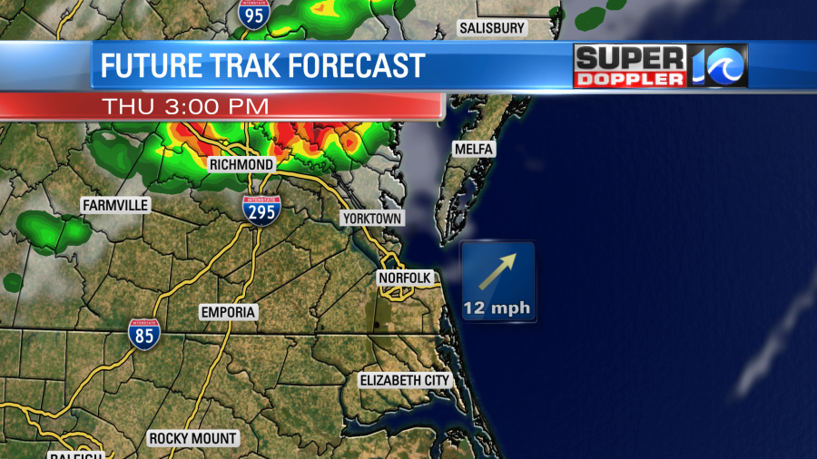
The strong cold front will march to the southeast tomorrow, but it won’t get here until late in the day. We’ll have quiet weather for the first half of the day. Then a few showers and storms will form north of the metro during the afternoon.
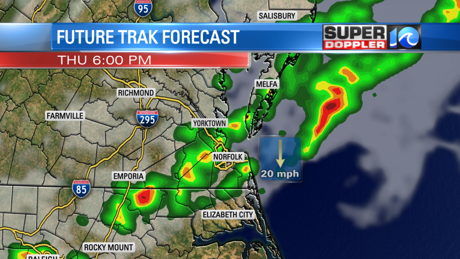
These storms will drop to the southeast into the evening. There could be a few strong storms with some gusty winds.
Hopefully, we’ll get some heavy rain for a bit. We need every drop we can get. I’m a little leery on the coverage though. Lately, the models have advertised a lot of rain, but the super dry ground has eaten up some of the past rain showers. So I’ve capped the chance at 40% for tomorrow. The models tomorrow morning will be more dependable. So check back for updates on that. Either way it is going to be hot and humid tomorrow. High temps will be near 90 in the metro. We’ll be in the mid-upper 80s north of the metro and probably in the low-mid 90s over North Carolina. However, tomorrow there will be a strong breeze out of the southwest. So that will help a bit in how it feels. That should offset the heat indices in the low-mid 90s a bit.
By Friday the big temperature drop arrives. High temps will only be in the upper 60s to low 70s.

The humidity will drop like a brick.

We’ll have lots of sun Friday with a steady north breeze. This will be the first full day of Fall.
We’ll have great weather on Saturday! We’ll have lots of sunshine with lows in the 50s and high temps in the low 70s. We’ll warm up a bit more on Sunday into the low 80s, but the humidity shouldn’t rise much.
While we will be cooling down nicely, the tropics are heating up. (Too cheesy?). As I write this blog there are 2 named storms with a high potential for a third soon.
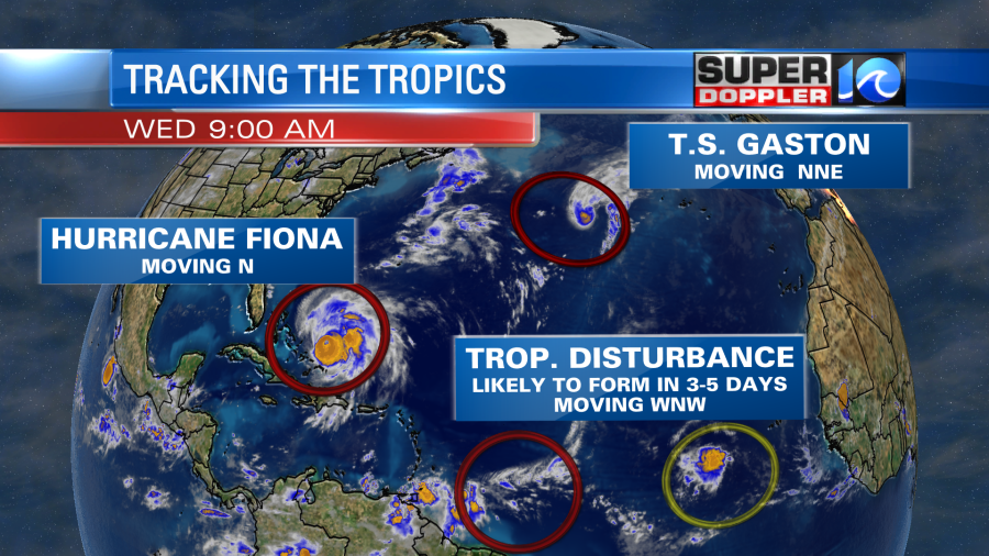
There are 2 weak disturbances in the eastern Atlantic, but I won’t be talking about them today. Hurricane Fiona has made the biggest headlines so far. It is now a category 4 hurricane. The eye is very distinct on satellite.
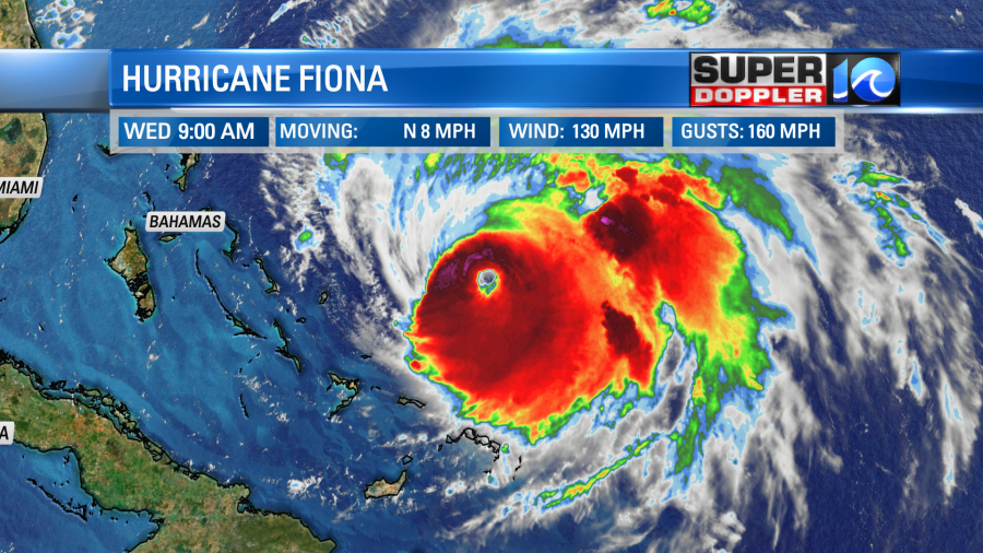
The hurricane is moving to the north at about 10mph. It will turn to the northeast, and it is forecast to move to the west of Bermuda by early Friday morning. The latest forecast from the National Hurricane Center keeps the hurricane force winds just to the west of Bermuda, but it has tropical storm force winds over the entire island.

If Fiona goes a little more to the east, OR if the hurricane expands more then they could be on the edge of the hurricane force winds. The hurricane will have some wind shear, and it will be steered northward by a large upper level trough coming in from the west. However, it will stay over warm water for some time. In fact it may hit as a hurricane or a powerful nor’easter along the Canadian maritimes by the weekend.
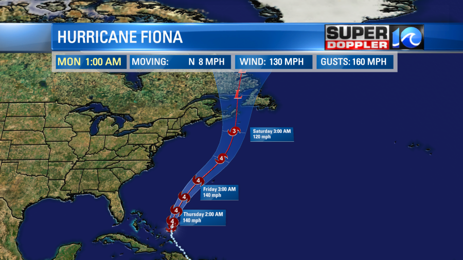
There have been several tropical systems hitting either Nova Scotia or Newfoundland over the last 2 decades.
Meanwhile tropical storm Gaston is currently churning over the northern Atlantic. It has gained some strength since yesterday evening. It will continue to move northeast and then meander around.
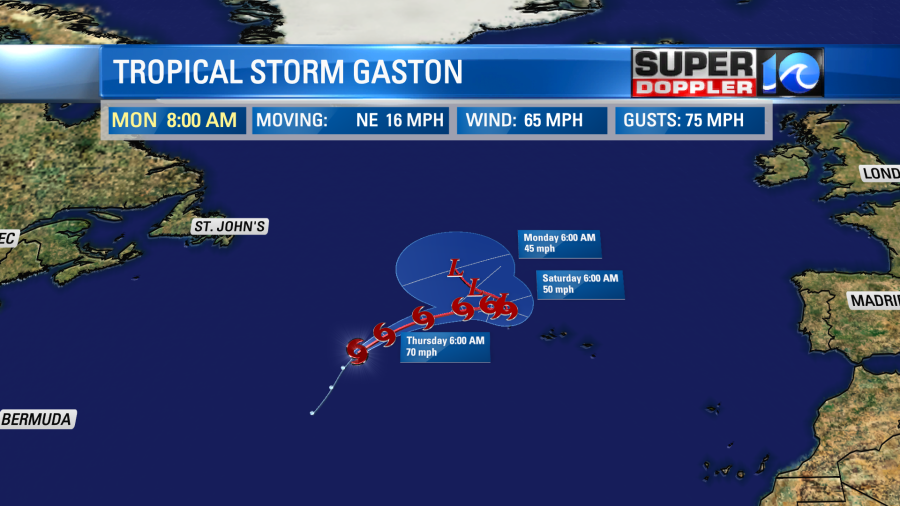
It should eventually weaken over the north Atlantic and should pose no threat to land. It should even miss the Azores islands.
So the next potential system will likely be from a tropical disturbance east/northeast of South America.
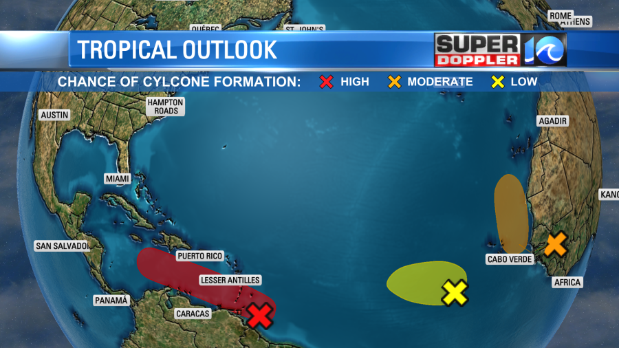
This feature is moving to the west/northwest. The concern is that it will move over the open waters of the Caribbean sea for a while. The water is very warm down there. Plus, there won’t be too much wind shear. So strengthening is likely. There is good agreement in the models at taking the tropical feature along this path. Then they split as to how fast and hard it turns northward.
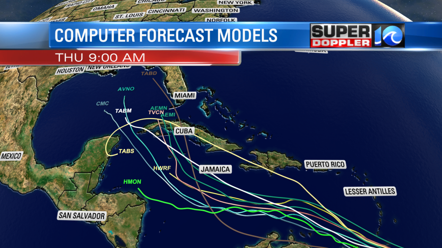
This will greatly depend on the synoptic weather over the U.S. The 2 global models (The GFS and Euro) take this into account. Here is what they show in about a week.
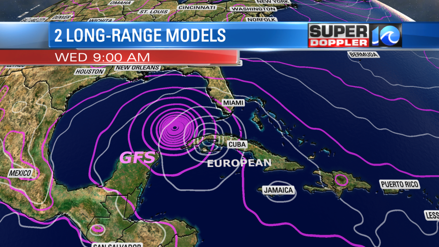
The GFS is scary as it sends the system (as a hurricane) into the Gulf of Mexico without any land interaction. So for now folks along the Gulf Coast will have to watch this carefully. There is a low chance that it could move more to the east and ride up along the east coast. We have LOTS of time to monitor.
With the recent uptick in tropical activity the waves are going to start increasing at our beaches soon. The rip current threat isn’t too high today. However, it will probably be high tomorrow through the weekend. The waves may be good for experienced surfers for a time tomorrow.
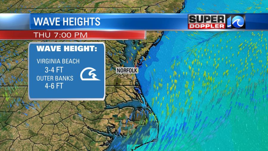
There could be some higher waves around Hatteras. Stay tuned to WAVY TV and FOX 43 for updates on all of this.
Meteorologist: Jeremy Wheeler


