Yesterday we did cool down as predicted. High temps were in the upper 60s to low 70s.
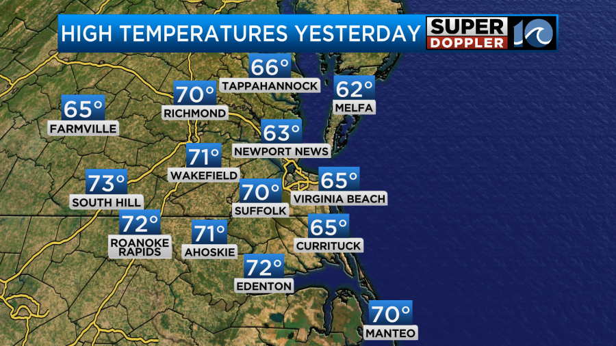
It was actually very nice out, and the temps were seasonable. However, the front that had stalled out to our south is now moving north as a warm front.
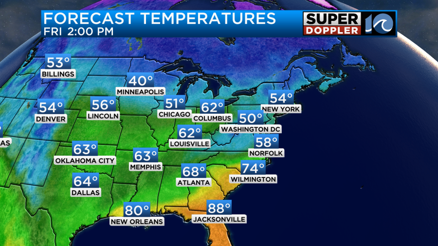
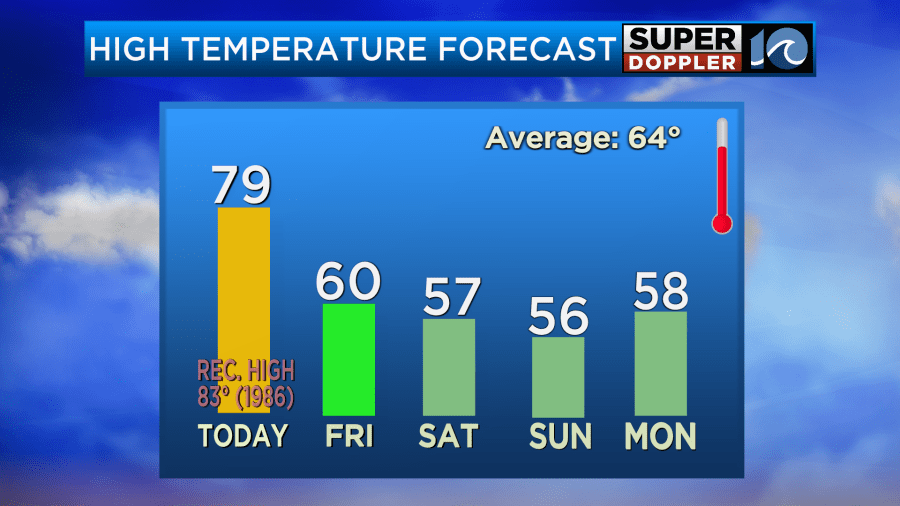
We’ll warm up today into the upper 70s to near 80 this afternoon. This is pretty far above the average.
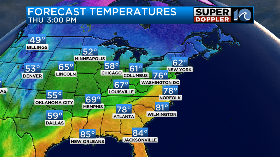
The average high for this time of year is in the mid-upper 60s. The record high for today is 83 degrees set back in 1986. We’ll be partly sunny today with the breeze out of the southwest. It will run up to 10-15mph with gusts up to 20mph.
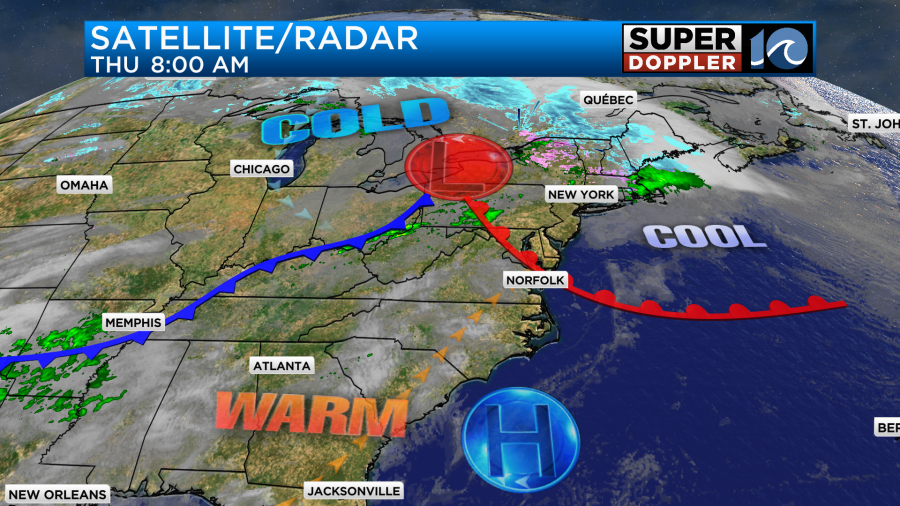
The cold front to our northwest will move in tonight. We’ll be mostly cloudy with some spotty showers overnight. Tomorrow the front will briefly stall out to our south with a weak area of low pressure forming along the boundary. We’ll have enough moisture for a lot of clouds, but it’s hard to tell how much rain we’ll receive. I’m talking more about coverage than amounts. No matter what amounts will be light. We are talking about a couple hundredths of an inch.
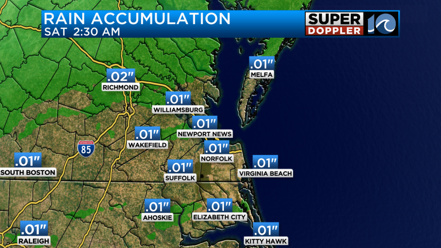
When you look at Future Trak it is very lean with hardly any green on the screen.
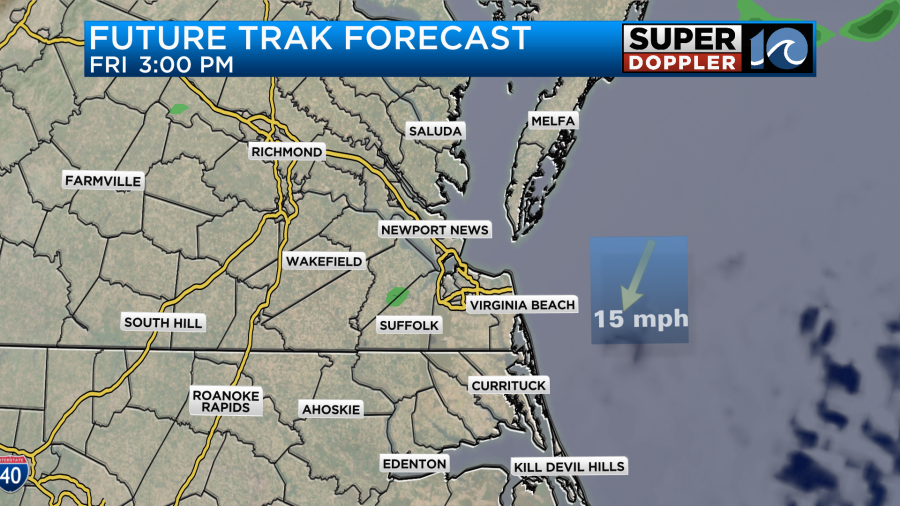
However, it doesn’t do well with very light precip or drizzle. So I think it is trying to tell us that we’ll have scattered pockets of drizzle with a few light rain showers. Either way we will be much cooler. High temps will probably happen around noon. We’ll reach to around 60 degrees. Then temps will pull back to the upper 50s during the afternoon.
We’ll stay chilly over the weekend. High temps will only be in the 50s Saturday and Sunday.
Things look dry for us on Saturday as the front slips farther to the south. There may be some isolated showers over the Outer Banks. However, Sunday is tricky. There will be a stronger area of low pressure along the front on Sunday. (To our south). However, moisture will push north of the that feature and the front. I’d say that North Carolina has a decent shot at some rain, but the Hampton Roads area will probably be on the edge of the light precip.
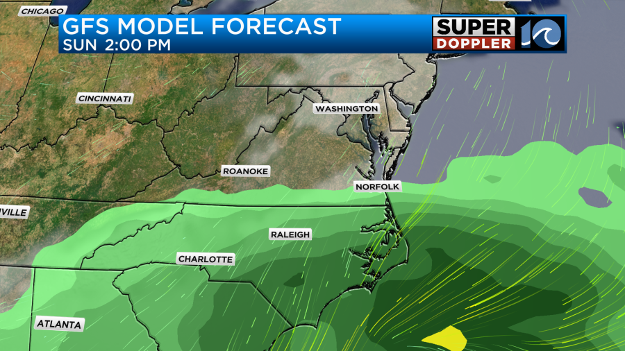
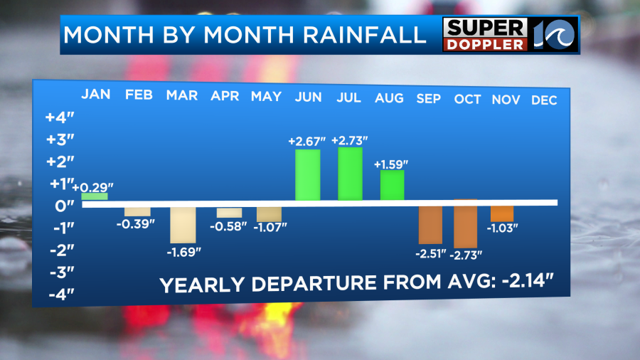
We’ll see how far north the rain gets. We really need rain. We have been running quite a deficit over the last 3 months.
Things are quiet in the tropics for now.
In world news…I ran into an interesting article this morning about saltwater intrusion. There are fresh water aquifers under land that hold a lot of our drinking water. In some cases salt water from the ocean or another source can push up into those reservoirs, and this can impact the local community’s drinking water. It can also affect vegetation and farmers. This has recently affected parts of the Mississippi River Valley as a bad drought is happening there. Here is the article with more information. The Maryland Eastern Shore is mentioned: Saltwater intrusion.
In other news… Hurricane Otis blew up in strength last month and hit the west coast of Mexico near Acapulco. A recent article claimed that a wind speed of 205mph was recorded during the storm. If verified, then it will be one of the 15 strongest winds recorded by a surface based instrument in the world. Here is the article with more information. Wind gust over 200mph in hurricane Otis.
Meteorologist: Jeremy Wheeler