Yesterday we had heavy rain and thunderstorms in the morning, but then we dried out in the afternoon. Today we are going to have scattered rain showers at times through the whole day, but it should be mostly light. Plus, it shouldn’t be a washout!
A cool front has stalled out to our south since last night. However, moisture is pushing north of the front creating a band of rain.
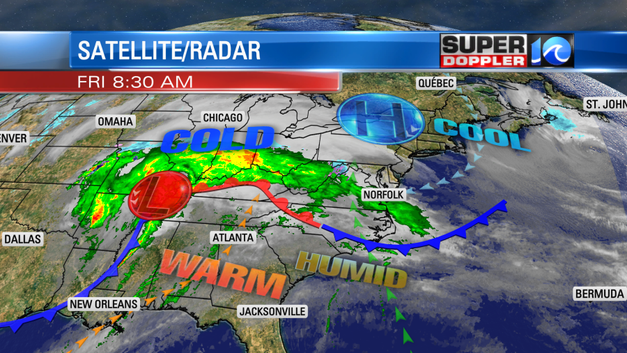
This is called overunning. It basically happens when you have a warmer and more humid air mass pushing up over a cooler/drier air mass. The ample moisture will produce cloudy skies through the day. We’ll have scattered rain showers at times, but it won’t be a washout.
There is one line of showers moving through this morning, but a scattershot of showers will come back later today.
We’ll have an increasing breeze out of the east/northeast. Some of the gusts will be up to 20mph with a few higher gusts near the shore.
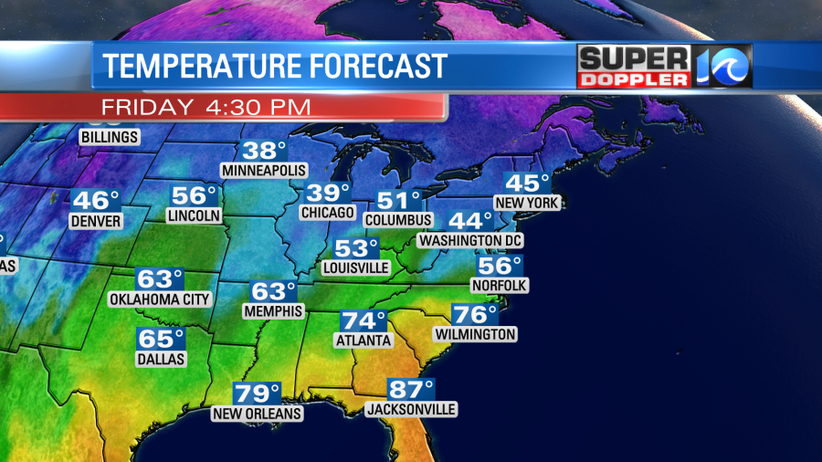
Temps will be held down today. They will only top off in the upper 50s to low 60s this afternoon.
However, temps will actually increase this evening as the front lifts north as a warm front.
During the day today there will be some more strong to severe storms over the Tennessee River Valley.
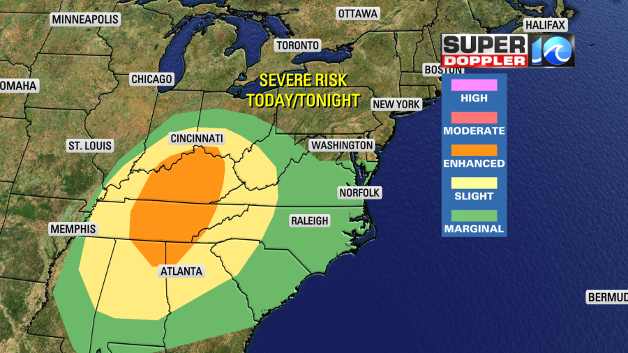
The area of low pressure out there did cause a lot of severe weather over the central U.S. yesterday.
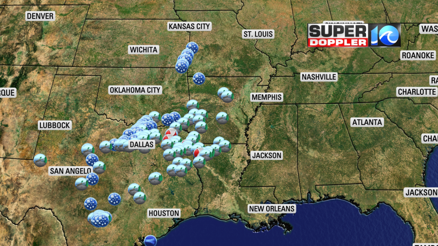
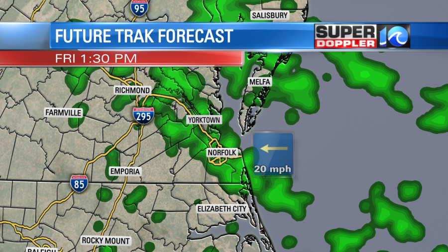
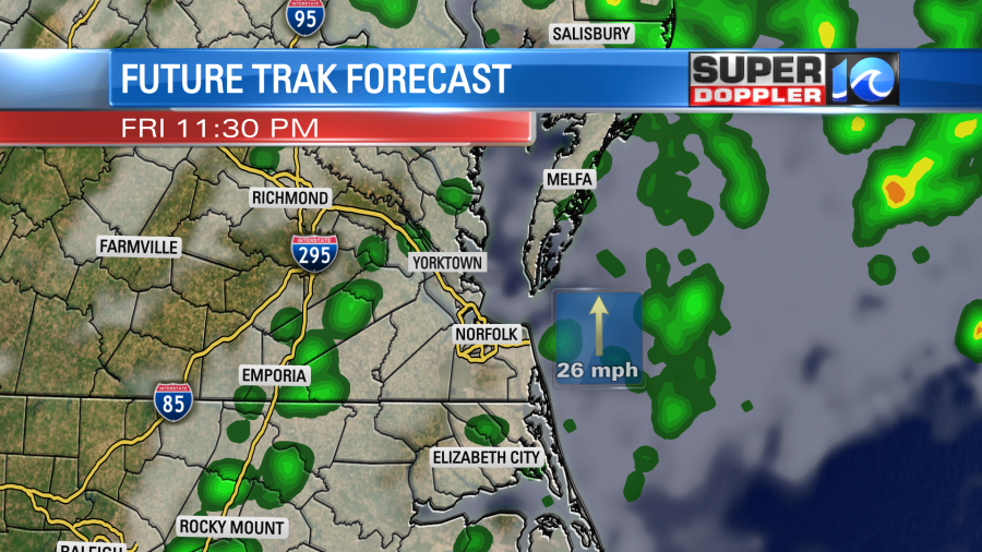
As the system moves east it will really lose a lot of its energy. A cold front will move through overnight. There may be some isolated showers and strong storms during ahead of it.
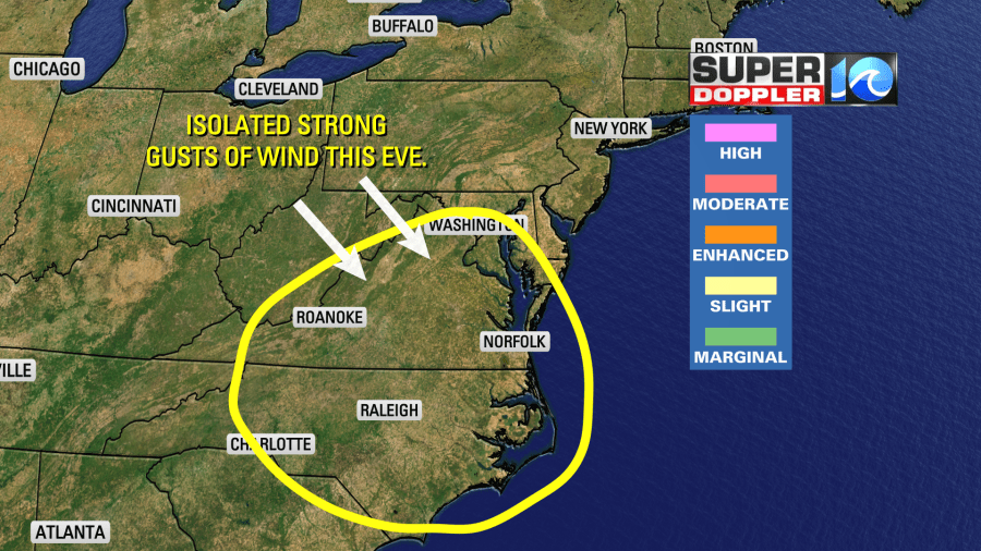
The models really aren’t too impressive. So I think the operative word is “isolated” for that time. Here is what Future Trak shows just before midnight.
We’ll dry out tomorrow. High temps will rise to the mid-upper 60s. It should be a pretty nice day with partly cloudy skies. One nuisance will be the wind. There will be a few gusts up to 25-30mph out of the west/northwest. High pressure will build into the area between Saturday and Sunday. We’ll have nice weather on Sunday with fair skies and highs in the upper 50s.
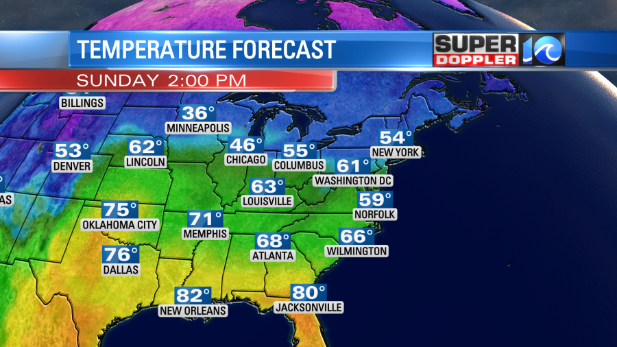
We’ll have more nice weather into early next week. High temps will be in the 60s Monday and Tuesday with dry weather.
Meteorologist: Jeremy Wheeler