We are looking at some pretty good weather today. It won’t be too hot nor humid. We really did just wrap up a heat wave. High temps were in the 90s for a while. It was even in the upper 90s for a few days.

However, yesterday we ended up in the mid 80s. It was less hot, but it was still very muggy. There was a lot of clouds and humidity yesterday until the late afternoon. Then a cool front started dropping to our south. Now today that front is sinking into the Carolinas.
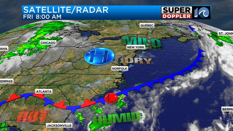
Temperatures will be about the same today. Highs will aim for the mid 80s, but there will be some upper 80s inland.

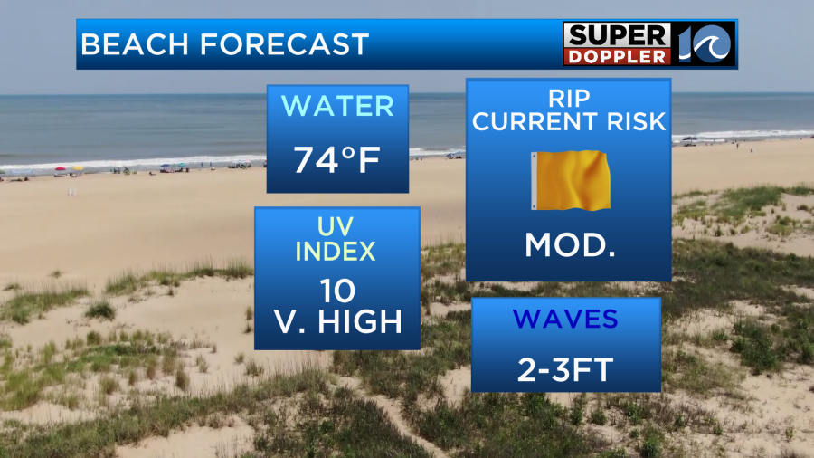
We’ll be mostly to partly sunny. There will be a nice breeze developing out of the northeast. It will run at 10-15mph with a few higher gusts near the shore. It will be nice out. There shouldn’t be any rain except for an isolated shower over the southern Outer Banks. Dew points will drop to the low-mid 60s. One problem out there today is that there is a moderate threat for rip currents at all the local beaches.
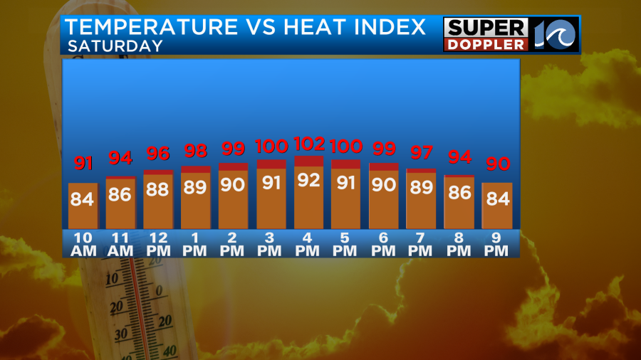
Tomorrow the warm front will lift north as a warm front. We’ll be hot and humid with high temps rising to the low 90s. The heat index will be up to near 100 degrees as dew points rise into the low 70s.
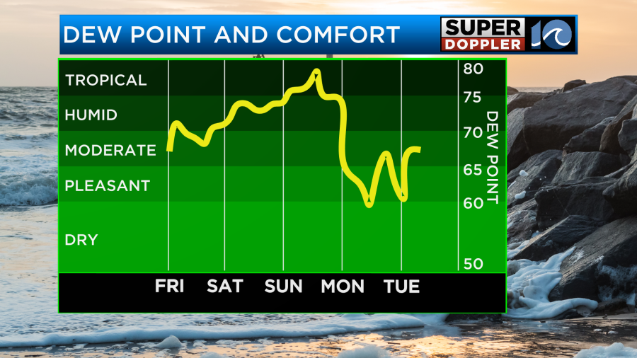
We’ll be partly cloudy with only some isolated PM showers or storms. By Sunday the heat and humidity will become rough again. High temps will be more in the mid 90s. The heat index will be between 100 and 105 degrees.

We’ll be partly cloudy for a while. Then some scattered showers and storms will form later in the day. Our Future Trak model has the scattered storms forming by the afternoon, but it’s possible that they could arrive a little later in the day.
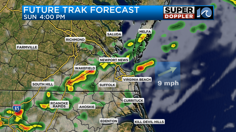
We’ll have more scattered showers and storms from late Sunday into Monday morning. This will be ahead of and along a cold front. That front will cool us down nicely next week. We’ll be in the low 80s Monday and Tuesday. Plus, the humidity will drop a lot. We’ll likely heat up to the 90s again later next week. That will be just in time for the 4th of July.
Things are heating up over the Atlantic. There is a tropical disturbance in the middle of the Atlantic that is really starting to look organized. It may become an official system by later today or tomorrow.
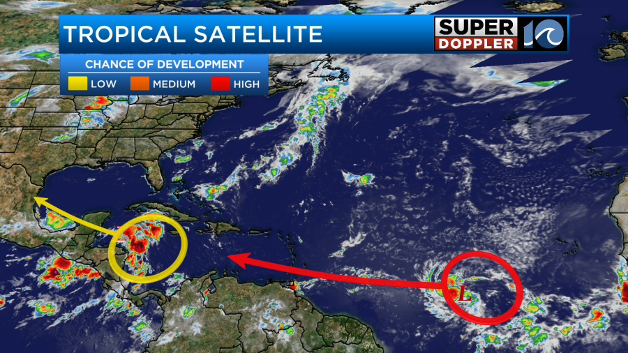
This feature is forecast to move to the west/northwest over the next few days. It is forecast to move into the Caribbean where there is some very warm water. So it will likely strengthen over that time.
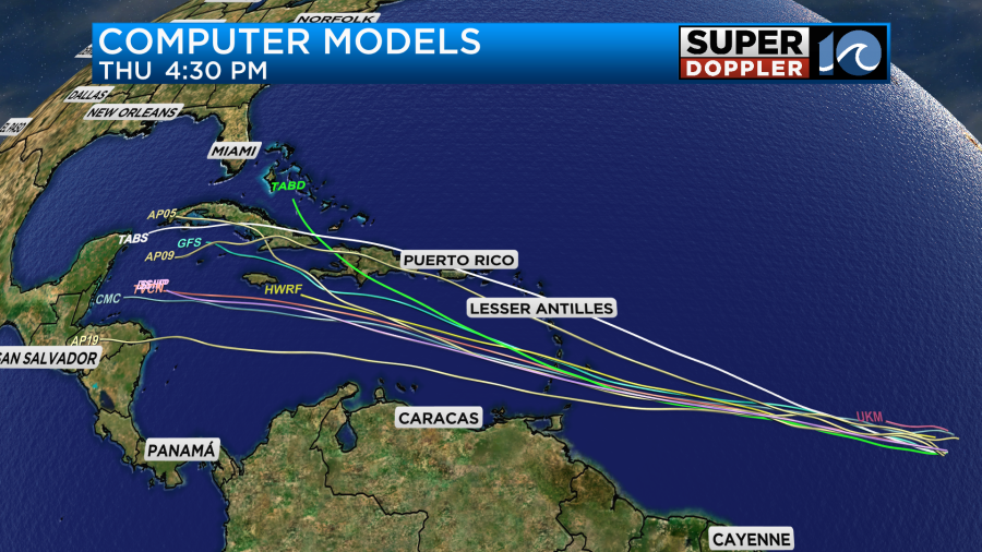
We’ll have updates on it later today and over the weekend. There are a couple of other weak features that have a low chance of formation. One is in the Caribbean, but it is moving towards the Yucatan Peninsula.
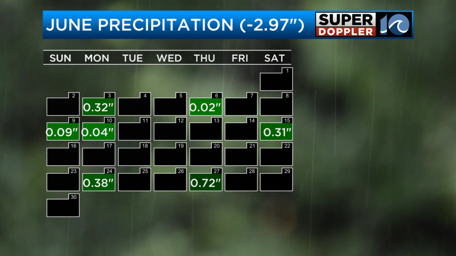
We could use a weak tropical system here at this point. We are now in a moderate drought (level 2 out of 5).
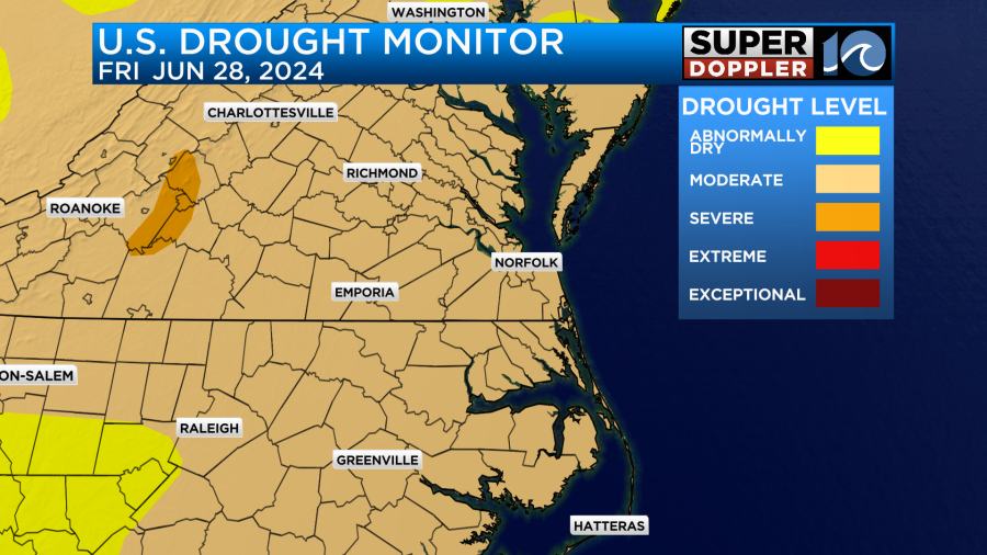
There hasn’t been much rain recently. In fact we are running about 3 inches below average for rainfall for the month.
It’s hard to believe that we are already at the end of June.
Meteorologist: Jeremy Wheeler


