
The weather is looking fairly decent for this St. Patrick’s day, but it could be better. Let’s talk about it: First off…we are coming off of a pretty nice Thursday. We had lots of sun with high temps near 60 degrees in the afternoon. That is close to the average high for this time of year. The big area of high pressure that sat directly overhead has now pushed out to sea.
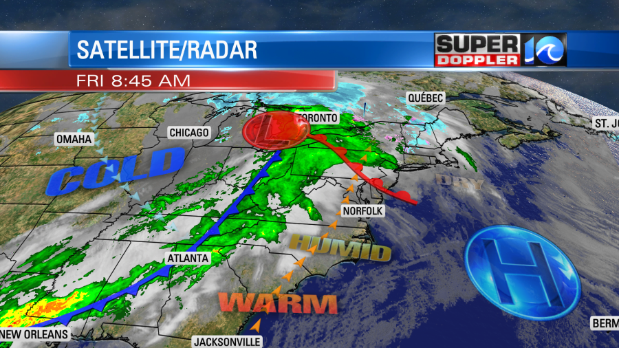
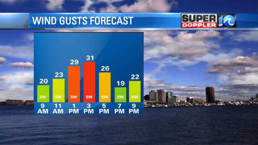
There is a warm front lifting to our north with a cold front to our west. We started off with some filtered sunshine this morning, but clouds were starting to increase already. We’ll warm up today with the wind increasing out of the southwest. Wind gusts will increase to around 30mph this afternoon.
This will push the high temperatures up to near 70 degrees.

Moisture and clouds will both increase today. We’ll have some spotty showers possible between the late morning and the early afternoon. However, a handful of showers will try to move in from the west during the afternoon.
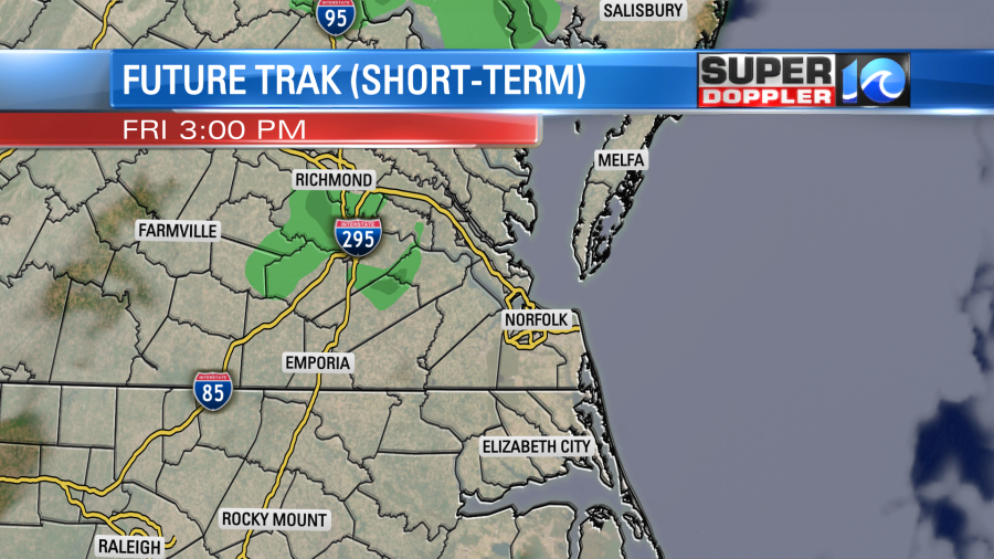
There won’t be a lot of rain later today, but a few showers will be possible. The chance for rain will increase by this evening. In fact, rain could become almost widespread by the late evening hours.

Rain is likely overnight into early tomorrow morning.
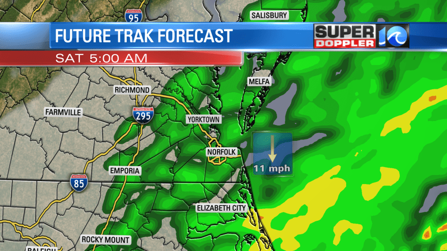
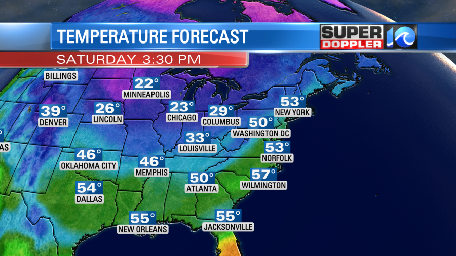
It could be briefly heavy as the cold front arrives. The good news is that the model trend is for the rain to wrap up between 7 and 9am. So hopefully, that’s the case. That would be good news for both the St. Patrick’s Day parade in Oceanview and for some of the races for the Shamrock at the oceanfront. We will dry out through the day Saturday. Temps will kind of hold steady. They will basically be in the low-mid 50s for most of the day. We’ll have a breezy north/northwest wind, but it shouldn’t be as windy as today.
The cold air will settle into the region even deeper by Sunday. So low temps will be in the 30s, and high temps will only be in the upper 40s. We’ll have more freezing temps possible Monday morning. Of course that would be the first day of Spring…
High temps will be near 50, but at least we’ll be dry. We will warm up a little by the middle of next week.
In U.S. News… I’ve talked some lately about people getting buried in the heavy snow in the West, the North, and Northeast. (Especially out west). I’ve also talked about the flooding in the west. Well, I do have some good news for a change. Out west in some parts of California the waterways have had some recovery from the Mega Drought that was ongoing for years. They still have a way to go, but there has been some significant improvement. Here is an article with more details. It has a couple of before and after drone pics: Drought recovery in California.
Meteorologist: Jeremy Wheeler