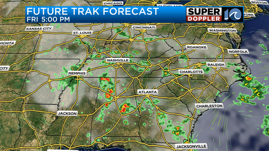
After causing yesterday’s damage across the deep south, today Francine has become a rainmaker across parts of the Mid-Mississippi river valley.

It is bringing some beneficial rain to that area. The weak low will linger for a couple of days.
There is also a tropical feature in the middle of the Atlantic. This is tropical depression 7, and it will likely become tropical storm Gordon soon.
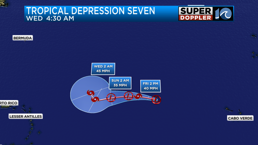
This system will slowly meander to the west/northwest over the next few days. Towards the end of the forecast you’ll note that there’s a tick northward. This system will probably stay out to sea, but we’ll watch it over the weekend to be sure.
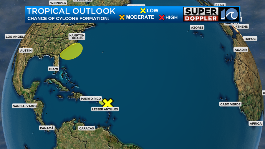
The rest of the tropics are quiet for now. However, there is a potential area of low pressure that could form near our coast early next week. That’s why there is a yellow blob on the tropical weather outlook near the Carolina coasts.
The models handle this feature differently. The GFS is basically stronger and earlier with the European model forming it later and a bit weaker. The GFS model has a low forming to our south between Sunday and Monday.
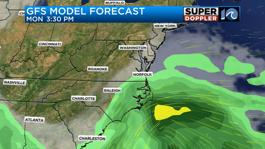
It brings the low up into our area on Tuesday.
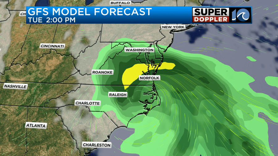
You can see some of the wind associated with it (more lines together = more wind). It’s possible that it could be a tropical storm, but it may also be a non-tropical or subtropical low. It should then move to our north on Wednesday. On the other hand, the European model doesn’t show much up through Tuesday. However, it does have some rain on Tuesday.
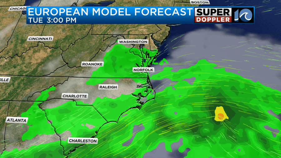
However, It does have a weaker low forming offshore on Wednesday.
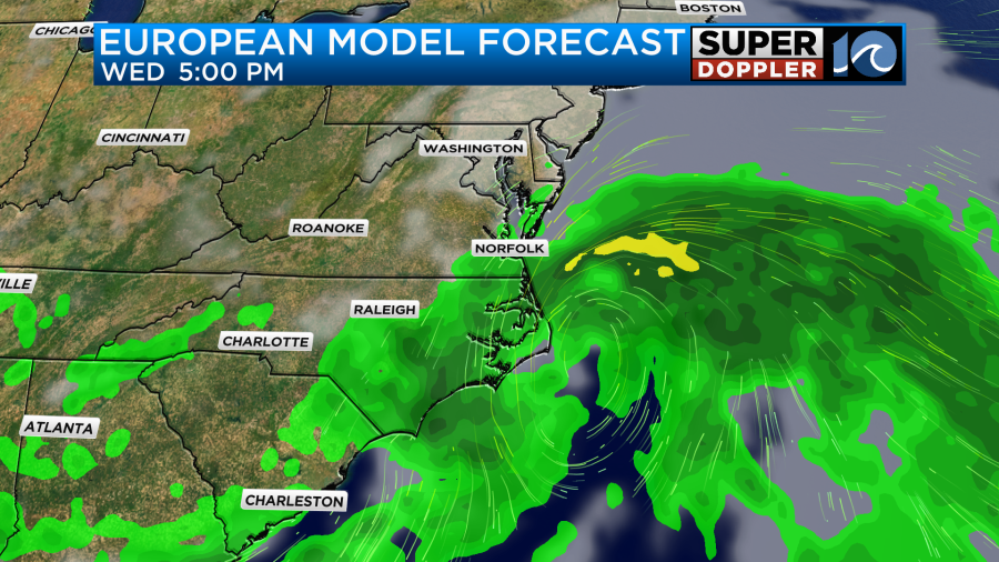
So the upshot of this is that this will be our best chance at getting some much-needed rainfall. Here is the 5 days rainfall forecast for both models. It’s important that the cutoff for this graphic is 5 days.
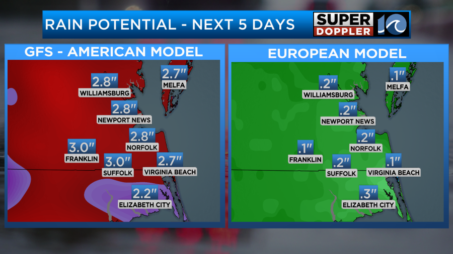
Since the GFS is earlier it has a much higher amount of rain. However, the Euro would still bring some rain in. The bulk of it would be on day 6. So at this time I would say that there’s a growing confidence that at least some kind of system will form near the coast. There’s also an increasing chance for getting rain between Monday and Wednesday. Hopefully, the details will come together by tonight or tomorrow. Stay tuned for those updates.
In the short-term we will have some decent weather for the weekend, but it will be very humid. High pressure is to our north today. A stationary front and a weak area of low pressure are far to our south.
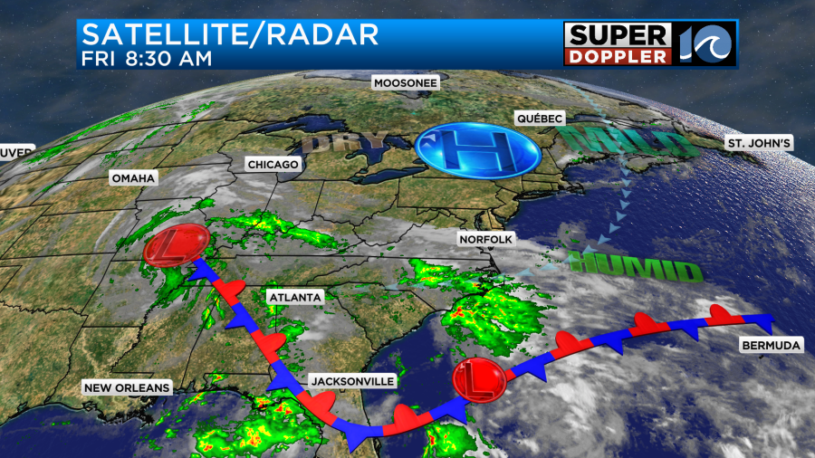
We have had a lot of clouds so far today, and we’ll be partly to mostly cloudy through the day. There were some scattered showers this morning across North Carolina with spotty showers and sprinkles over southeast Virginia.
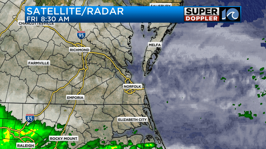
There will be some more isolated showers possible today with a little more coverage over northeast North Carolina.
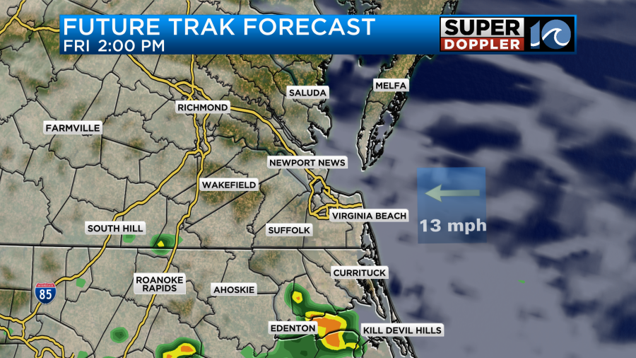
We’ll have an easterly breeze running at 10-15mph with a few gusts to 20mph near the shore. This persistent east breeze is pulling in a lot of moisture off of the ocean. This moisture pipeline is actually feeding into the remnants of Francine. High temps will be near 80 this afternoon.
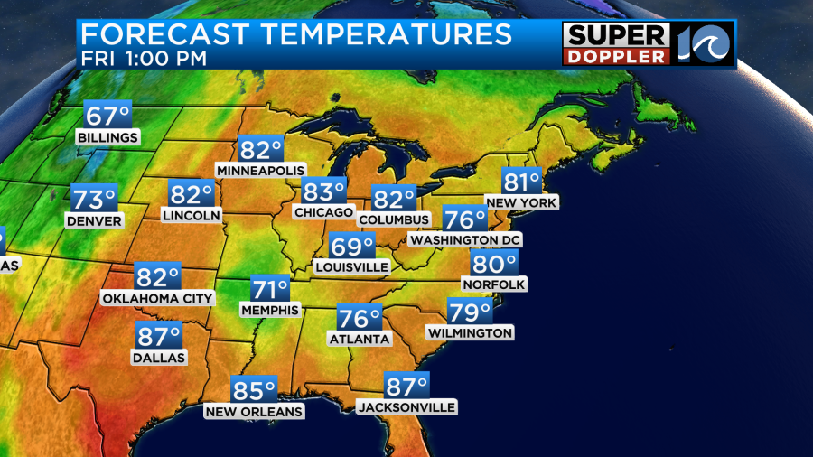
It will be a warm and muggy day, but the breeze should help out with the comfort levels. For now I am thinking that we’ll have similar weather conditions this weekend. I’m calling for a mix of sun and clouds with isolated showers possible.
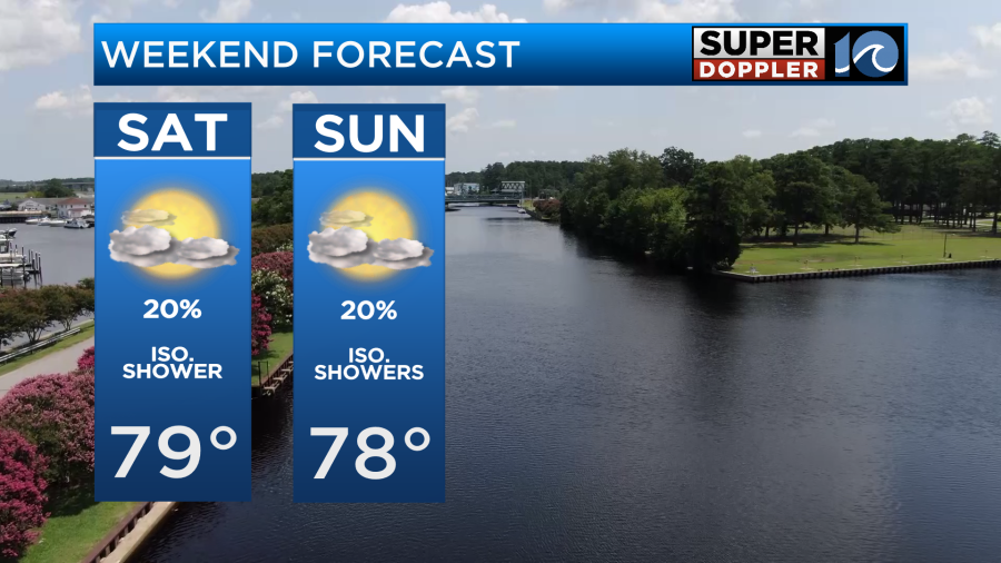
It should be good weather for the games. Keep in mind that when the sun does pop out that it will feel fairly hot and muggy in those stadiums.

Early next week the rain will likely increase as that coastal low forms. Again, we’ll have more updates on that during the weekend. Please keep checking back so you aren’t caught off guard next week. Otherwise, have a good weekend! Good luck to all our local teams.
Meteorologist: Jeremy Wheeler


