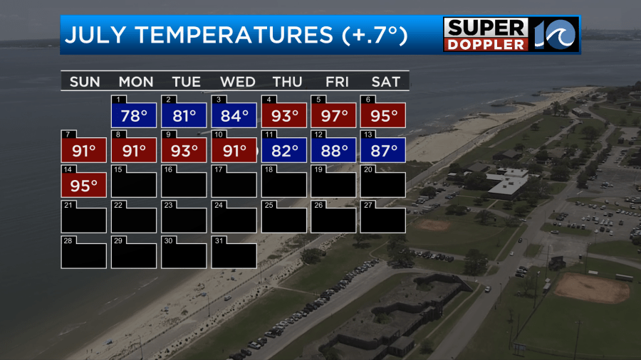
Seems like we can’t win lately. We go from a drought with heat to storms and flooding to dangerous heat. I guess it’s that time of year, but this Summer is definitely one of the hottest ones we’ve had in a wile. So far…
When the storms came in last week we did at least cool down to the 80s for 3 days.
The rain was heavy at times until Saturday. The rain really added up in the rain gauges.

Yesterday we did have some storms in the region, but they were mainly in northeast North Carolina.
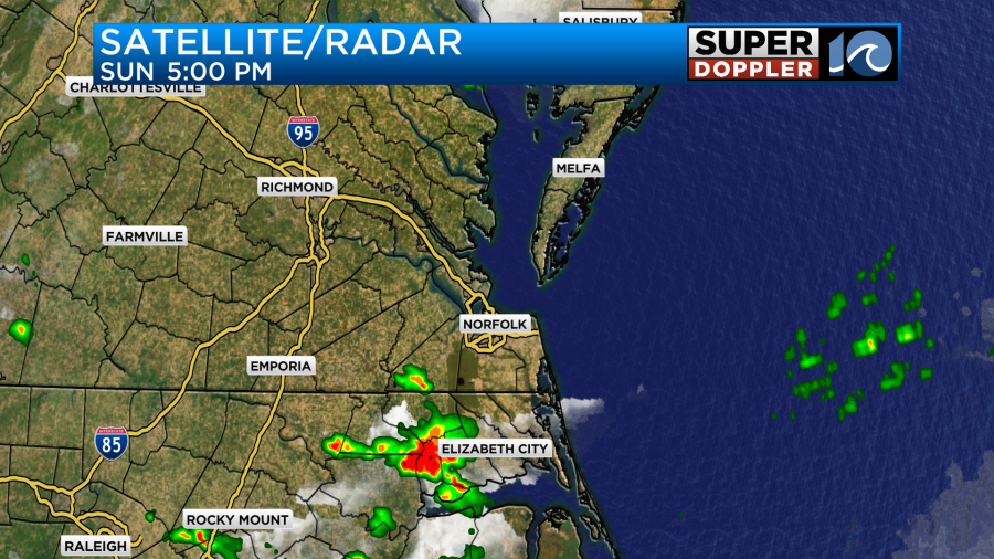
The stationary front that sat over us for a few days fell apart yesterday. So that limited the rain and storm coverage. Today it is gone, and high pressure has slid a little closer to us from the east.
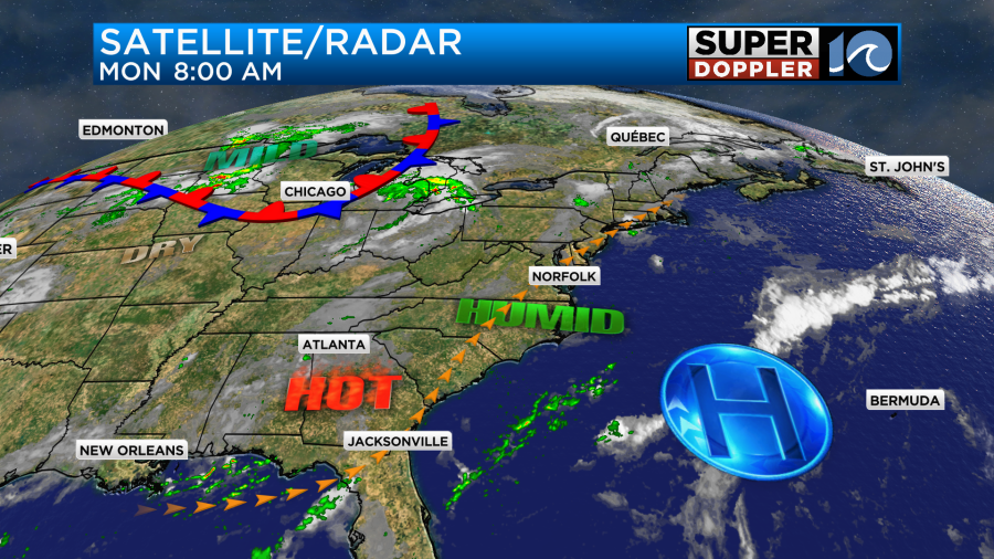
We’ll have lots of sunshine through the day. A sea breeze may kick in and create some isolated showers or storms, but it’s a low chance. High temps will run up into the upper 90s this afternoon.
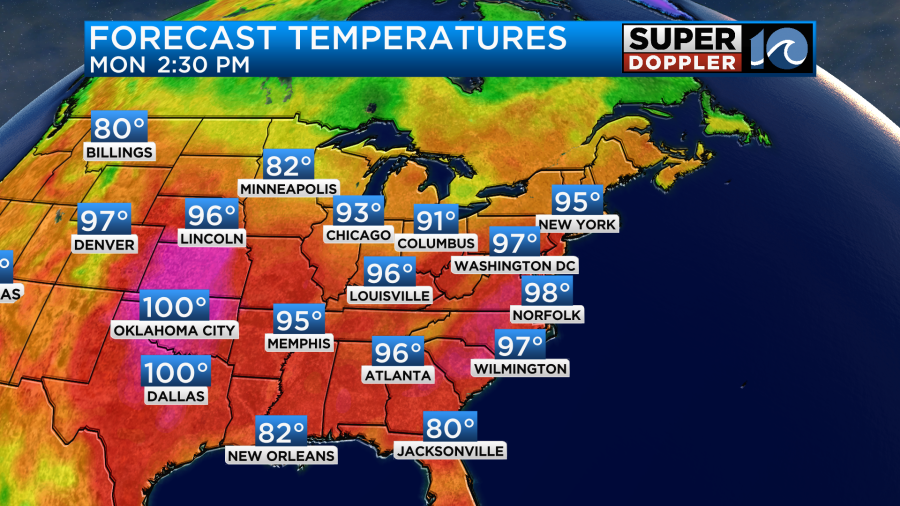
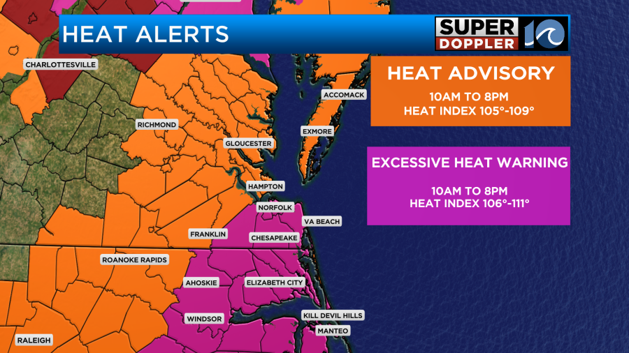
The heat index is going to be up above 105 for much of the region. It may even get up to 110 in several places.

We’ll only have a light southwest wind. So that will barely help. There are heat alerts up for the whole viewing area. Some are under Excessive Heat Warnings.
Tomorrow we will have similar weather in the area. I am calling for the high temps to hit the upper 90s to near 100 degrees with the heat index over 105 for many locations.
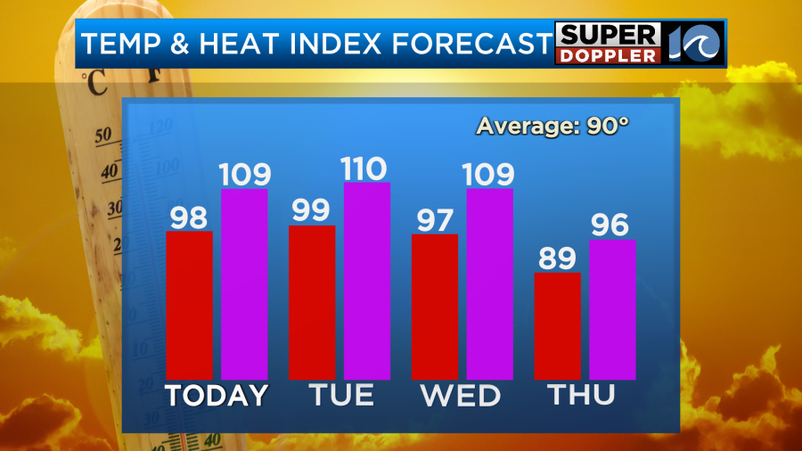
We’ll be mostly sunny again with only some isolated PM showers or storms. It will still be hot on Wednesday. However, there is a better shot at some scattered showers and storms late in the day.

If the storms fire up soon enough, then the temps may get knocked down. If they take longer to form, then we’ll probably hit the mid-upper 90s with a heat index over 100.
The front will definitely move in by Thursday. We’ll go from heat to storms again. I’m hoping that it won’t be as much as last week, but there will be a potential for heavy rain. At least the high temps will be knocked down into the 80s.
The front may dip south enough on Friday that we’ll decrease the rain chances. We’ll see. With highs in the mid 80s it’s possible that Friday could be a decent day overall. I’ll have more on next weekend’s forecast in tomorrow’s weather blog. Until then… Stay cool!
Meteorologist: Jeremy Wheeler