We are coming off of a nice Fall weather weekend. It was beautiful in the afternoons with lots of sunshine and cool temps. The air was dry all weekend with the exception of early Saturday morning. Today we are going to start off with some more cool/dry air. We started off this morning with lots of sunshine.

While it looked very nice, there was some pretty cold air inland. Temps had dropped down to the mid-upper 30s in several inland locations.
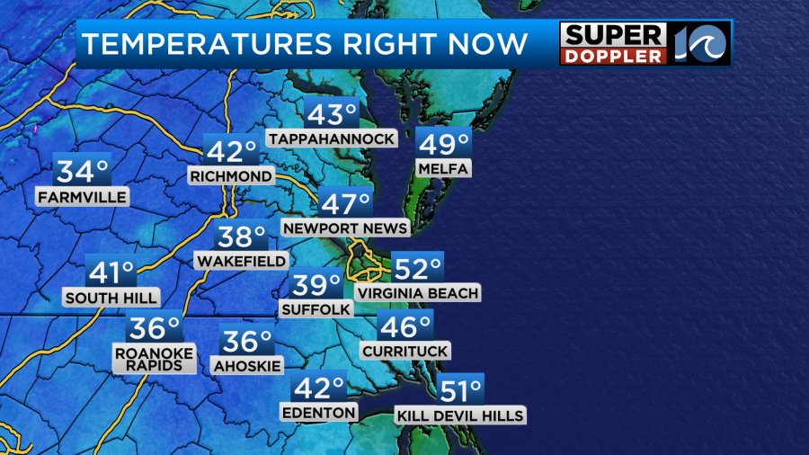
There may have even been some patchy frost. High pressure has built into the eastern half of the country.
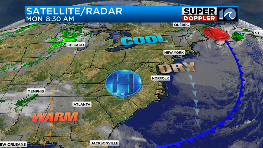
This is going to provide a lot of sunshine for the eastern third of the country for today and tomorrow. We’ll definitely have lots of sun throughout the day today. However, we’ll also have a steady north breeze. It will run at 8-12mph with a little stronger breeze near the shore. This will keep the temps from climbing too much. So high temps this afternoon will only be in the low-mid 60s.
Overhead, the jetstream is taking a dip in the east, but there is a big ridge (rise) in the middle part of the country.
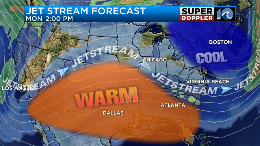
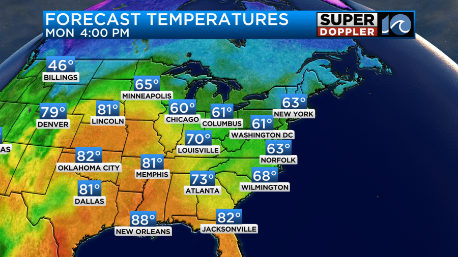
Under this ridge there is a lot of unseasonably warm temps over the central U.S.
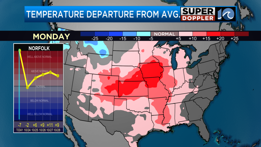
Tomorrow the warmth will push north and east. So temps will be well above average over the Midwest and north/central U.S. The 80s will reach up all the way into Illinois and Iowa.
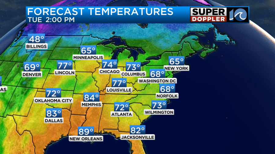
We’ll have lots of sun with less wind here. So our high temps will warm up a bit into the upper 60s. We’ll keep heating up through the week as the winds turn more out of the south. High temps will be in the upper 70s to near 80 by the end of the week.
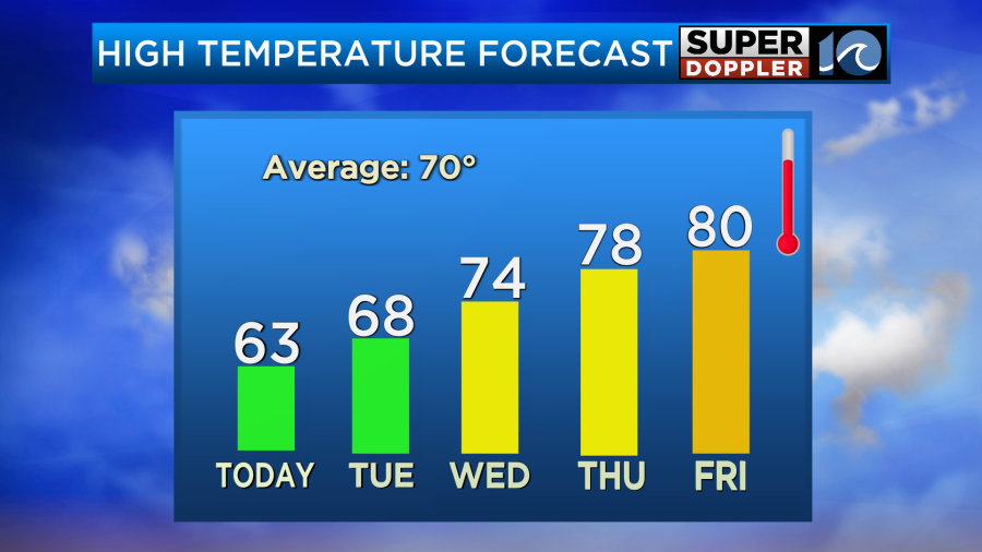
The humidity will climb slightly through that time.
Meanwhile in the tropics. Hurricane Tammy is now north of the Lesser Antilles. It is still a category 1 hurricane.
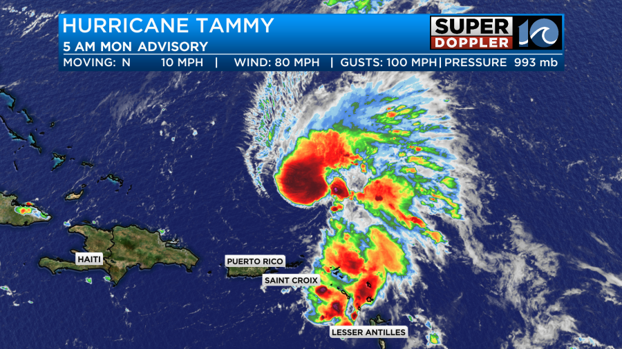
It will meander its way northward over the next few days. It is possible that it will move towards Bermuda.
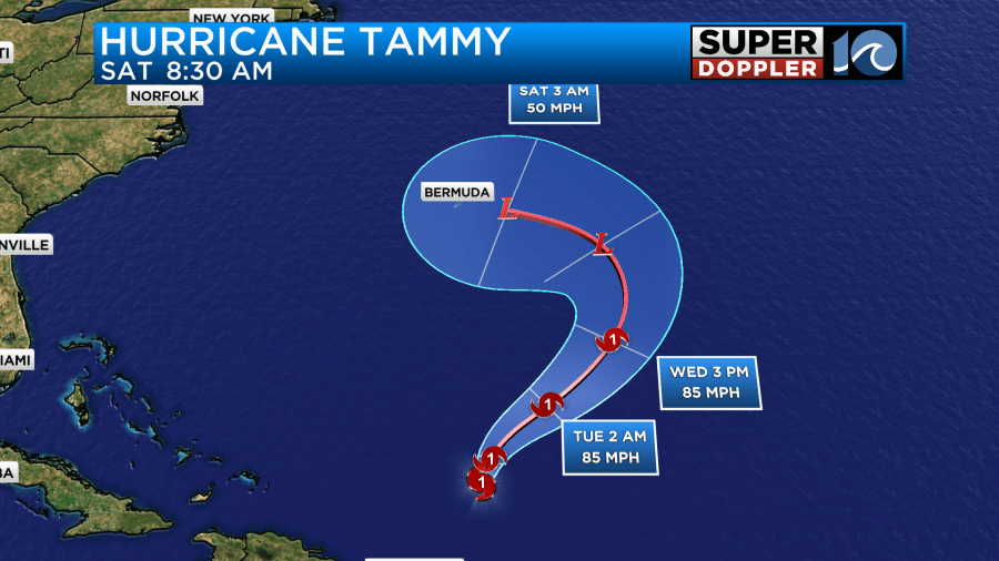
However, the models are actually more uncertain about the track than they were a couple of days ago.
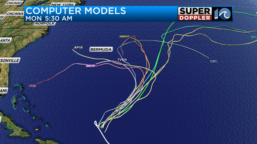
The track of Tammy will depend on the strength, and that is in question right now. So we’ll have updates on it tomorrow, and hopefully we’ll have more confidence in that track.
There is another disturbance in the southern Gulf Of Mexico that has a medium chance of formation.

Basically it could briefly become a depression (or storm) before making landfall around Nicaragua in the next 24-36 hours.
Meteorologist: Jeremy Wheeler