
Today we will have some decent weather out there, but pretty soon the rain and wind will be an issue. Let’s talk about it.
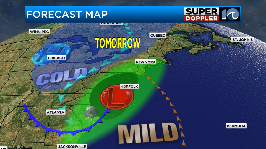
Today we still have high pressure in the region. There is a stationary front to our south with low pressure over the central U.S.
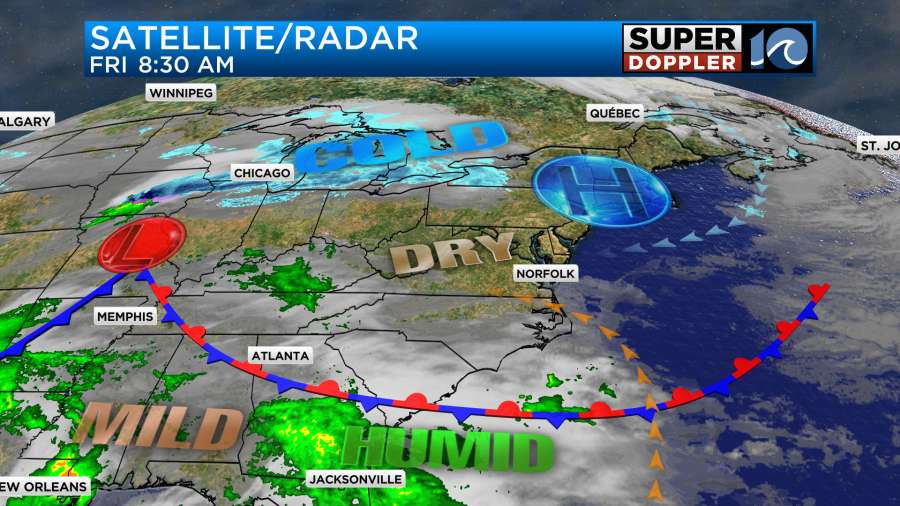
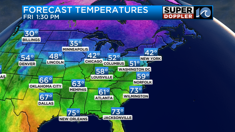
We have been super dry lately, but today we’ll develop a southeast breeze. It won’t be too strong (gusts up to 20mph), but it will allow more moisture to move into the region. With the increasing moisture we’ll also have increasing clouds through the day. Despite this temperatures should be able to warm up to the upper 50s to near 60 degrees this afternoon.
By tonight the area of low pressure will be streaming towards us. High pressure will move out to sea. There may be some isolated showers by the early evening, but most of the rain won’t arrive until late tonight.

Rain will become nearly widespread and heavy late tonight into tomorrow morning. There may be some real downpours early Saturday.
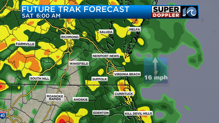
The rain will keep falling through the mid-late morning, but then it will probably break up a little around midday.

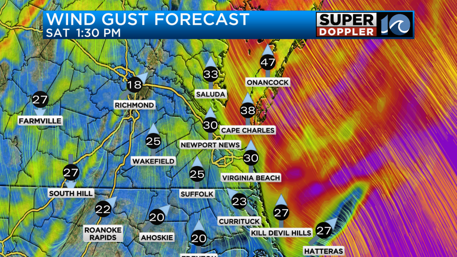
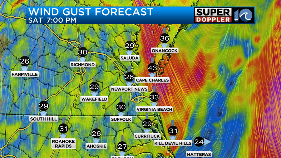
Through that time we’ll have strong winds out of the south. Gusts will be up to 35mph with some gusts to 45mph near the shore.
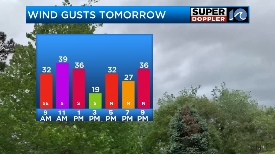
These strong south winds will be just ahead of a cold front that will be trailing the low.
Once the front comes through we’ll have the winds turn out of the north.
Also, as the front and the low move through we’ll have some scattered showers ride in from the west. There will also be a few thunderstorms as well.
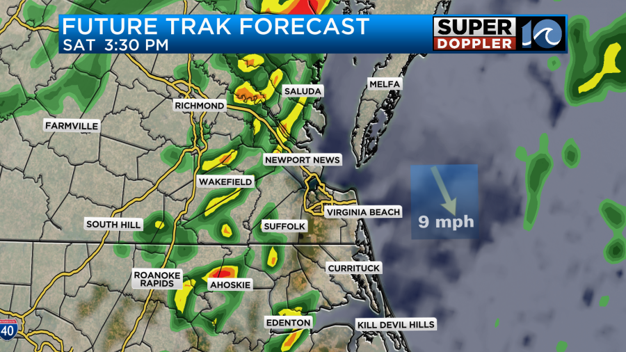
The scattered showers will continue into the evening, but the coverage should decrease. Then we’ll dry out later in the evening. Before the rain ends we’ll likely get 0.5 to 1.5 inches of rainfall. Some local spots may get up to 2 inches.
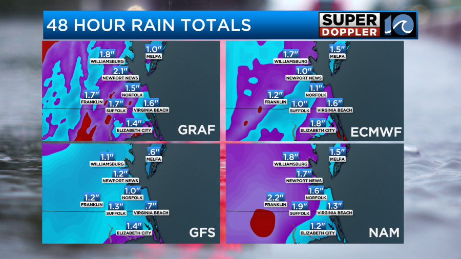
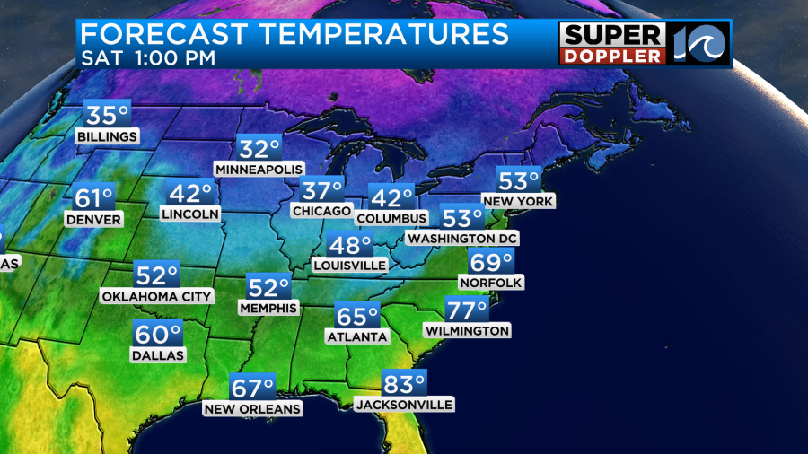
This will be over a time though. So we won’t have widespread flooding. Instead we’ll have ponding on the roads at times. We also could have some brief standing water in a few locations. High temps on Saturday will reach the upper 60s to low 70s.
On Sunday the low and the front will stream out to sea. High pressure will build back into the area. We’ll be dry, but it will be chilly and windy. High temps will only run in the low 50s with upper 40s north of the metro.

Winds will gust up to 35-40mph out of the north.
It will definitely feel colder with the wind. This north wind could also create some minor tidal flooding over the lower Chesapeake Bay and along the Outer Banks. There may be some overwash along the Outer Banks this weekend as well. Well calm things down early next week, but another storm system could impact us later next week. Stay tuned for updates over the weekend.
Meteorologist: Jeremy Wheeler


