
We just wrapped up some wet weather after the last couple of days. The last of the showers passed through Hatteras, NC earlier this morning. Today we’ll have some pretty nice weather as 2 areas of low pressure push out to sea.
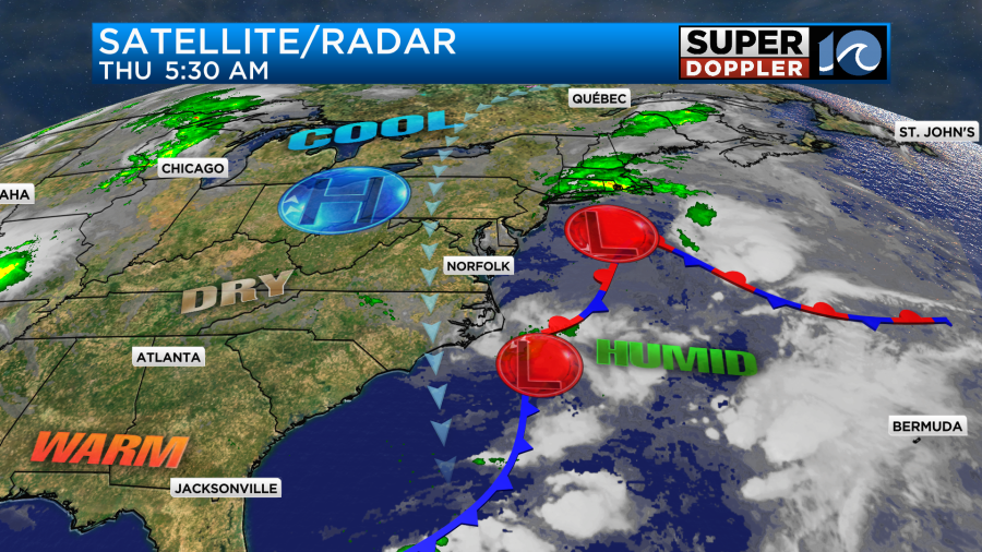
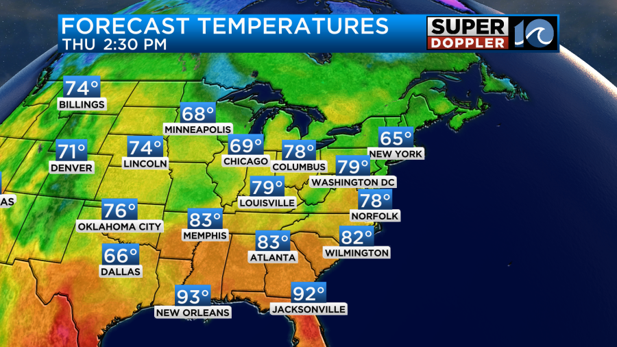
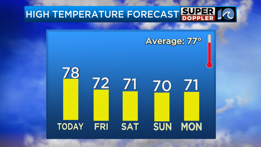
High pressure is to our northwest, but it won’t really build into our region today. Also, the 2 offshore lows will only slowly move east today. This will allow the breeze to stay steady out of the north/northwest. It will run at 10-15mph with gusts to 20mph. We’ll be partly cloudy through the day. The sun will warm us up nicely, but the breeze will cap the temps a bit. Highs will be in the upper 70s with a few 80s inland/south.
We should be dry with partly cloudy skies for the majority of the day, but an isolated shower or two may move in during the evening.
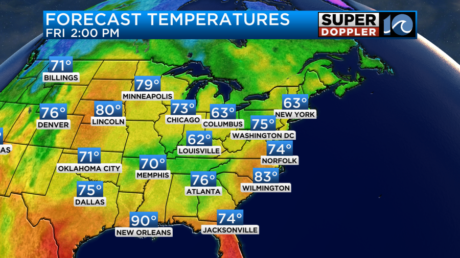
Tomorrow the lows will stay offshore, but a weak cool front will move in from the north. The breeze will pick up a little more out of the north. There could be some gusts up to 25mph. This will cool down the temps some more. Highs will be in the lower 70s.
We’ll have a mix of sun and clouds. There will be some isolated showers on the west/southwest edge of the viewing area during the afternoon. Our model has a couple of them moving east and falling apart.
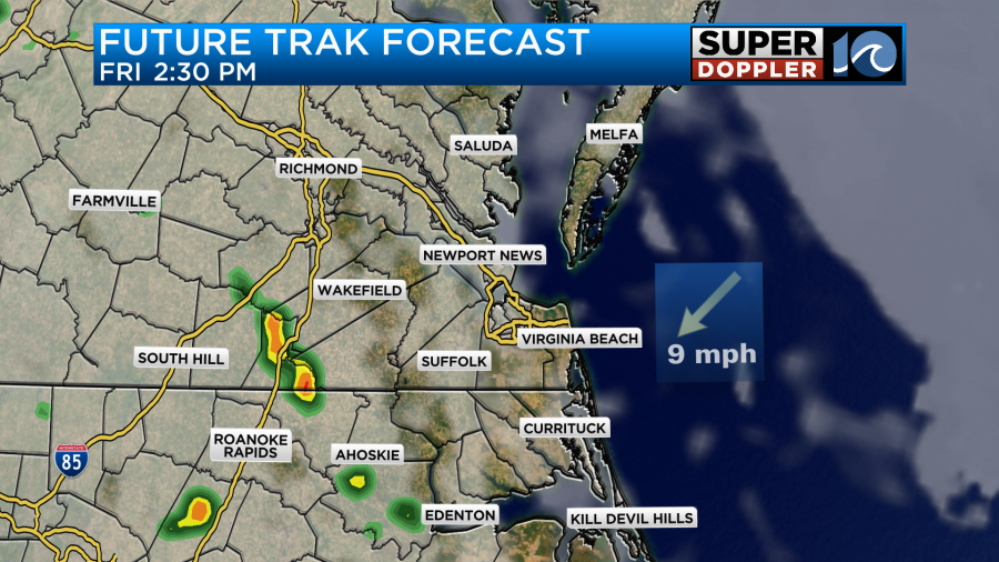
I think the bulk of the region will be dry, but a couple of showers may try to move in from the west during the early evening.
As we go into the weekend we are looking at some wet weather. There will be a larger area of low pressure forming and coming in from the west. There will already be a few showers during the morning.
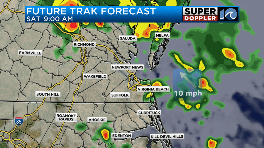
Then there will be some more scattered showers during the afternoon. I will say that our model doesn’t have a lot of rain during the afternoon, but almost all of the other models do.


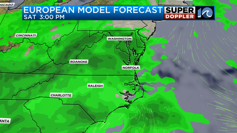
Keep in mind that the GFS and Euro are broader models. The bottom line is that we have a pretty good chance for rain on Saturday, but I doubt it will be a washout. We’ll pinpoint the forecast better over the next 24 hours. High temps will be near 70 or in the low 70s during the whole weekend.
The GFS and Euro models do have rain on Sunday, but the Euro tapers off the rain a little sooner. So there will be some time to get out to the many festivals that will be taking place this weekend. Stay tuned for updates.
As of right now it looks like we’ll warm up some more next week with fairly quiet weather for the first half of next week.
Meteorologist: Jeremy Wheeler


