Yesterday, we had a nice/cool northeast breeze through the day. It was actually a bit strong at times. Especially near the Virginia Beach shore and over the Outer Banks. This wind has been partly caused by high pressure building to the east/southeast. It is still to our north today. There is also a stationary front and 2 weak areas of low pressure to our south.

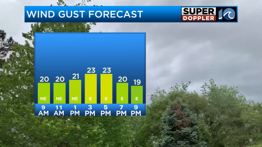
This will let the northeast breeze keep blowing today. It won’t be as strong as yesterday, but the gusts will be up to 25mph at times. Especially near the shore.
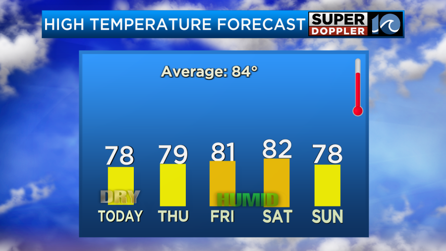
The surface will be pretty dry during the day, but there is some moisture coming in at the upper levels. This will bring us partly to mostly cloudy skies for sky cover. Other than a stray shower or sprinkle we should be dry. High temps will be in the mid-upper 70s.
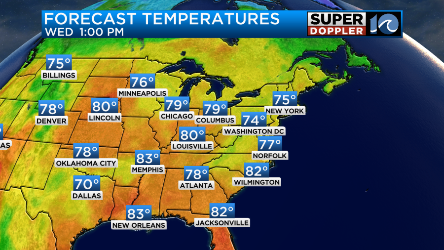
The eastern half of the country is running below average. They are getting a nice break from the heat over the central U.S. However, the western U.S. is in the middle of a heat wave.
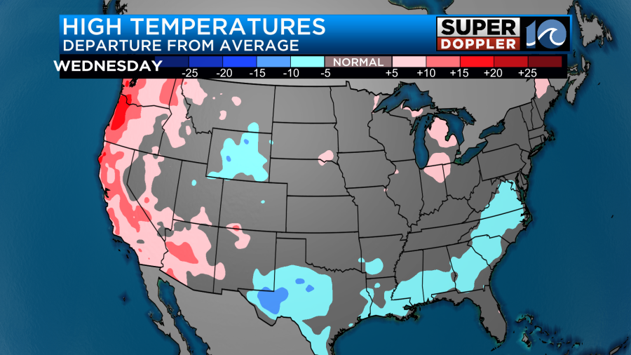
Parts of California will experience triple digit heat today. Phoenix, AZ has just broken a record. They have just had 100 days of 100 degree temperatures or higher.
Luckily, we will continue to be below average for a few days. Tomorrow our high temps will be in the upper 70s to near 80.
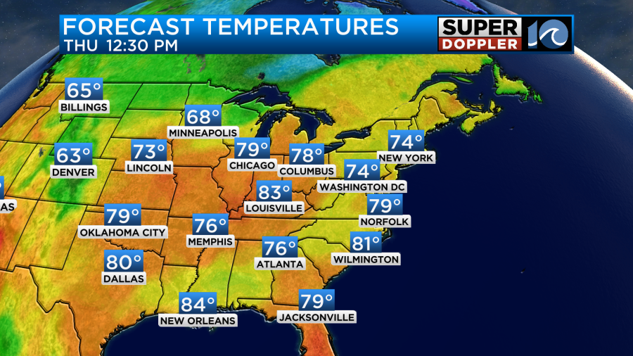
We’ll be mostly cloudy for a large part of the day. There may be an isolated shower or two. The humidity still won’t be bad. It will be moderate. However, the humidity will be increase on Thursday and Friday.

We’ll be mostly cloudy with some isolated showers possible on Friday. I’ve backed off of the rain a little bit as some of the models have done as well. However, I’m wondering if a large swath of drizzle will try to move in off of the ocean. I’ll have an update on that tomorrow. Regardless, high temps will be in the low 80s. The models do still have quite a bit of rain for Saturday.
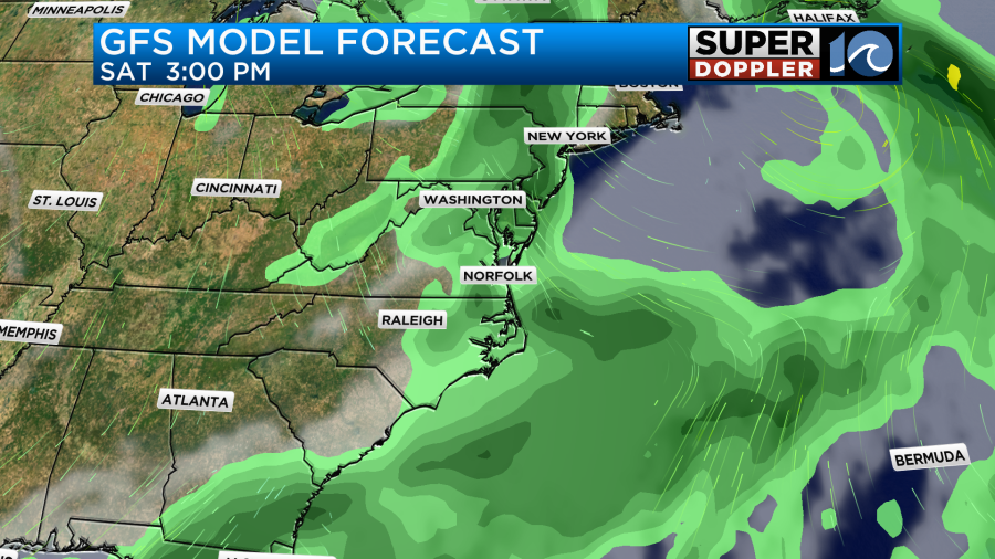
It doesn’t look like a washout, but we will probably get some more much-needed rainfall. Then we’ll dry out on Sunday. High temps will return to the 70s.
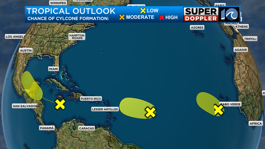
There are 3 tropical disturbances in the Atlantic basin that we are tracking. They all currently have a low chance of formation.
Meteorologist: Jeremy Wheeler


