Yesterday a cold front slowly slid through the region. Temps did pop up to the upper 70s for a time, but then the colder air started to take over as we went into the early evening. Today that cold front is sinking to our south.
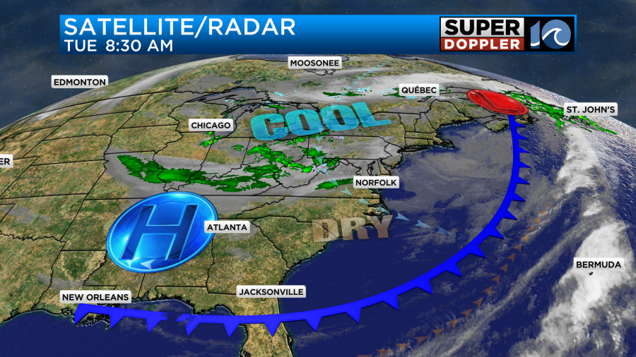
We started off with lots of sunshine and a few clouds. It’s very dry at the surface now with dew points down in the 30s and 40s.

As we go through the day we are going to have an increase in clouds. Usually high pressure builds in behind a cold front. However, this time the high is kind of hanging back to the west. There is an upper-level low that is sitting over the Midwest. It’s rather large.

Well, today that upper-level low will slowly sink down into our region. We will increase the clouds, and there may be some isolated showers or sprinkles late in the day.
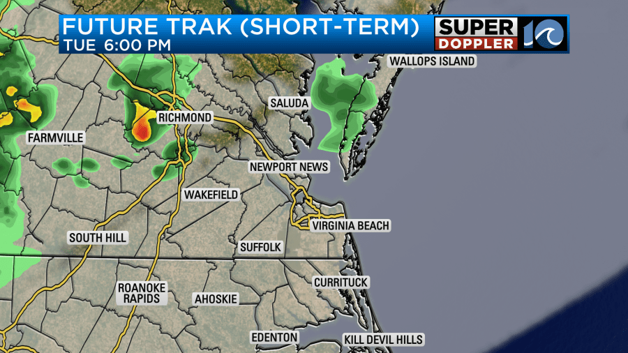
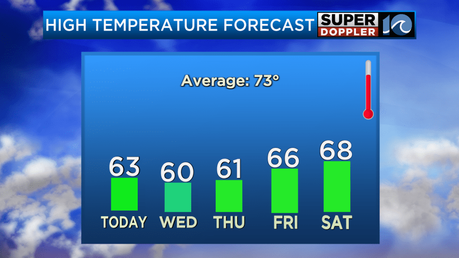
While the upper-level moisture may increase, the surface is too dry for anything other than isolated light showers or sprinkles. We’ll have a light northwest breeze at the surface. High temps will only manage the low 60s this afternoon.

That’s a big contrast to the recent mild weather.
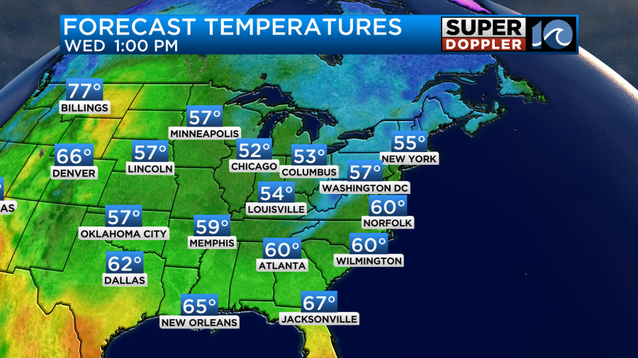
Overnight we’ll have that upper-level sliding overhead, and that will continue into tomorrow morning. We’ll be mostly cloudy with some spotty light showers or sprinkles. Then tomorrow afternoon the upper-level low will start to slide out. So we’ll have clearing skies. Winds will be out of the north at 10mph. Despite the clearing, our high temps will only be near 60 degrees.
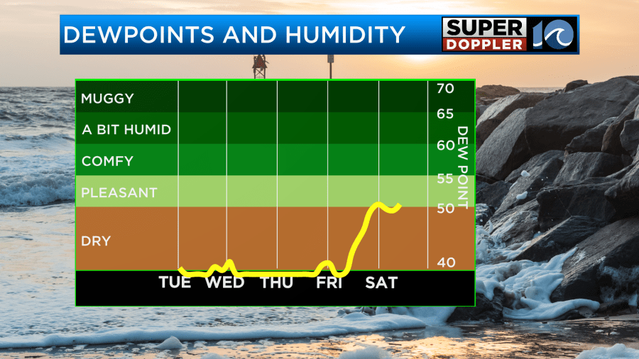
Dew points will be in the 30s tomorrow through Saturday.
High pressure will build in stronger from Thursday into the weekend. The upper-level low should also head out. That setup will allow for a lot of sunshine. High temps will stay in the 60s for a while.
There may be some patchy frost going into Thursday and Friday mornings. This will be more for far rural and northern areas. I’ll have more info on that in tomorrow’s weather forecast.
Meanwhile warm ocean water is still producing possible tropical systems. There is a tropical disturbance in the middle of the Atlantic, and it is moving generally to the west.
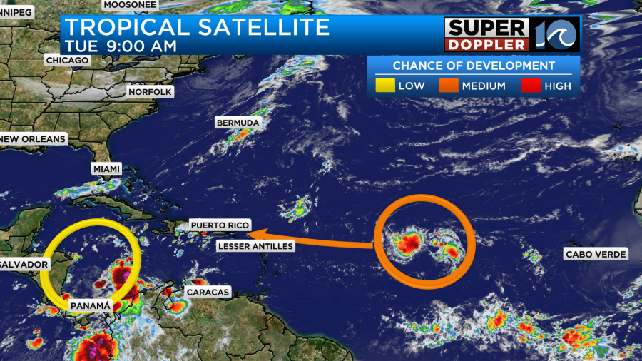
It has a medium chance of formation over the next few days. It could turn into a tropical depression or storm. We’ll keep an eye on it. However, I’m hopeful that some of these large cold fronts will keep the system away from the U.S. Stay tuned for updates.
Meteorologist: Jeremy Wheeler


