First off, yesterday there was a derecho in the Midwest. This is a large line of storms that can travel for hundreds of miles.
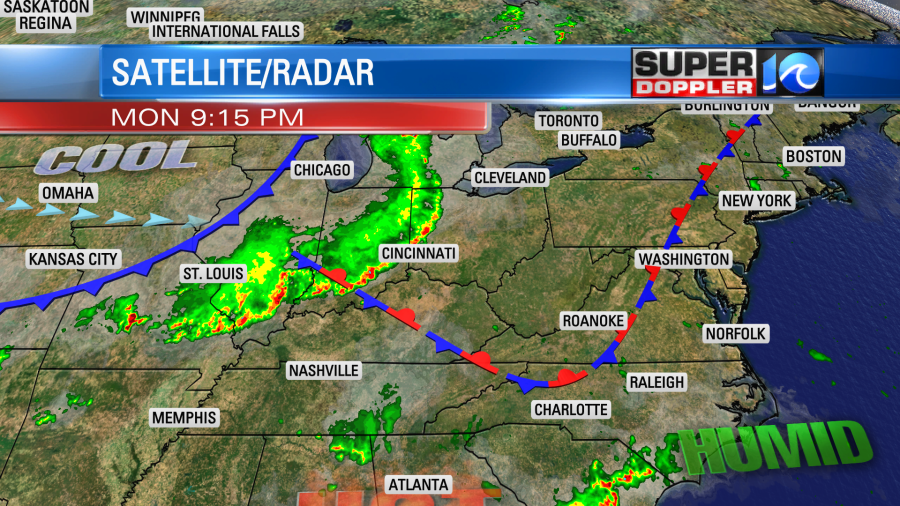
It caused a huge amount of wind damage reports in that region. Then the storm died out quickly last night over the Ohio River Valley. I’ve been in the middle of one of these, and it’s like being in a hurricane for 5 minutes.
Locally, today we have high pressure offshore.
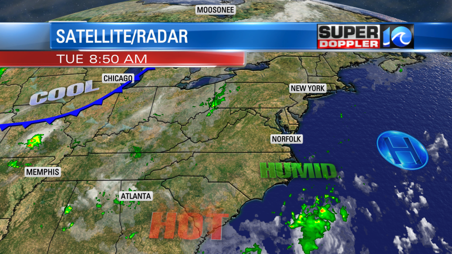
We’ll have pretty typical Summer weather. Skies will be mostly sunny and then partly cloudy. We’ll have a few showers and storms pop up this afternoon. There is a lot of humidity in the area, but luckily there are no big weather systems out there. High temps will be in the low 90s, but the heat index will be in the mid-upper 90s. We’ll have similar weather tomorrow. Then later this week an upper level disturbance and a cool front will move overhead. The front will stall out, and that will create more clouds and a higher chance for rain. Temps will come down slightly, but the humidity will stay high.
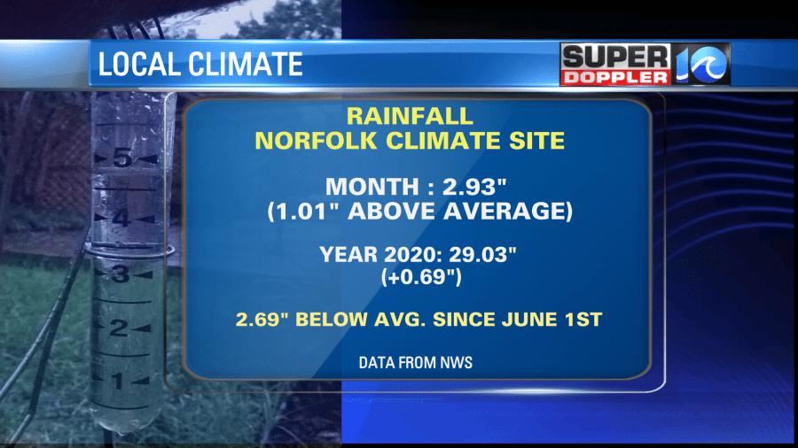
In terms of local climate, we are already up an inch above the average monthly rainfall. We are also up about 0.63″ for the year. However, we had a strong dry spell for a couple of months in the late Spring to early Summer. So we are actually down about 2.7″ since June 1st.
On another climate note…It got swept under the rug due to tropical storm Isaias. However, we ended up with the hottest July on record:
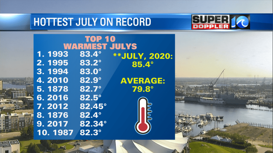
We beat the hottest year on record (1993) by about 2 degrees. We were almost 6 degrees above the average. That’s huge in terms of climate. I don’t see us cooling down anytime soon. Maybe September if we’re lucky, but probably October.
Last but not least…We have Tropical Depression 11 in the central Atlantic. It is moving off to the West and continues to strengthen.
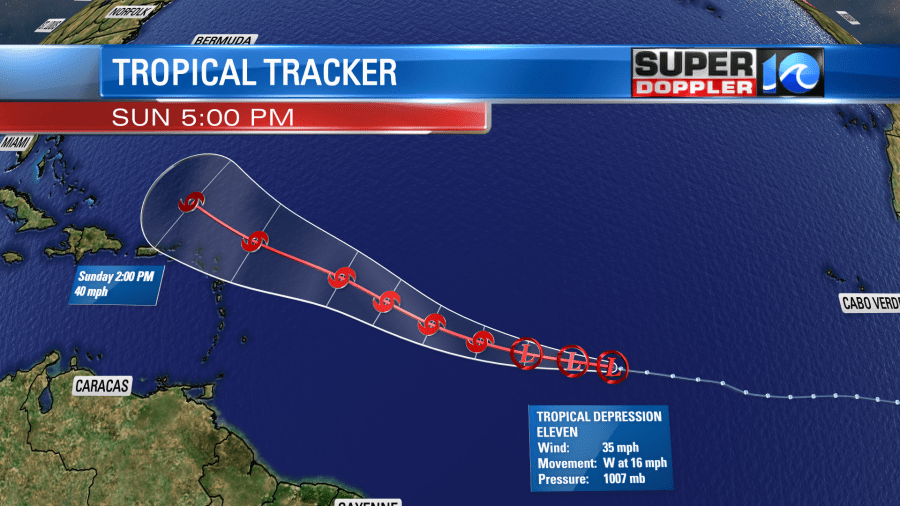
Luckily most of the global models have the system falling apart in a few days. We’ll see. We’ll track it over the next few days. Stay tuned for updates.
Meteorologist: Jeremy Wheeler


