Yesterday’s weather became great! The sun popped out a bit sooner than expected, and the breeze was just a bit stronger than expected. So we warmed up a little more than forecast. High temps made it into the upper 60s to low 70s.
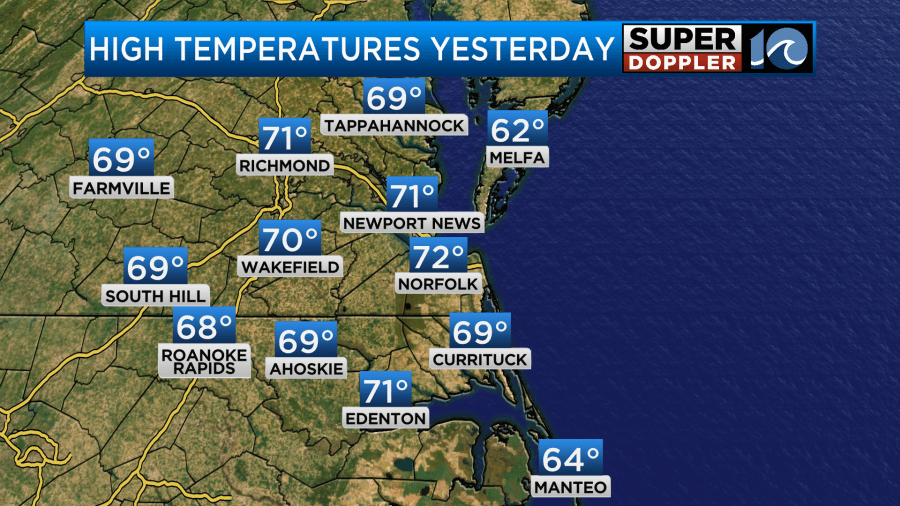
I walked the dog for about a mile and a half. When I returned to the back yard I did a little more exercise. I actually got so warm that I had to take the shirt off. (Plus, I wanted some extra vitamin D). Ahem… Anyway, we did have a good amount of sunshine yesterday. Today will be warm, but there is a lot more clouds and moisture. In fact this morning we had some thick fog over the James River Bridge.
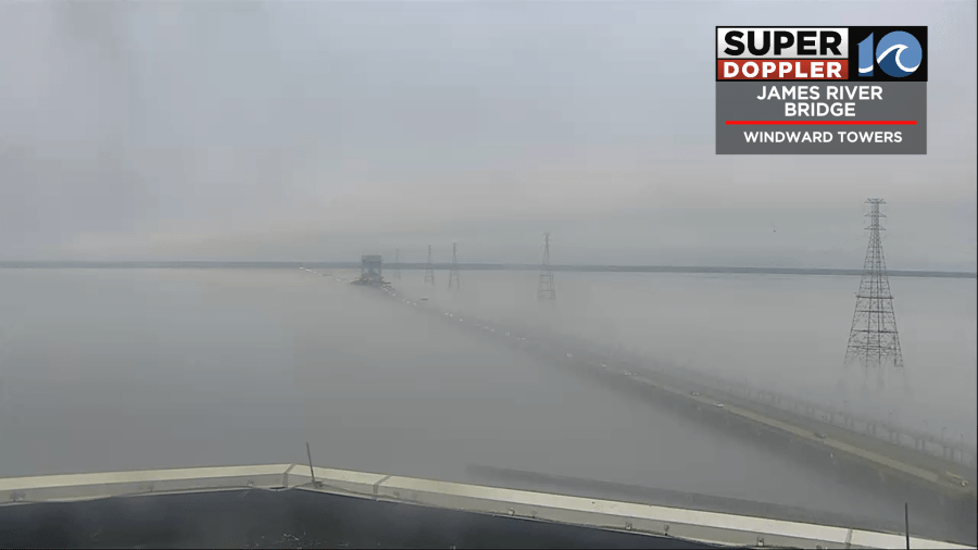
This fog was mainly caused by the warm humid air riding over the cooler waters. You can also see from the pic that we had a lot of thick clouds. There were also pockets of drizzle in the region. We have high pressure far offshore. There is a stationary front to our north and west.
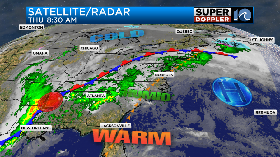
There is an area of low pressure over the deep south. Along with the unseasonably humid air that feature has caused a lot of flooding in that region over the past 24 hours.
Our local humidity has shot up as well. A few days ago dew points were in the single digits. Today the dew points are in the low 60s.
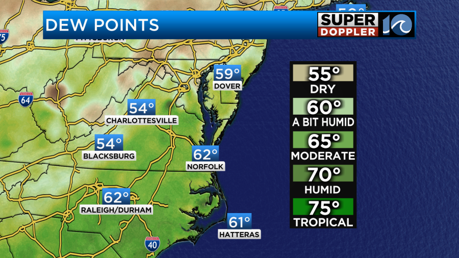
So it is going to feel a bit muggy outside today. At least the breeze will be up. So that will help. It will run at 10-15mph out of the southwest. However, this will also help to push our high temperatures back up to the low-mid 70s again.
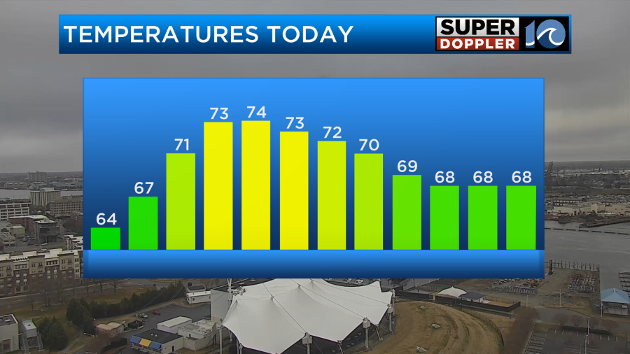
We’ll have spotty showers and sprinkles through the early afternoon. The sun may pop out a bit. However, we’ll be cloudy with scattered rain showers moving in from the west this afternoon.
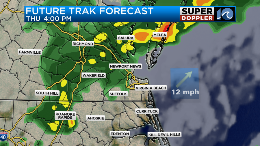
The scattered showers should end by the late evening. Tomorrow we’ll probably have more of a mix of sun and clouds. There will be a few spotty showers for the first half of the day, but some more scattered showers will return later in the afternoon.
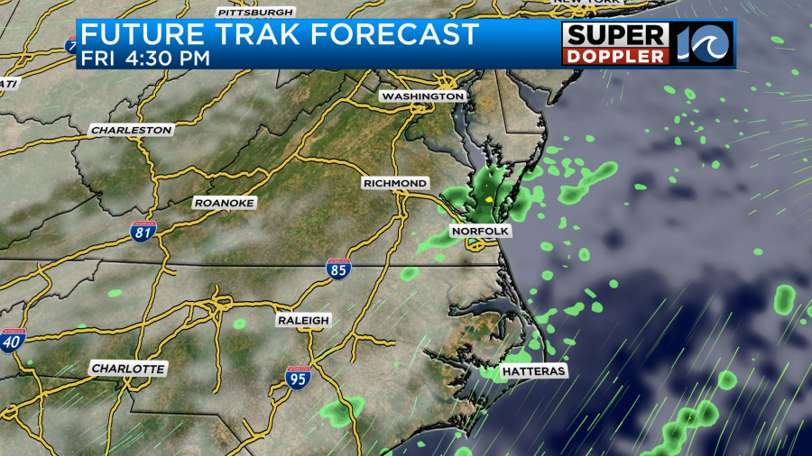
There may be some isolated thunderstorms as well. There will be a little fuel for them as we’ll have some pretty warm and humid air in place. High temps will aim for the low-mid 70s.
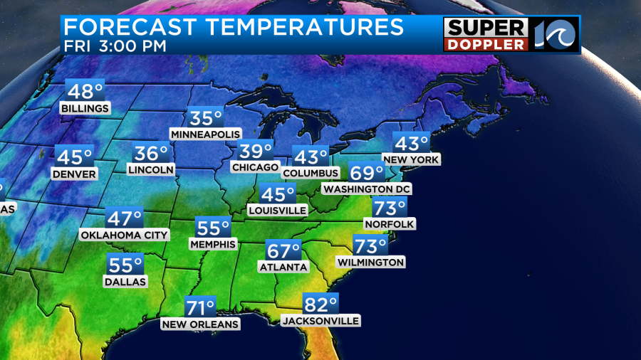
Also, a cold front will be moving in from the west. We’ll cool down behind the front on Saturday. High temps will drop to the low-mid 50s. The front will stall out to our south in the morning. However, the front will start pushing back to the north by Saturday afternoon. The warm/humid air will overrun the cooler airmass for a while. This will create more rain showers later in the day.
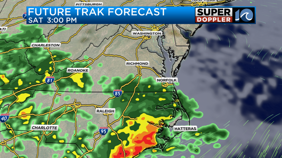
The front will stall out over southeast Virginia on Sunday, and an area of low pressure will move along the front. This will likely bring us a lot of rain to our region.
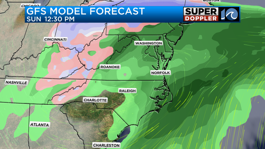
High temps will be in the upper 50s to near 60.
Behind the front we’ll have another cold front sweep in behind it. This will cool us down even more early next week. High temps will be in the 40s Monday and Tuesday. There may be a few rain showers on Monday. If the precip hangs around behind the system Monday evening, then we may have a brief wintry mix. We have plenty of time to keep an eye on that. Stay tuned for those updates.
Meteorologist: Jeremy Wheeler


