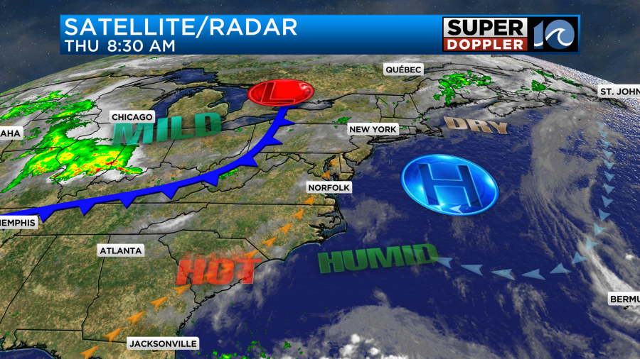
Today’s weather will be pretty good for this 4th of July. At least in our local area. We have high pressure moving offshore. This is allowing the winds to turn out of the southwest.
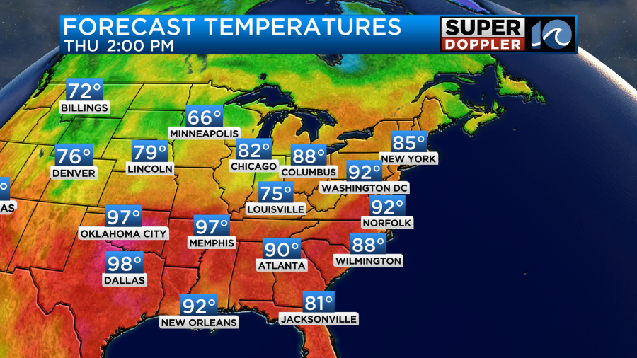
We’ll have partly cloudy skies through the day. The breeze will run at 5-15mph. This will push the high temps up to the low 90s.
If you are doing some travel over the region, then keep in mind that there will be some scattered storms forming off to our west.
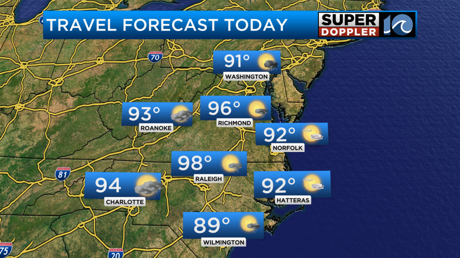
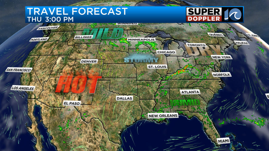
Travel should be pretty good for most of the country. There will be some scattered afternoon storms across the southeast. There will be some bigger clusters of storms over parts of the Midwest.
While our local temps will reach the low-mid 90s. Our heat indices will get up into the upper 90s this afternoon. We should stay quiet during the day. However, by the evening some scattered thunderstorms will be moving in from the west. These storms should mostly fall apart, but some isolated showers or storms could survive during fireworks time. The different models handle the amount of storms differently. Here is the HRRR model:
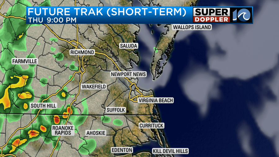
Here is our Future Trak model

I think it will be a little in-between these two forecasts. So there may be a little better chance for rain west and northwest of the metro. Check the WAVY weather app to stay ahead of any rain.
Tomorrow we’ll have some pretty typical Summer weather, but it will get even hotter. High temps will run up into the mid 90s. However, the heat index will be between 100 and 105 degrees. This will be the same for Saturday.
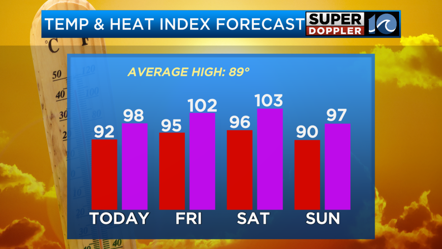
We’ll be partly cloudy both days with a few showers and storms popping up in the afternoons. Dew points will be in the 70s through the weekend and even above 75 for a time.

We will cool it down a bit on Sunday. High temps will drop to the upper 80s to low 90s, but it will still be fairly humid. We will have more clouds and a little higher chance for rain on Sunday as a cool front stalls out over the region. We’ll have pretty typical Summer weather early next week.
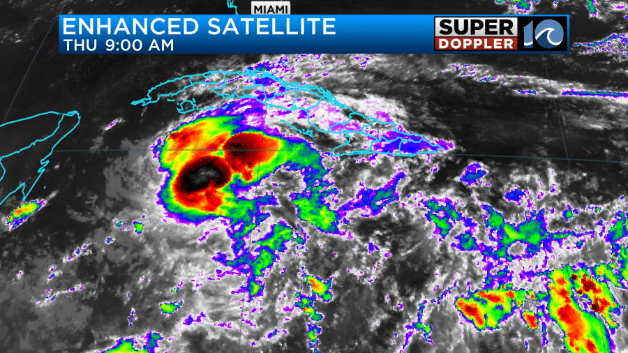
Meanwhile hurricane Beryl is cruising through the Caribbean. It caused a lot of damage over parts of Jamaica yesterday. Though the damage was not as bad as some of the islands over the southern Lesser Antilles. Beryl has passed Jamaica now, and it is affecting the Cayman islands.
The storm is moving to the west/northwest. It will reach the coast of the Yucatan Peninsula by tomorrow morning.
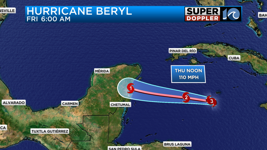
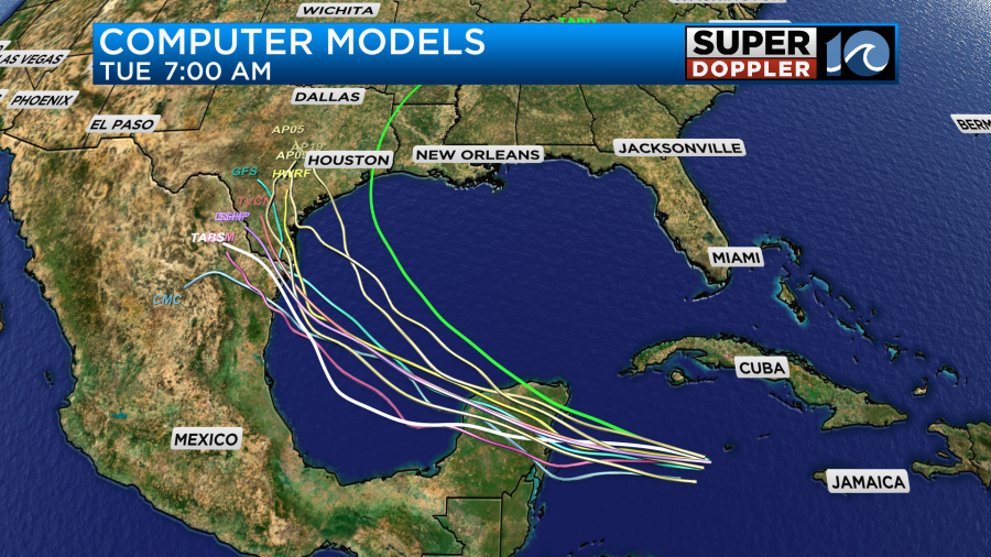
It will likely pass south of Cozumel. Then it will move over land and weaken to a tropical storm. After that there is a lot of uncertainty. The forecast cone widens quite a bit in the 3-5 day range. It does look like it will aim for south Texas.

The models are pretty split after the Yucatan. They have been trending north still. There are a few models which take the storm near or even north of Corpus Christi.
We’ll bring you updates over the next couple of days.
Have a fun and safe holiday!
Meteorologist: Jeremy Wheeler