We had some more great weather yesterday. High temps were in the upper 70s to low 80s in the region.
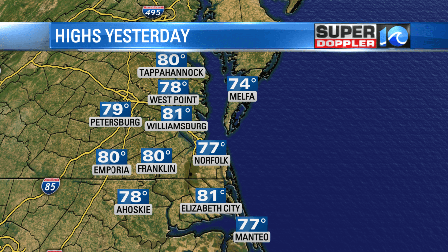
The humidity was still down. It was warm in the sun and great in the shade. A big area of high pressure is over the region. However, today it is sliding just a bit offshore.
That is allowing the winds to turn out of the south. So today we’ll start warming up the temps. We’ll be in the upper 80s with a few 90s inland.
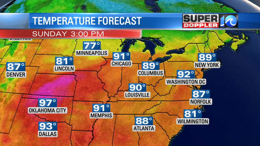
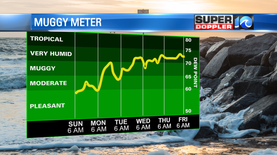
Humidity will be low-moderate with a light south wind. We’ll heat up some more tomorrow and Tuesday. High temps will be in the 90s.
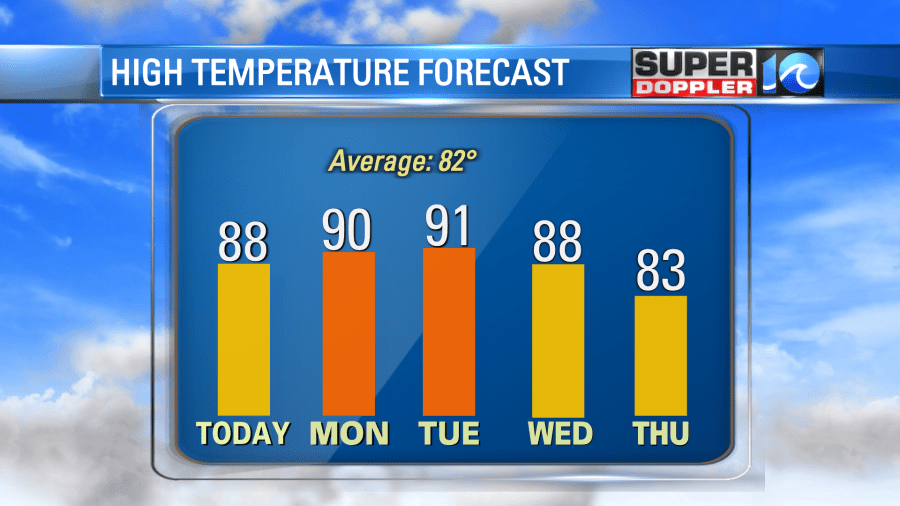
Humidity will also climb. Dew points will go from about 60 today to near 70 on Tuesday.
At least we’ll have quiet weather. We will cool down later in the work-week with a few thunderstorms possible.
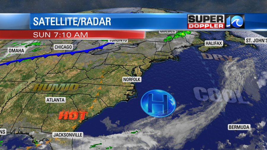
The tropics are not quiet, but at least there are no active systems…yet. Larry became post-tropical yesterday. It brought some rain and snow (yep) to Greenland. With Larry that far north now the waves along the east coast are settling down. Today there is a moderate threat for rip currents, but that’s better than the high threat we’ve had for the last couple of days. The surf won’t be as rough.
Having said all that… There are several features that we are watching. There is a tropical disturbance over the Bay of Campeche that is showing signs of strengthening. This has a high chance of formation today, and it could be one by the time you read this blog.
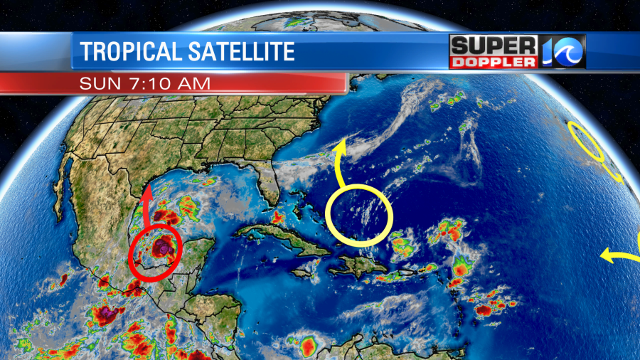
Unfortunately, several models have it forming and running up into the Gulf Coast. It could bring some very heavy rain to the coast of Texas and Louisiana. A couple models even have rain in Louisiana for a few days. Let’s hope not as they are still in rough shape from Hurricane Ida.
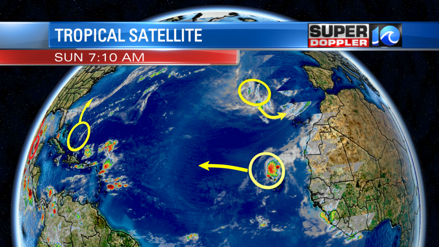
There is another weak disturbance that is north of Haiti. This could move north (offshore of the east coast this week). If it gets closer to the coast, then we’ll have to up the rain chances later this week. There are also a couple of weak features in the eastern Atlantic. They have a low chance of formation.
Meteorologist: Jeremy Wheeler