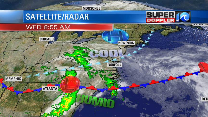
If you are out today along the oceanfront, then you would think that there is a nor’easter just offshore. While the remnants of Arthur are far offshore, they are not solely responsible for the wind and higher tides. It will churn up the Atlantic waters today, but again…it’s far out to sea. We do have another area of low pressure to our southwest. There is also an area of high pressure to the northeast.

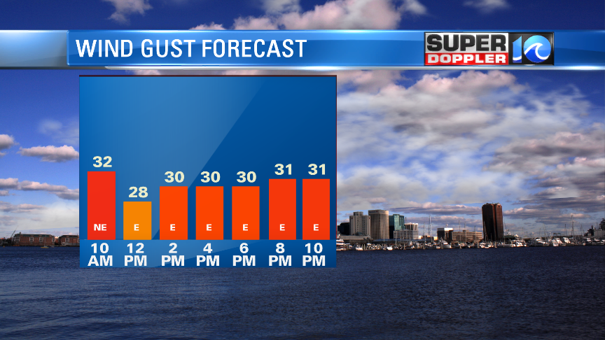
It’s the interaction of these 3 features that is causing the strong/persistent northeast wind. It will stay up today out of the northeast at 15-20mph. The gusts will be up to 35mph. We even had a few gusts above 40mph this morning, but those were isolated.

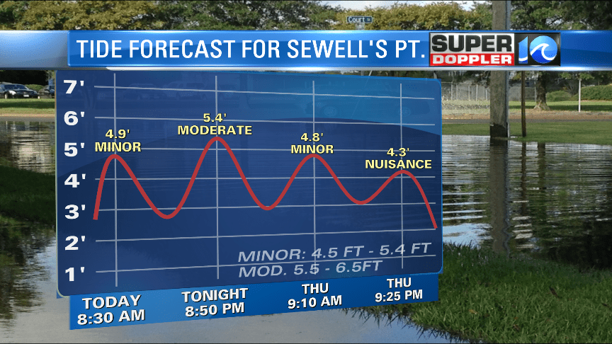
The wind will create some tidal flooding today. High tide is generally between 8 and 11am and 8pm and midnight. The high tide wasn’t too bad last night and this morning. It was a little lower than forecast, and the forecast has come down a bit too. Here is the latest tide forecast for Sewell’s Point:

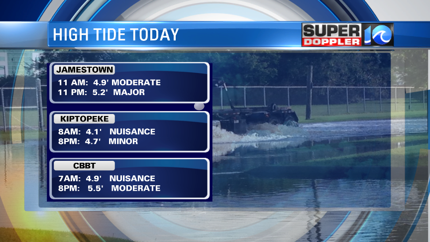
It looks like the highest tide will be during tonight’s high tide. That will be moderate tidal flooding for a lot of the Chesapeake Bay, but minor along the oceanfront. The one area of concern is around Jamestown. The threshold for major tidal flooding there is less than other locations. It’s only 5ft. The forecast level for there tonight between 11pm and midnight is about 5.2ft.

You can click here for the latest tide forecasts from the National Weather Service: NWS tides. The tide will go down tomorrow as the winds decrease and turn more out of the east.
As far as rain goes….We had a lot of rain yesterday evening and last night. It was light, but there was a lot of coverage. Then it took a long break this morning. We’ll have scattered showers and pockets of drizzle on-and-off through the day, but it won’t be a complete washout. Skies will be cloudy. Temps will struggle to climb out of the low 60s this afternoon.
Again, tomorrow we’ll have less wind, and it will be more out of the east. It will run at 10-15mph with some gusts up to 20-25mph. That will allow the high temps to climb to the upper 60s. The average high is in the mid 70s this time of year. We’ll have some scattered showers and pockets of drizzle, but it won’t be a washout. However, the models are showing more rain coming in on Friday as the low (and upper level low) finally move east. The good news is that we should start drying out on Saturday as that system moves out to sea and weakens. We’ll have a mix of sun and clouds with a few showers. Highs will be in the lower 80s. We’ll dry out on Sunday and Monday as high pressure builds in. High temps will be in the 70s. So we’ll finally get a break from the rain as we go through Memorial Day weekend. Stay tuned for updates.
Meteorologist: Jeremy Wheeler


