Yesterday we did have some sunshine in the region. There was even a little bit near the shore. Winds were strong and tides were up. On Tuesday, the area of low pressure that has been sitting over the ocean is actually moving west instead of east.
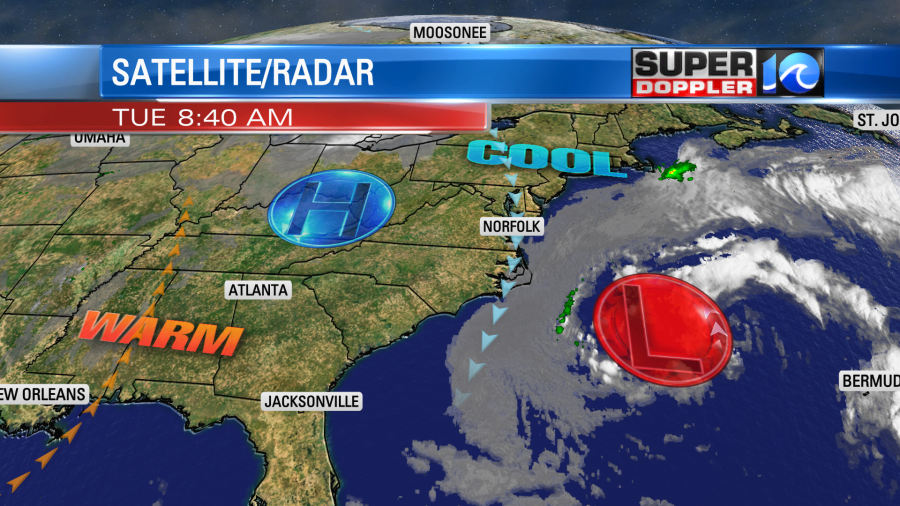
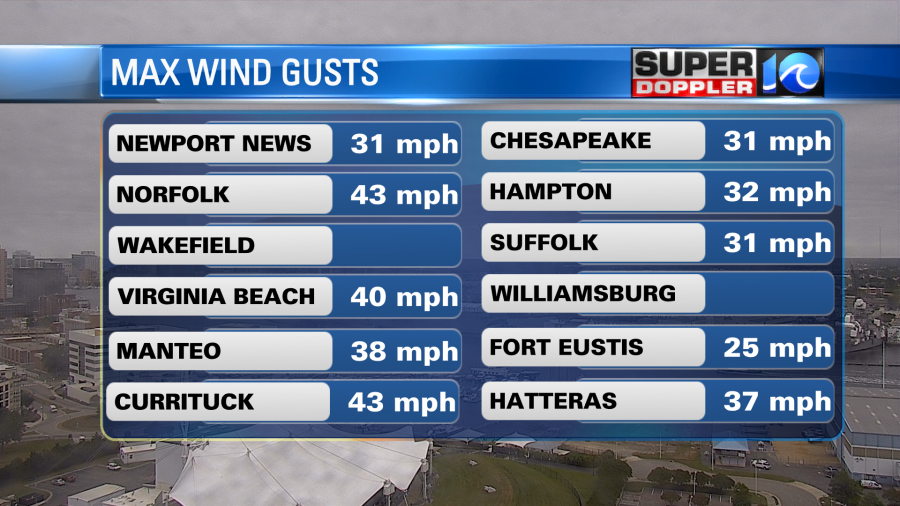
Meanwhile high pressure is still locked-in to our west. So the winds are still strong along the coast and in the metro. Winds have been gusting to 30mph with gusts up to 40mph near the shore.
Wind will stay up through the day. There are Wind Advisories for areas along the coast until this evening, but they will expire sooner on the Eastern Shore.

Winds will gust to 35-40mph near the shore with gusts to 30mph in the metro. It won’t be too bad inland. Winds will gust to 20-25mph.
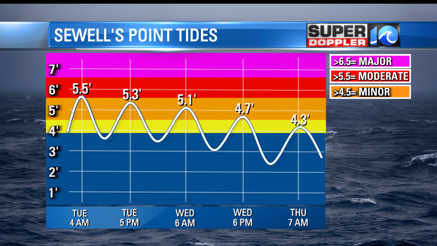
This is leading to more tidal flooding. ALTHOUGH… the tide forecast has come down dramatically. This morning Sewell’s Point hit about 5.5ft. This was low-end moderate. The tide will gradually get better over the next 24-48 hours.
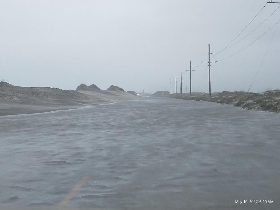
There were some flooded streets in Hampton Roads. There was also some ocean overwash along the Outer Banks. Here is a photo of it from NCDOT:
Going forward the tides will gradually decline over the next couple of days. The next high tide over the Outer Banks should be more minor to moderate.
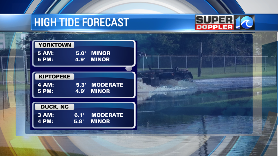
The tide was minor to moderate this morning across the southern Chesapeake Bay. It will be more minor in the next 24 hours.
Tomorrow the low will weaken a little as it basically meanders around offshore. We’ll have lots of clouds with winds slowly tapering off through the day. There may be some spotty showers along with some drizzle. High temps will be near 60. I’m hoping the sun pops out later in the day, but I’m not too optimistic.
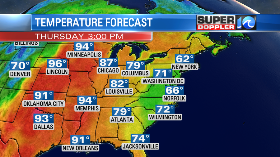
The low won’t fall apart, but it will weaken even more on Thursday. It will start to move back over the U.S. through that time. So we’ll be mostly cloudy with a few showers. However, the wind will die off. So high temps will be more in the mid 60s. While this will be a warmup for us. It will still be MUCH cooler than the Midwest and even up to the Canadian border. High temps there will be in the 90s.
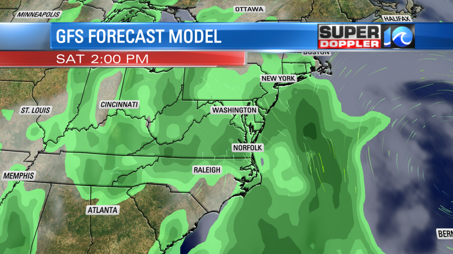
We’ll be even warmer on Friday, but moisture will increase. So we’ll have a decent shot at rain showers with highs in the 70s. The upper level part of the low will sit over us Friday and Saturday. So we’ll have more rain showers on Saturday with highs in the 70s.
I’m hoping that by Sunday we’ll start to dry up a little bit. So I have lower rain chances for now, but stay tuned. Either way I think we’ll be warmer. We may hit 80 degrees.
Stay tuned for updates on all of this.
Meteorologist: Jeremy Wheeler


