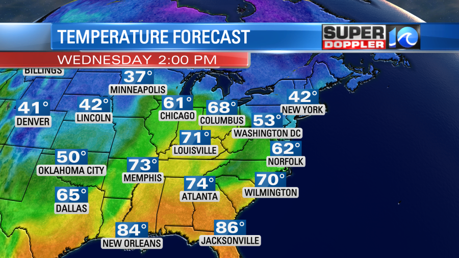
Finally, we are going to get some warming back into the region today. We started off the morning with temps mainly in the 40s. Overnight clouds and a light south wind helped to keep the temps up compared to yesterday’s deep freeze. There was a band of light showers and mixed precip early as milder and more moist air pushed up from the south.
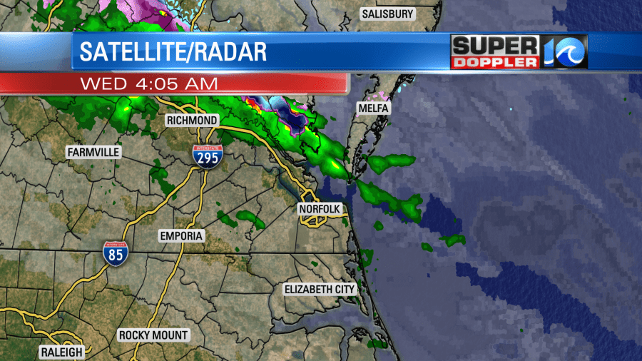
This started moving out by 8am, and there was already some clearing. We have high pressure moving to the northeast. There is a warm front to our south, and high pressure is sliding farther out to sea.
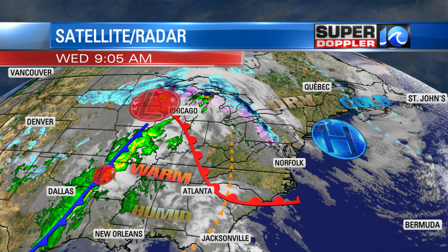
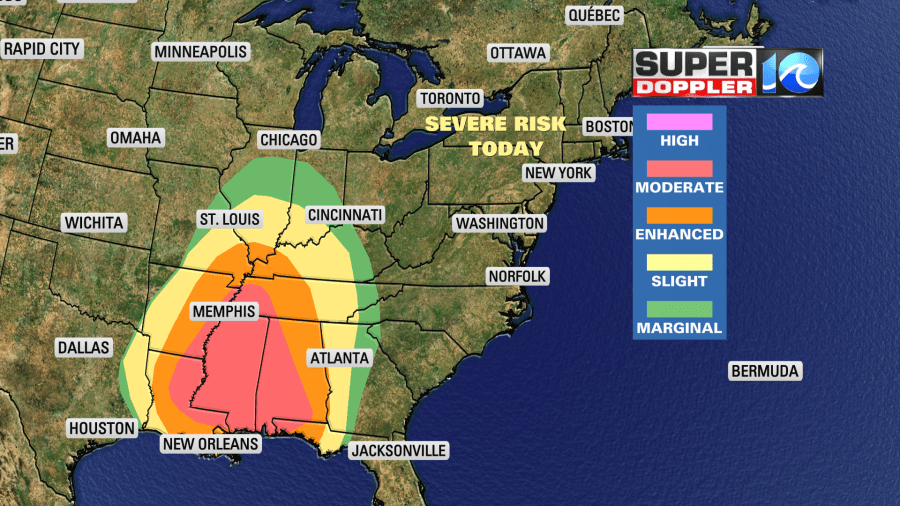
There is a big area of low pressure to our west. It’s tracking more north than east. There is also a highly unstable air mass over the Deep South today. So there is a “moderate” risk for severe weather over Mississippi, Alabama, and western Tennessee.
We’ll have a mix of sun and clouds today. It will be nice out for a long stretch of time. We’ll have a wind out of the south/southeast at 10-15mph. High temps will rise to the low-mid 60s with upper 50s north of the metro.
Meanwhile as the warm front lifts north it may bring us a few more isolated showers this afternoon. They should be spotty and light.
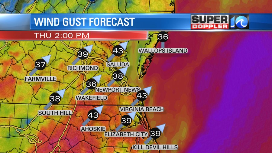
Tomorrow we’ll be very warm and windy. Winds will be out of the south at 10-20mph with gusts up to 35mph. There may be a few gusts to 40mph.
This will push out high temperatures up into the upper 70s. It’s possible that we could get a few 80s out there. Moisture will increase quickly as well. Dew points will rise up into the 60s. We’ll have increasing clouds tomorrow morning through the early afternoon. There will also be some spotty showers. Then some scattered showers and storms will move in later in the afternoon.
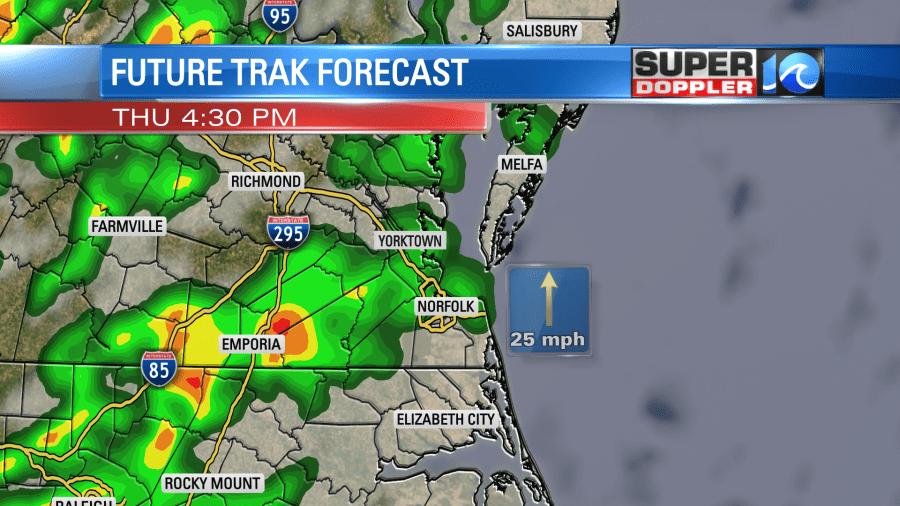
By the evening some strong storms will quickly swipe through the region.
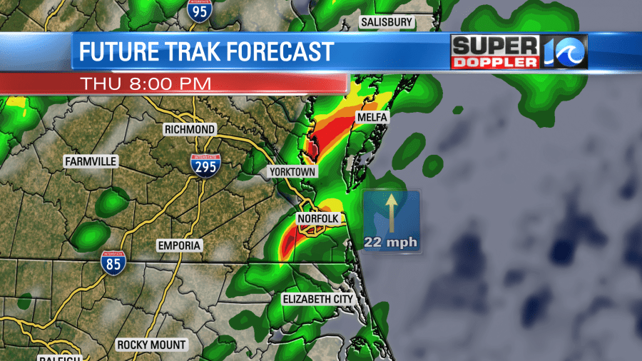
Some of these could be strong to severe. There is a marginal risk for severe late tomorrow with a slight risk just to our west.
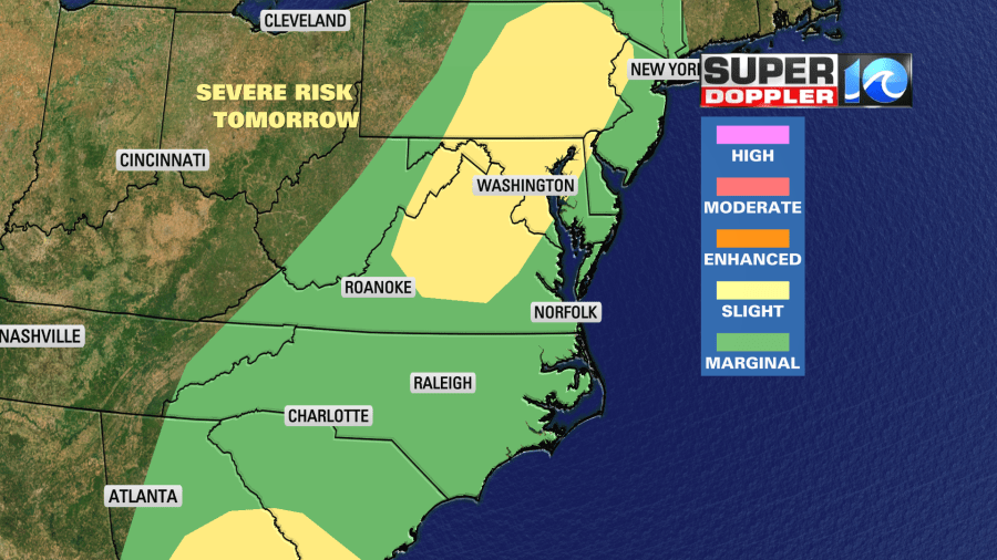
There will already be some strong/gusty winds before any storms arrive. When they do move in, then they could create some even stronger gusts with some brief heavy rain. Those will be the main threats. An isolated tornado can’t be ruled out, but conditions will favor more straight-lined winds.
We will see varying amounts of rainfall. Some locations could see a quarter of an inch. Some could see a little more than an inch. That will depend on who gets those passing downpours. They should move fairly quickly. So I don’t expect any large scale flooding.
The rain will taper off through Thursday night. Then we’ll dry out on Friday. High temps will be in the upper 60s. It will be a little breezy, but a fairly nice day overall.
We’ll be dry and cooler on Saturday. Highs will be in the upper 50s. We’ll be in the mid 60s on Sunday with partly cloudy skies. There could be some isolated showers, but they should be limited.
Stay tuned for updates!
Meteorologist: Jeremy Wheeler
