Locally, we are going to start warming up for a while. We just wrapped up a cooler than average October. Now I think we are going to have temps that are typical for September. At least for a few days.
Today we don’t have any big weather systems near our area, but there is a weak feature that is affecting us. A stationary front has developed just offshore.
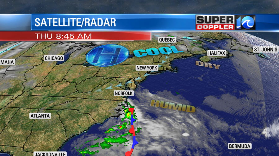
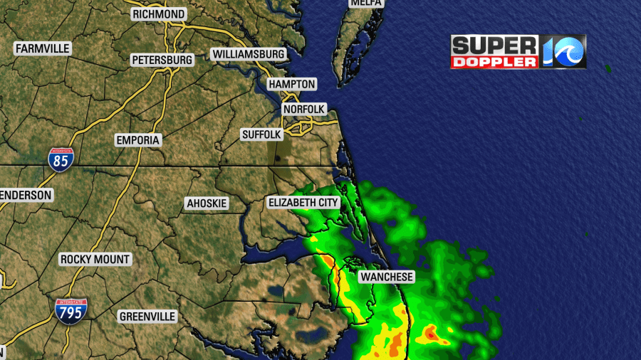
The Gulf Stream is offshore, and that is supporting the warm/humid air east of the front. This boundary had some thunderstorms along it earlier this morning (offshore). However, some showers have moved to the west/northwest.
There is an area of high pressure to our north. However, it is not building into our region. There is a cool northeast breeze, and some of the offshore moisture is wrapping into that wind and blowing into our area. Clouds should break up a little as we go through the morning. We’ll have a mix of sun and clouds this afternoon with some isolated showers possible. Despite the light northeast breeze temps should be able to warm to near 70 degrees this afternoon.
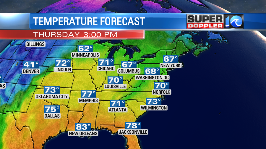
It’s still cold in the west, and it’s very warm over the Midwest.
Tomorrow we’ll have similar weather. Expect a mix of sun and clouds with some isolated showers. High temps will make it to the low 70s.
However, over the weekend we will develop a southerly wind. This south breeze will help to push temperatures up to the upper 70s.
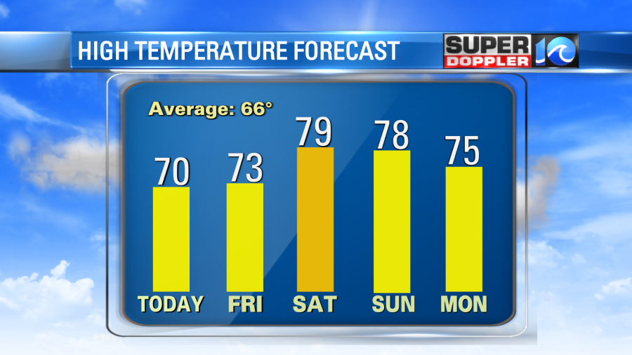
There will probably be a few 80s in the area. (at least in some inland locations).
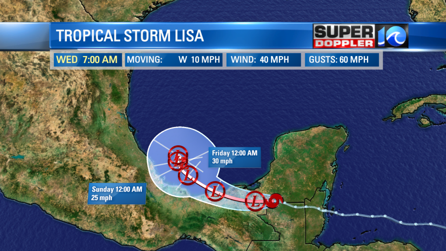
Lisa is a tropical system that is now over southern Mexico. It did make landfall last night as a hurricane over Belize. Now it is moving west and weakening.
It is basically going from a tropical storm to a depression this morning. It will move towards the Bay of Campeche later today. Despite being over the water, it will get hit with some increasing wind shear. That should allow it to dissipate in a few days. However, that is not a guarantee.
Meanwhile hurricane Martin is over the north/central Atlantic. It is moving quickly to the northeast. It is over cooler water, but it has maintained, and even gained, strength.

However, it is interacting with some cooler/drier air as well. It is taking on more of the shape of a baroclinic system. So it will become post-tropical later today. It will more-or-less become a nor’easter out over the ocean. It will eventually weaken, but it could impact the U.K. in a few days.
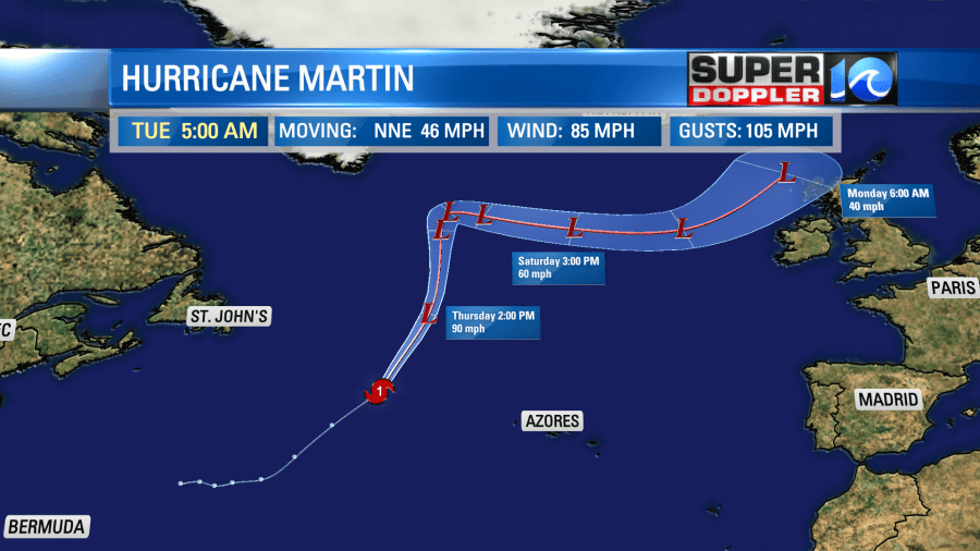
While it will stay offshore, it will also likely bring us some higher waves as we go into the weekend. It may be good for surfers, but there will be a high threat for rip currents that will impact swimmers. Keep that in mind if you are tempted to go swimming with the warmer temperatures ahead.
Meteorologist: Jeremy Wheeler