We are going to have a transition day today in our region. The pesky/weak area of low pressure that has been sitting off the coast will finally push farther out to sea today. High pressure will edge in from the west.
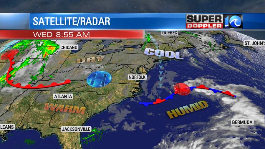
We had a lot of clouds this morning, but there were some breaks. Plus, the drizzle was a lot more patchy. As we go through the day we’ll have gradual clearing. The showers/drizzle will be very isolated. We’ll have a light north breeze. So high temps will be able to rise to the mid-upper 70s.
Our humidity will drop slightly.
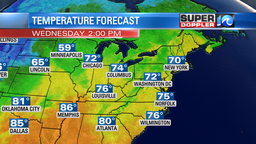
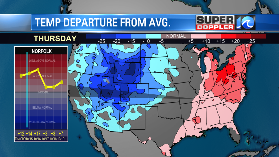
Tomorrow and Friday we’ll have drier & warmer weather. High temps will rise to the low 80s. Temperatures are going to be well above average in the eastern U.S., but it will be cold over parts of the west.
We’ll be mostly sunny to partly cloudy both days. We’ll be in the low-to-mid 80s on Saturday with partly cloudy skies most of the day. Clouds will increase late in the day, and there will be a few showers and storms. This will be ahead of a strong cold front. The front will bring a line of showers and storms Saturday night. This should move out by Sunday morning. Behind the front we’ll be a big drop in temps and humidity. High temps will be near 70 degrees. Dew points will drop to the 40s.

We’ll stay cool and dry early next week.
There is only one weak tropical disturbance in the tropics.
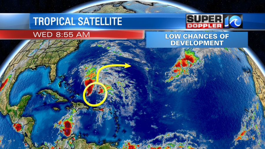
This has a low chance of formation. Even if it does, then it should stay out to sea.
Speaking of tropical systems… I ran across a neat article today that talks about how birds can be transported in hurricanes. More specifically they can be trapped and transported in the eye of the storm. I’ve heard of it before, but I admit I knew little about it. Here is the article with more information. Hurricanes transport birds.
Meteorologist: Jeremy Wheeler