For the 3rd year in a row the Norfolk St. Patrick’s day parade was cancelled last weekend. Now today we have lots of rain for this St. Patrick’s Day itself. It won’t be a washout, but there has already been some heavy downpours and thunderstorms. Around 7:30 this morning there was a ring of heavy showers moving up from northeast North Carolina up to the Southside.
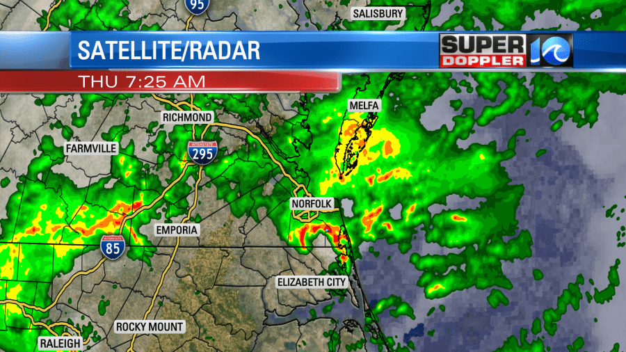
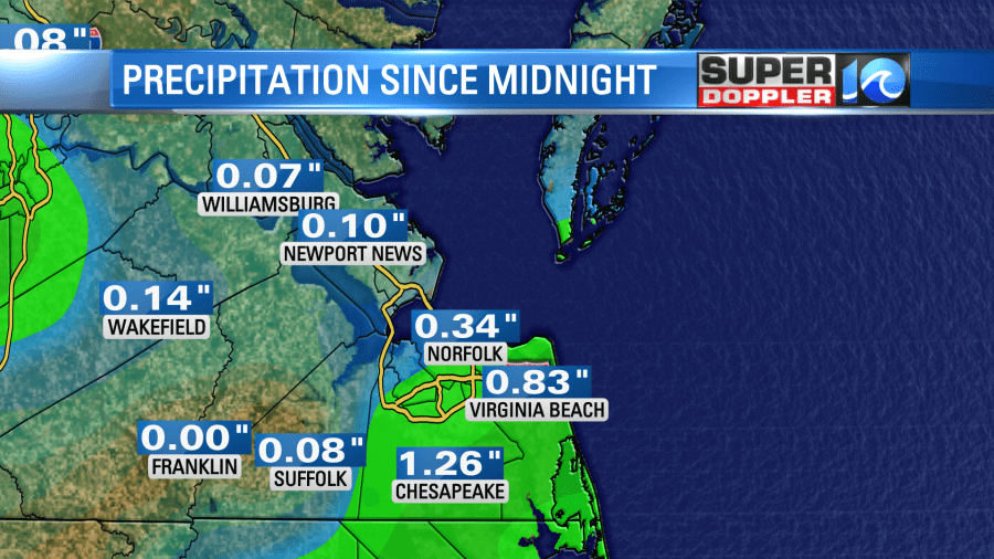
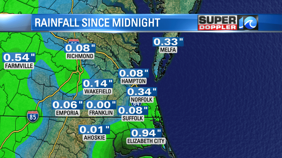
We picked up over an inch of rain in Chesapeake since midnight. We picked up about 8-tenths of an inch in Virginia Beach.
This was due to a weak area of low pressure sliding through the region with an upper level low drifting overhead.
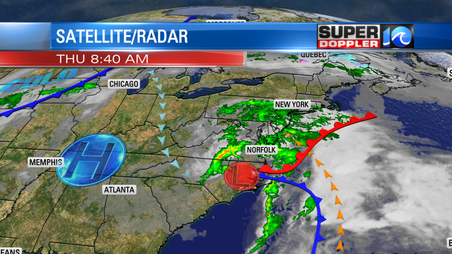
Today the surface low will push to our northeast. However, the upper low will linger longer. So rain showers will become more scattered this afternoon. There will be a lot of clouds, but I’m hoping that the sun pops out for a short while. High temps will be in the 60s. Winds won’t be too bad. They will run out of the northwest from the late morning onward.
Tomorrow high pressure will build into the region. It will be very nice out. High temps will be in the low 70s with partly cloudy skies. Another system will bring us rain on Saturday. A warm front will push to our north by the morning. Then a cold front will move through later in the day. The models are handling the rain differently. For now I’m calling for scattered showers at times. Our future Trak model isn’t showing much rain during the day. However, the GFS model is showing a fairly wet day.
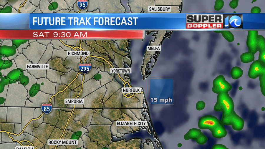
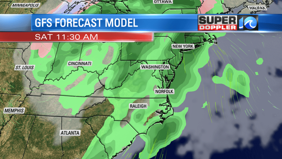
Keep in mind the GFS model is a broader model. So that could be part of the reason for the difference. The European model mostly has scattered rain showers in the morning.
Either way we’ll dry out on Sunday. It will be nice for the first day of Spring. High temps will be in the mid 60s.
Meteorologist: Jeremy Wheeler


