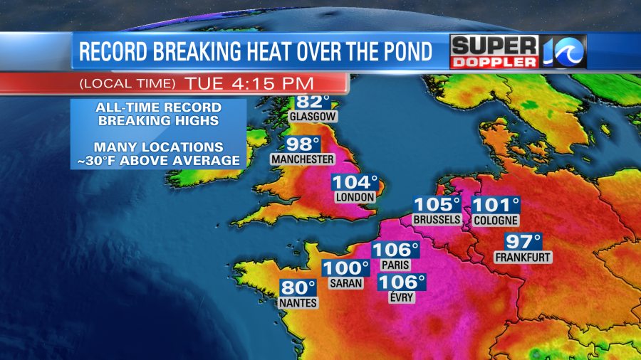
I’ll talk about the local and U.S. temperatures in a moment. However, I did want to talk a little more about the temperatures in Europe. Parts of Europe had record heat again yesterday. Temps swelled into the 100s for many. London broke a record with 104 degrees in the afternoon.
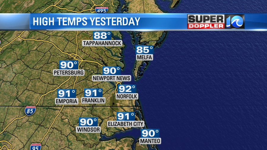
It was hot across the central U.S. again yesterday as well. It ended up hitting 115 degrees in Witchita Falls, Texas. Wow! It wasn’t that hot here as we luckily has some clouds in the morning. So topped off in the low 90s over most of the region.
Today we are starting off with lots of sunshine. I don’t see the cloud bank forming again. So temps will shoot up fast. We’ll aim for the low-mid 90s this afternoon.
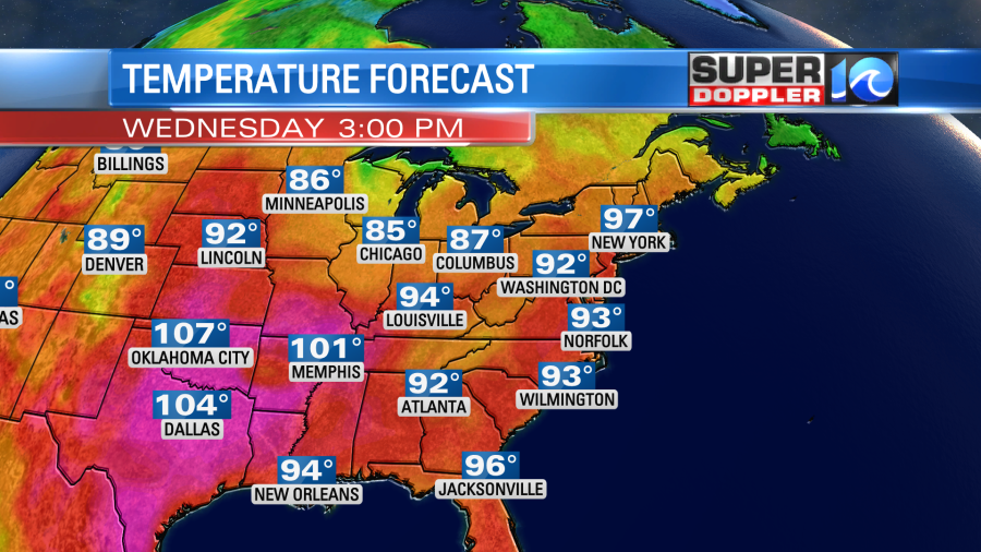
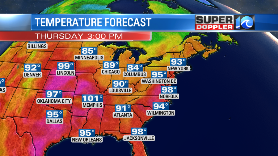
It will still be well into the 100s in the central U.S. I don’t expect any 100s here. The record highs locally are around 102 degrees over the next few days. Now keep in mind that the heat index will be near or a little over 100 for many.
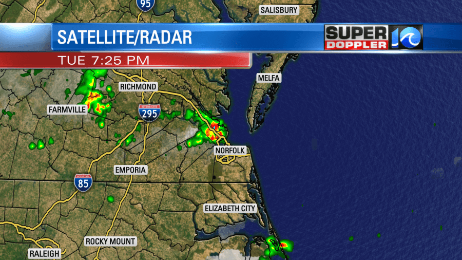
We’ll be mostly to partly sunny. There will only be some isolated pm showers or storms. It may pick up a little more by the evening. Yesterday there was a big downpour during the evening on the Peninsula, but there wasn’t much elsewhere.
There won’t be much wind today compared to the last couple of days. So the heat may hit folks a little harder today. Tomorrow the wind will pick up out of the southwest. While it will be nice to have a breeze again (A few gusts to 20mph), it will also pull in more heat. High temps are forecast to be in the upper 90s Thursday afternoon.
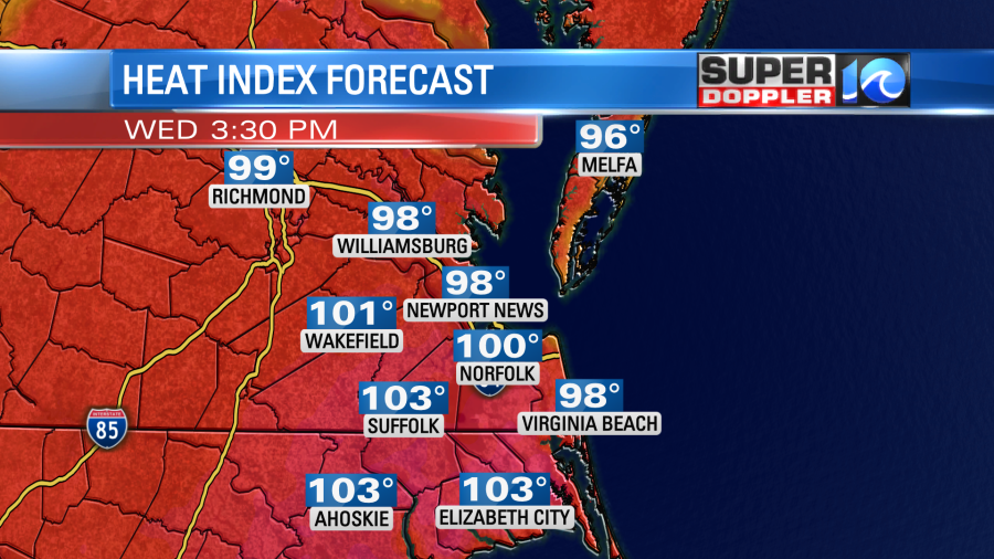
The heat index will likely be over 105. That will prompt Heat Advisories if we actually meet that criteria. There could be a few inland locations where the temperature reaches 100, and the heat index gets close to 110 degrees. That could happen in places like Williamsburg. We’ll be partly cloudy with only some isolated showers or storms. There could be a few more by the evening.
A cool front will move into the region and stall out on Friday. This will knock the temps down just a little bit. Highs will be in the lower 90s. It might drop the humidity slightly as well.
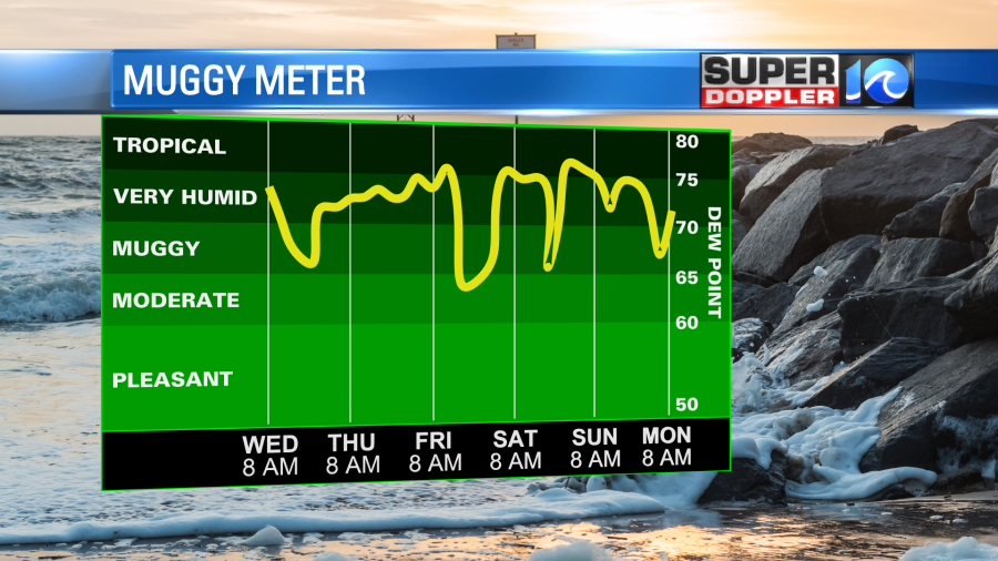
We could have some isolated showers or storms. Then we’ll stay in the 90s Saturday and Sunday with very little rainfall. The hot/muggy conditions will continue into early next week here. Stay tuned for updates.
Meteorologist: Jeremy Wheeler


