Yesterday was definitely a chilly day. Temps only topped off in the 40s as the increasing clouds capped the temperatures. We also had a light northeast wind. Today we are going to try to warm up a little, but it will be a bit of a struggle. While we did have some clearing last night, we also had more clouds swoop in early this morning. There is a push of moisture coming up from the south, and that is going to keep a lot of clouds in the region through the day.
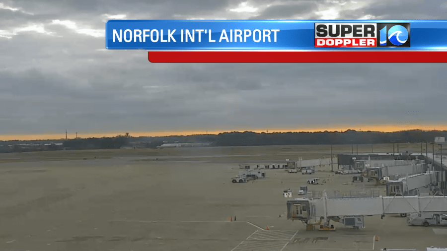
The surface wind will be light and out of the southwest. Again, this will try to pull up some warmer air, but it will be a struggle due to the clouds. (They should break up some.) High pressure is offshore. There is a strong warm front to our south/southwest.
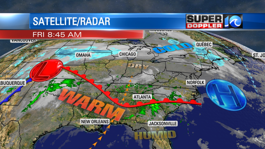
The front will push north of our region late in the day. Between this and the moisture a couple of showers will be possible later this afternoon
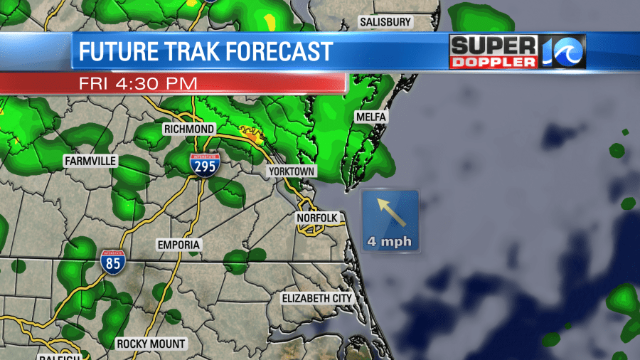
The showers may increase a bit more during the early evening, at least for a time. In yesterday’s forecast (for today), I thought we would hit the lower 60s this afternoon. However, I trimmed that back to the upper 50s with a couple of 60s over North Carolina and near the state line.
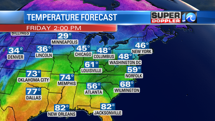
It will be much warmer south of the warm front. High temps will reach the 70s and 80s over the Deep South and the Gulf Coast.
Tomorrow the wind will be very strong out of the south. It will increase to 10-20mph with gusts up to to at least 30mph. A few gusts could be around 35mph. The warm front will lift far to our north. The strong cold front will just to our west.
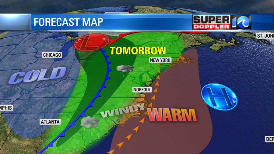
We’ll have partly to mostly cloudy skies. There will be some isolated showers during the day, but there won’t be much. Our high temps will reach the lower 70s. Especially, if the sun pops out. If it pops out a little more than forecast, then I bet we’ll hit some mid 70s.
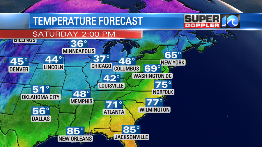
The record high for Saturday is 75 (1971).
The cold front won’t arrive until tomorrow night. There will be a line of rain showers along the boundary.
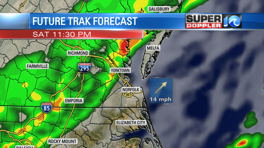
The rain may be heavy for a time. There may even be a few thunderstorms. Rain will continue into Sunday morning behind the front.
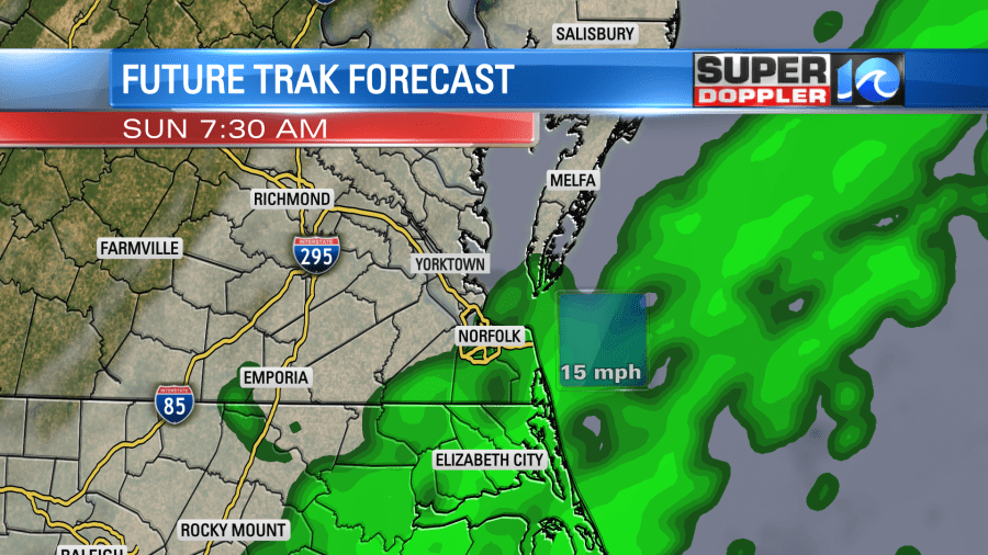
Then the rain will move out by the mid morning. Winds will flip around out of the north. they will run at 10-15mph with gusts up to 20mh. Skies will clear through the day, but high temps will only make it to the low 50s in the afternoon.
Before it all ends we could see about a half inch to an inch of rainfall if we are lucky.
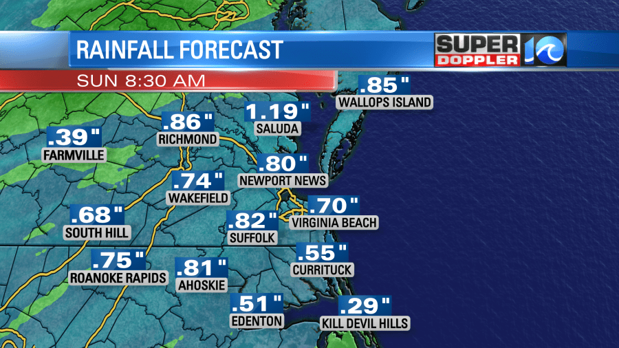
Keep in mind that lately the dry ground has taken away some of the moisture during these recent rain events. So they have come in lower than forecast. However, I think this time the strong south wind will overcome that effect. So I’m hopeful for the higher amounts, but not overly optimistic.
Have a good weekend and stay tuned for updates on the weekend forecast.
Meteorologist: Jeremy Wheeler
