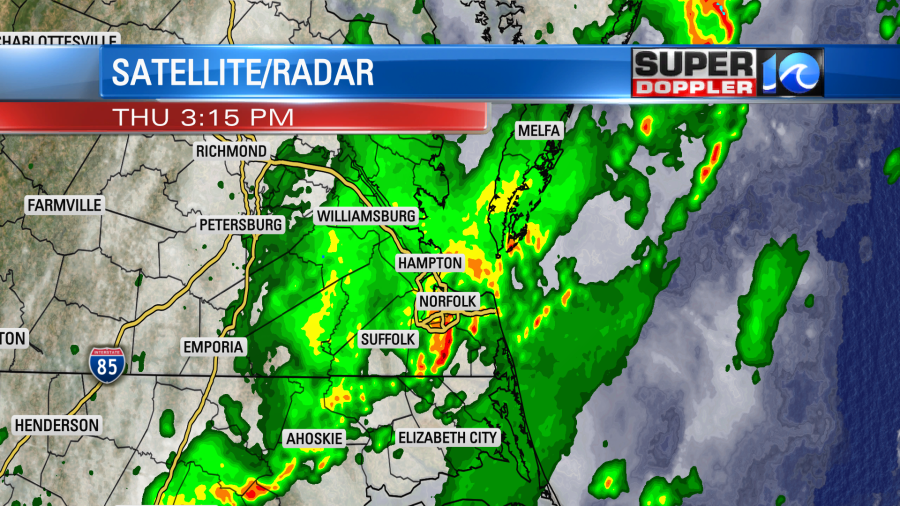
The weekend has arrived. Yes! We had some rough weather over the last two days, and now things will finally settle down and dry out. We did have some heavy rain yesterday. There were several Flash Flood Warnings.
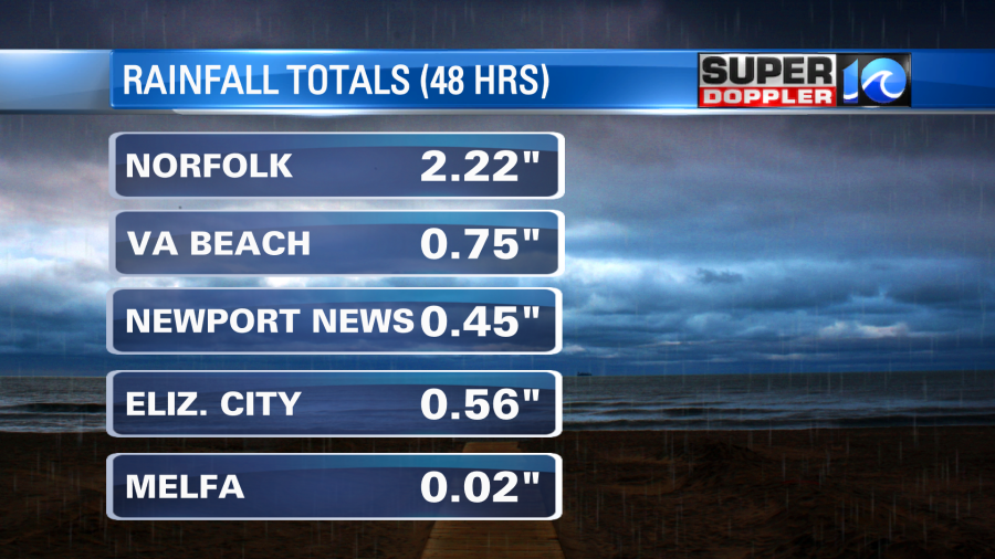
A few locations have had heavy rain for the last two days. Here are a few 48 hour rain totals:
A cold front had moved through the area yesterday, and it hit a very humid air mass. That allowed for the heavy downpours to form. Today that front has sunk to our south.

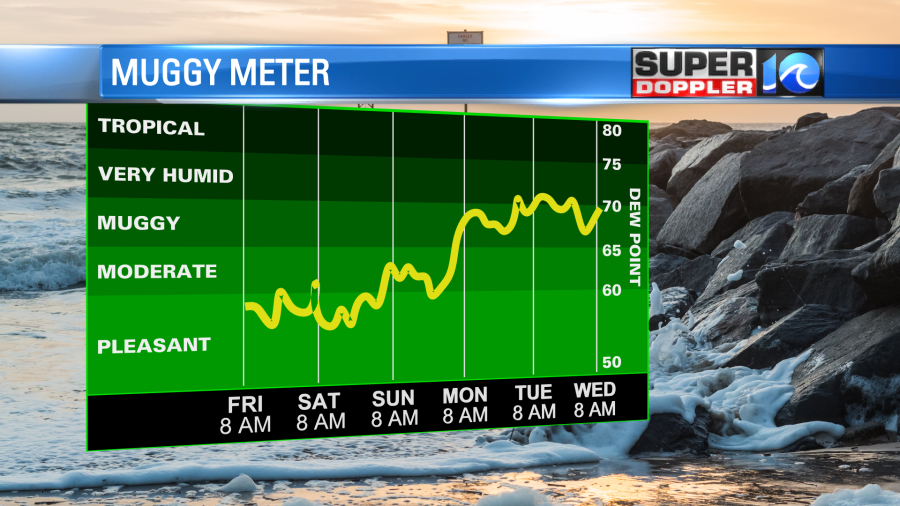
High pressure is building in from the northwest. We’ll have a north wind at 8-12mph with some higher winds near the shore. We’ll have lots of sun today which will be nice in itself. However, it’s the dry air that will be the highlight of the weekend. Dew points have dropped to the 50s, and they may drop a little more. We’ll stay dry through Sunday.
High temps will be in the upper 70s today. We’ll be near 80 tomorrow. Then we’ll be in the mid-upper 80s Sunday. No rain is expected through early next week. We’ll start to develop some rain later next week.
In the tropics… Mindy has fallen apart. It is now just a cluster of thunderstorms over the Atlantic.
There is a weak disturbance near central America. It has a low chance of formation in the next 48 hours, but it could get into the Bay of Campeche in 2-3 days. There is another tropical disturbance that is coming off of Africa that has a high chance of formation soon. It will move to the west/northwest over the next few days.
Meanwhile Hurricane Larry is churning over the North Atlantic. It is down to a Category 1 as it is moving over some cooler water. However, that doesn’t look like it will slow it enough. It is still forecast to head towards St. Johns Newfoundland by early tomorrow morning as a cat 1.

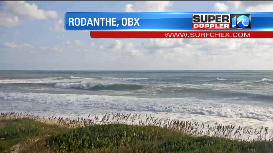
There have been tropical systems there in the past. So it’s uncommon, but not too rare. Larry was a pretty large storm at one point. For a time its eye was 60 nautical miles wide. Due to it’s previous size and strength it has caused a lot of high waves over the ocean. Waves near the center of the storm are forecast to be around 20 feet. The swells are traveling to the east coast. So there are some 6-7 foot waves along the Outer Banks today.

Check out one of the camera shots from this morning at Nags Head. This is on Surfchex.com:
The risk for rip currents is high at all of the Oceanfront beaches. So experienced surfers only in the water today. Waves are running about 3-5 feet at the Virginia Beach oceanfront. These should go down tomorrow. Hopefully, the rip current threat drops as well.
Have a great weekend!
Meteorologist: Jeremy Wheeler