
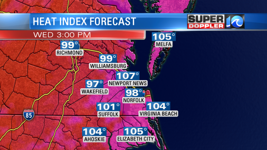
We have a heat advisory for the entire area today, and this is just the beginning. A heat advisory is typically issued when the heat index will be between 105 and 110 degrees for at least a couple of hours or more. The high temperatures are forecast to rise to the mid-upper 90s this afternoon. So with the current humidity in place (dew points are in the mid 70s), the heat index will rise up to between 100 and 107 degrees.
There is an area of high pressure to our southeast.
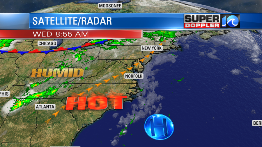
It is the Bermuda high as it is a persistent area of higher pressure that parks itself between Bermuda and the southeastern U.S. This allows the surface winds to be out of the southwest for a long period of time. In this case through the weekend. We will have a few showers and storms this afternoon, but there is less of a chance than yesterday.
Tomorrow a pocket of upper level energy will roll over us from the west. Also, there will be some extra moisture from the remnants of Barry moving east. So we’ll have a higher chance for some rain and storms in the region.
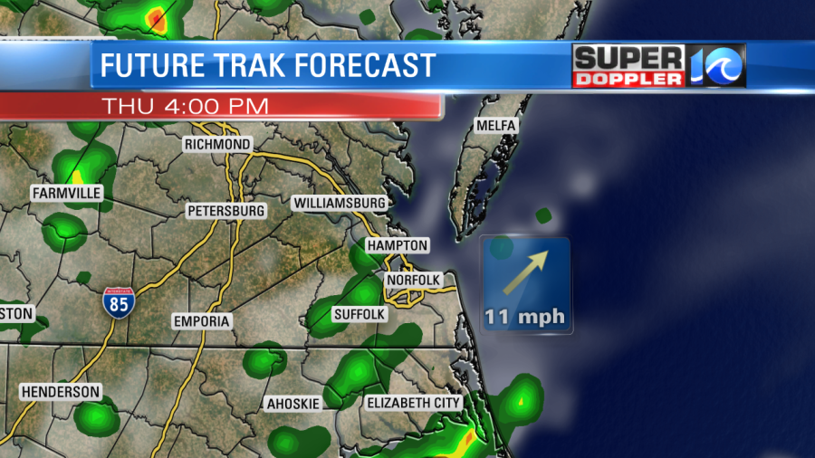
That might be enough too cool down the temps slightly, but we’ll still likely hit the low-mid 90s, if not the mid-upper 90s. The heat index will still be in the 100s.
After that upper level feature kicks out, then upper level ridging will take over. This will allow the pressure to stay high, and it will likely squash a lot of the rain and clouds from Friday into Sunday. That pattern will allow temps to rise into the upper 90s. The heat index will probably hit between 100 and 110. Excessive Heat Warnings may be issued during that time for at least part of the area. Heat Advisories mean that heat illnesses are possible, but a heat warning means that heat illnesses are more likely. These include, heat exhaustion, heat cramps, and heatstroke.
We’ll finally cool down by early next week. A cool front should move through on Monday, and this could drop the high temps down to the mid 80s by Tuesday. Stay tuned for updates.
Before I go…I found this interesting article about hurricane Barry. The rain was much less than forecast, and this article from vox.com explains some of the factors why. This is in stark contrast to hurricane Harvey 2 years ago over Texas. Here is the link: Hurricane Barry’s Lower Rainfall.
Meteorologist: Jeremy Wheeler


