Last night was a great night for a walk. We finally had the drier/cooler air sink into the region. I went out for a short trek around the block and enjoyed the crisp cool air.
I knew that we would have wet weather for a few days. Enter today…
We are currently on the cool side of a stationary front that has stalled out just south of Hatteras, NC.
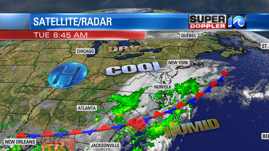
We’ve had a lot of clouds this morning with only a few pops of sun. There were already a few rain showers over North Carolina, but they were starting to push up into the Southside as I started this blog. Rain showers will continue to increase through the day.
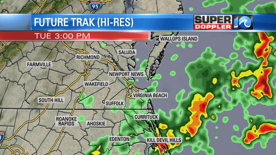
The cause of the rain today is overrunning. This is when you have warmer/more humid air pushing north over a cooler/drier airmass. When this happens it forces the air aloft to cool and condense. Eventually this happens enough that precip forms. The good news is that you don’t tend to get thunderstorms during this phenomenon. It is going to stay cool at the surface. In fact it will be very cool for this time of year. High temps will only be in the upper 70s to near 80. That’s about 10 degrees below average. We’ll have a northeast wind at 8-12mph.
Rain will become fairly widespread this evening. There will be a big area of rain overnight into tomorrow morning. Rain may be heavy at times. There could be a few thunderstorms. This will impact the morning commute tomorrow.
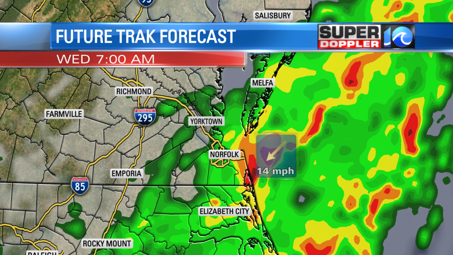
Tomorrow will be a little different. The front and a weak area of low pressure will be closer to the region. The surface humidity will also increase. It will still be fairly cool, but these features will allow for some thunderstorms and possibly some pockets of heavy rain. Rain showers will be on and off through the day.
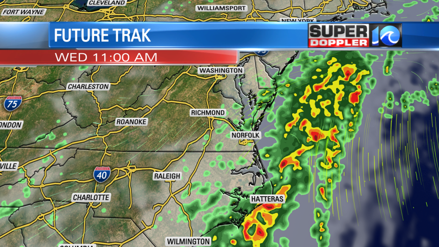
It will still be cool Wednesday with high temps in the upper 70s to near 80. The latest models back the rain off Wednesday evening into Thursday. That’s (potentially) some great news. For now I have a 40% chance for showers on Thursday but I’m cautiously optimistic.
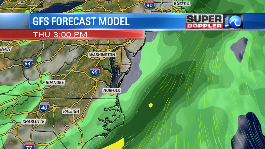
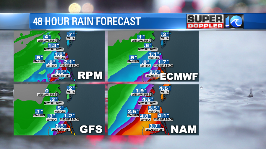
The rain may still be pretty broad over coastal North Carolina. The problem is that there has already been a good amount of rain recently in that area over the last week. Really over most of the region. However, the forecast models show most of the rain falling over Dare county for the next 48 hours.
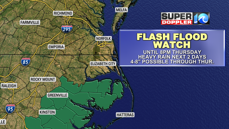
This has prompted them to issue a Flash Flood Watch for that county through Thursday.
Since Thursday is looking a little drier overall, it’s possible that the forecast numbers will be a little lower. Hoewver, even if 2-4″ were to fall then that would create some localized flooding. I think localized flooding will be possible anywhere in the area, but I’m holding onto the theme of higher rain amounts south and east. Lesser amounts north and west.
The models do have a few showers and storms on Friday, but not too much. The GFS picks up the rain some more on Saturday. (About a 50% chance). Then the models finally dry things out Sunday into early next week.
High temps will be in the upper 70s to low 80s through Friday. We’ll be in the mid 80s on Saturday. Then we’ll reach the low 90s Sunday into early next week.
Keep this in mind… This time of year fronts are notorious for stalling out or wiggling in the wrong direction. Any slight change can create a sizable change in the forecast. So it’s easily possible that the forecast will change for some of the days ahead. Hence the “we’ll see about Thursday and Friday”. That means for now we’ll have to take it day-by-day.
Meteorologist: Jeremy Wheeler
