
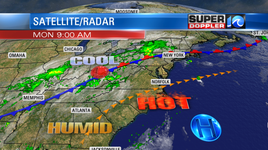
We are almost there. One more day before the cool down finally arrives to our region. Over the weekend Norfolk hit 100 degrees on both days. The heat index rose up to 110 or higher in many locations. It was rough! Many A.C. units struggled to keep up. They will have to tough it out for one more day. While temperatures have cooled down in the Midwest and the Northeast, our cool air is still far away. There is a cool front over towards Memphis Tennessee, but it only slowly moving to the east/southeast.
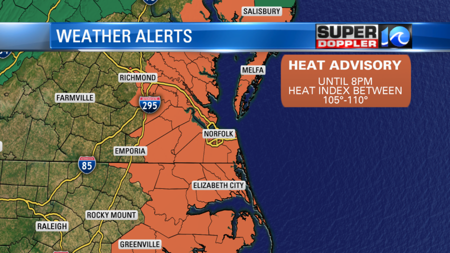
High temps will be in the 70s and 80s north of the front, but we’ll top off in the 90s in our area today. At this point I’m calling for upper 90s to near 100 degrees locally. The heat index will be between 105-110. There is a Heat Advisory for the viewing area until 8pm.
One big difference between today and last weekend is the breeze. There was hardly any breeze during the last 3 days. Today the breeze will pick up out of the southwest. Winds will run at 10-15mph with gusts to 25mph. That should help comfort levels slightly. It will feel a little better in the shade with that breeze. But in the sun it will basically be a hot breeze. We’ll be mostly sunny until the afternoon. Then we’ll be partly cloudy. There will be some isolated showers and storms late in the day, but the chance for rain is capped at 20%. There will be some scattered showers and storms tonight coming in from central Virginia/North Carolina. However, the front won’t arrive just yet. It will move in by midday tomorrow. Scattered showers and storms will fire up before then. However, the rain and storms will increase in coverage and intensity during the afternoon.
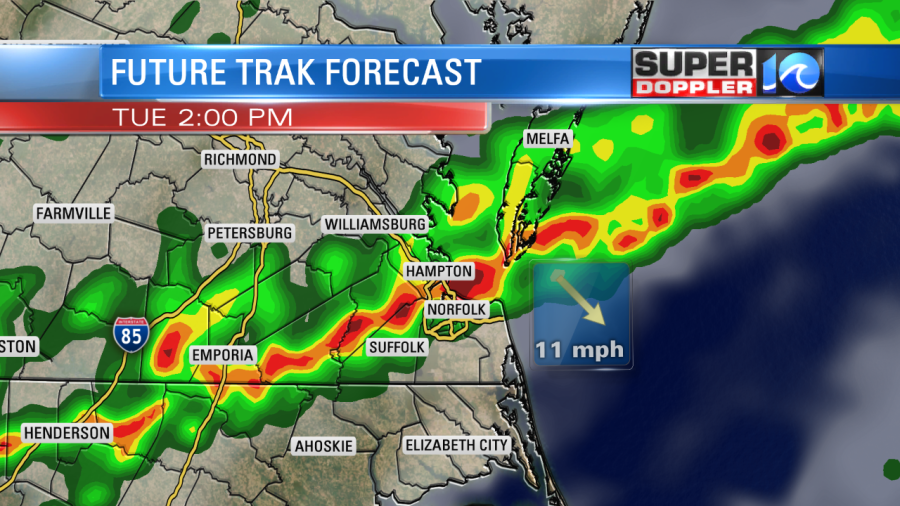
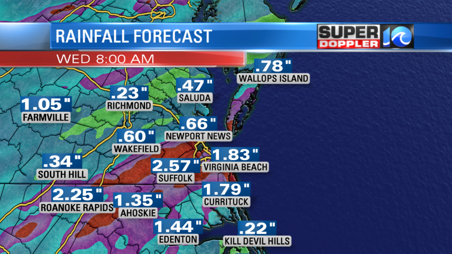
High temps will be in the low-mid 80s, and it will still be humid. However, as the front comes in, the winds will turn to out of the north. So temps will either hold steady or fall during the afternoon from that. They will probably also fall just due to cooling from the heavy rain. Rain will be heavy at times as the front will only slowly move to the south. This could create some localized flooding. Our model is calling for 1-2″, and it it suggesting that a few locations could see up to 3″.
This forecast goes from tonight through Wednesday morning. We’ll dry out from Wednesday afternoon into next weekend. The weather will be great. We’ll have highs in the 80s through that time. Overnight lows will drop to the 60s and low 70s. We’ll have partly cloudy skies for most days. Temps will warm a little, but it will be a world of difference compared to the last few days.
One more thing before I go…There is a weak disturbance near the Bahamas. It is moving slowly west. It has a low chance of formation over the next few days.
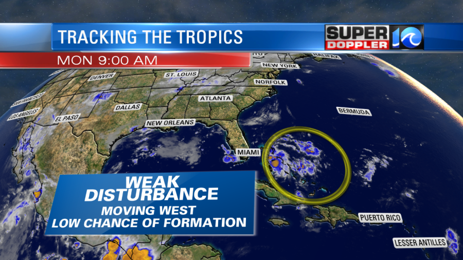
The cold front that is moving through here should run down that way. The upper level winds ahead of the front should chew up the disturbance before it forms, but there’s a small window of opportunity. Stay tuned for updates just in case!
Meteorologist: Jeremy Wheeler


