Yesterday we ended up in the low 80s as expected.
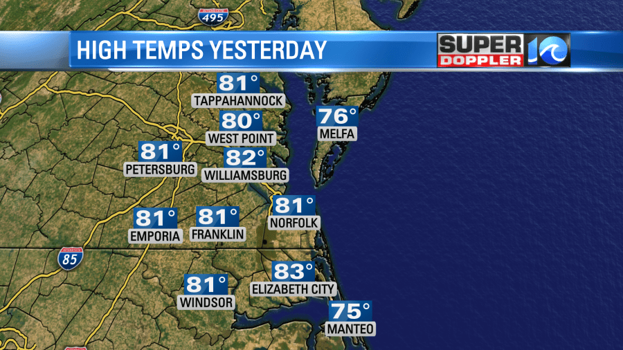
It was warm and humid, but it felt nice with the breeze. The wind was strong for a while. We did end up with a few gusts to around 40mph. Last night the cold front moved into the region. There was a line of rain showers out there, but as it moved east it pretty much fell apart.
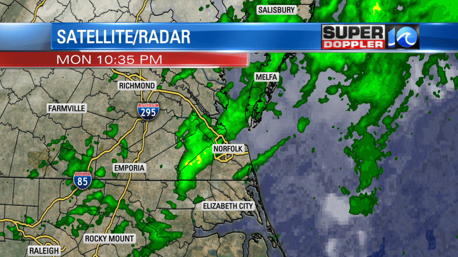
So we only ended up with about a tenth of an inch of rain or less. Don’t worry…more rain is coming. Just not today.
The cold front is going to keep sinking to our south during the day.
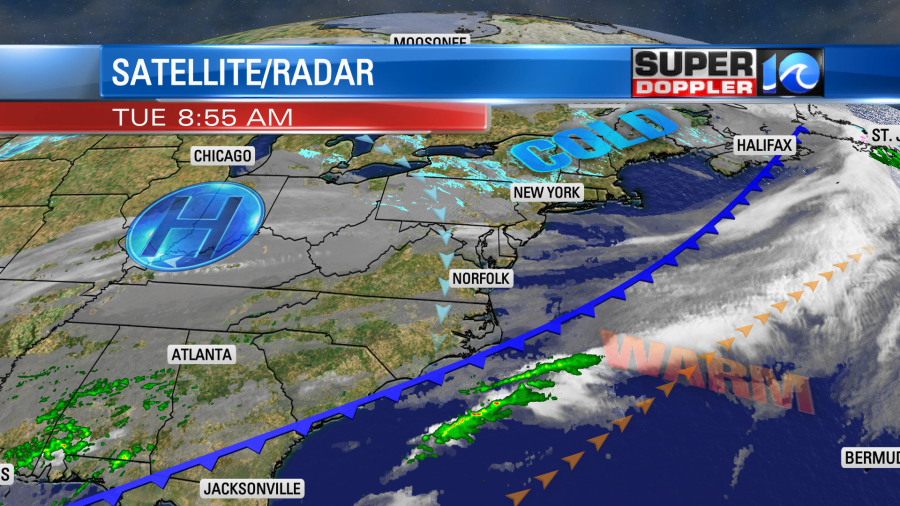
We’ll be much cooler and drier but less windy. High temps will only top off in the mid 50s this afternoon. So you may need the light or medium jacket today as opposed to yesterday’s sandals and shorts.
The front will stall out to our south tonight. However, upper level winds will come up out of the south. Plus, an area of low pressure at the surface will move up from the south. This will push the moisture up over the cooler air mass. This will create overrunning precipitation to form. Rain showers will be scattered later this evening. Then rain will become widespread after midnight.
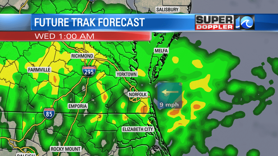
The rain will continue into tomorrow morning. This will impact the morning commute. Rain will be mostly light, but a few heavier showers will be possible.
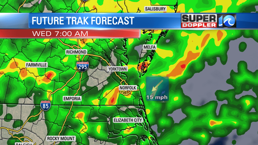
The rain will break up a bit during the afternoon as the low moves out to sea. However, clouds will hang tough, and scattered rain showers will continue into the early evening. We’ll have a northeast breeze through the day. So high temps will only be in the upper 40s to around 50 degrees. We could see about an inch to an inch and a half of rainfall before it wraps up Wednesday night.
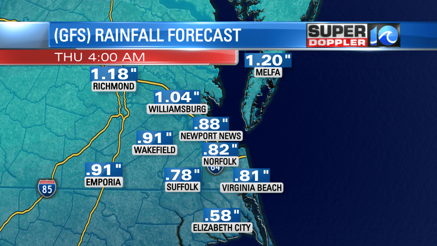
We’ll be cool with a few rain showers Thursday and Friday. High temps will be in the 50s. Saturday is going to be very interesting! The models show some strong warming in the morning. Temps (could) push up into the low-mid 60s. However, the models also show some rapid cooling by midday. So temps could drop to near 40 by the late afternoon. They may even drop to the 30s by the evening. Because of that, the models are showing a wintry mix for a time between the late afternoon and early evening.
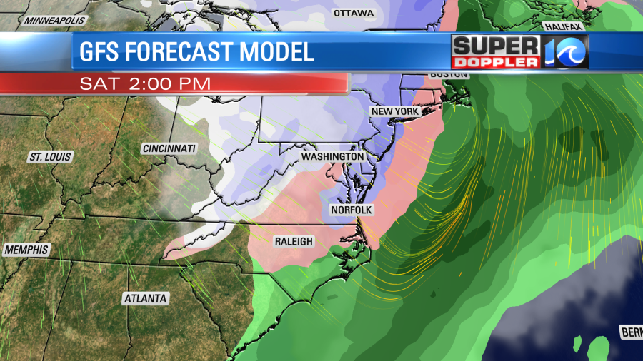
The Euro model also shows this. However, I’m pretty dubious. If we drop from the 60s to near 40, then that will still be too warm for snow to stick here. I think a mix is possible by the evening, but I don’t think it could happen during the afternoon. I do agree that we could drop down to the 20s Saturday night. We’ll see. We’ll have more on that in tomorrow’s weather blog.
Meteorologist: Jeremy Wheeler


