Today’s weather is definitely quiet. Tomorrow things should be fine during the day. However, we’ll have a wintry mix enter into the region Friday night, and it will likely turn into snow showers by Saturday morning. It could be somewhat of a repeat from last weekend, but there are definitely some differences. Let’s talk about it.
In the short-term we have high pressure in the region.
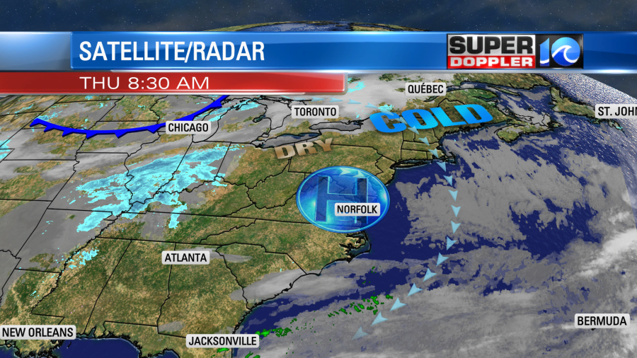
We’ll have a lot of sunshine today with temps warming to the upper 30s to low 40s this afternoon. A bit better than yesterday, but still pretty chilly. At least today the wind will be lighter. It will run at about 8-12 mph out of the northeast.
By tomorrow a strong cold front will be dropping out of the Midwest. It will be off to our northwest during the daytime, but it will drop in by the evening. At the same time an area of low pressure will be quickly forming to our south/southeast.
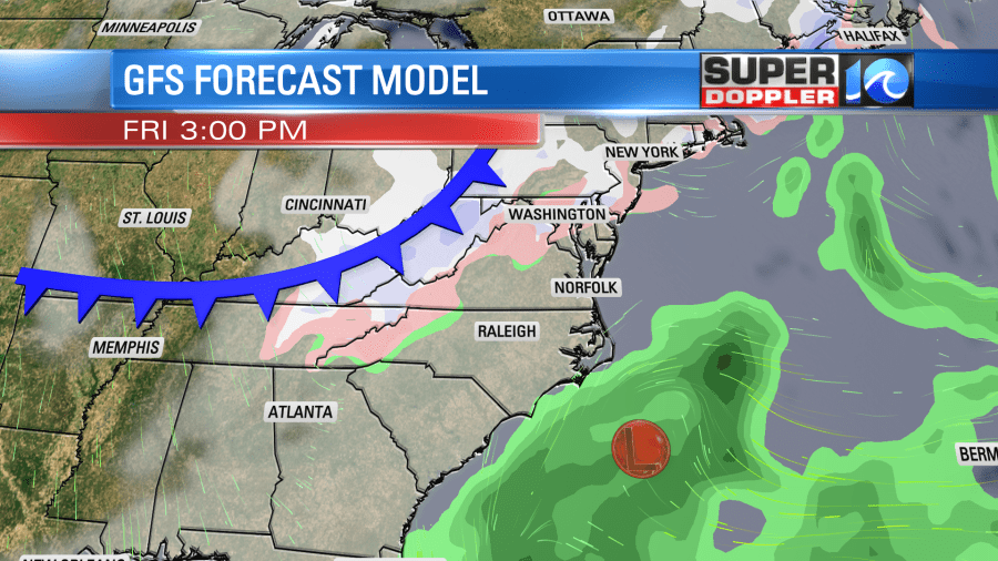
We’ll be mostly cloudy tomorrow with a few late day rain showers. High temps will be in the mid 40s with a light northeast wind. By tomorrow night we’ll see the rain turn into a wintry mix.
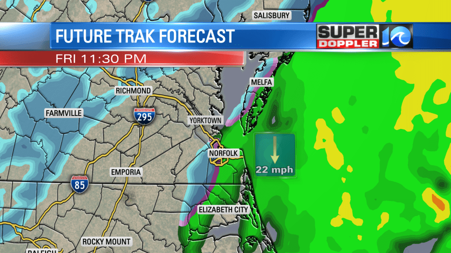
The cold front will move through during that time. Temperatures may not drop to around the freezing mark until about 3-4 a.m. So some of the initial precip will likely melt. As the front steadily moves offshore it will run into the moisture from the offshore low.
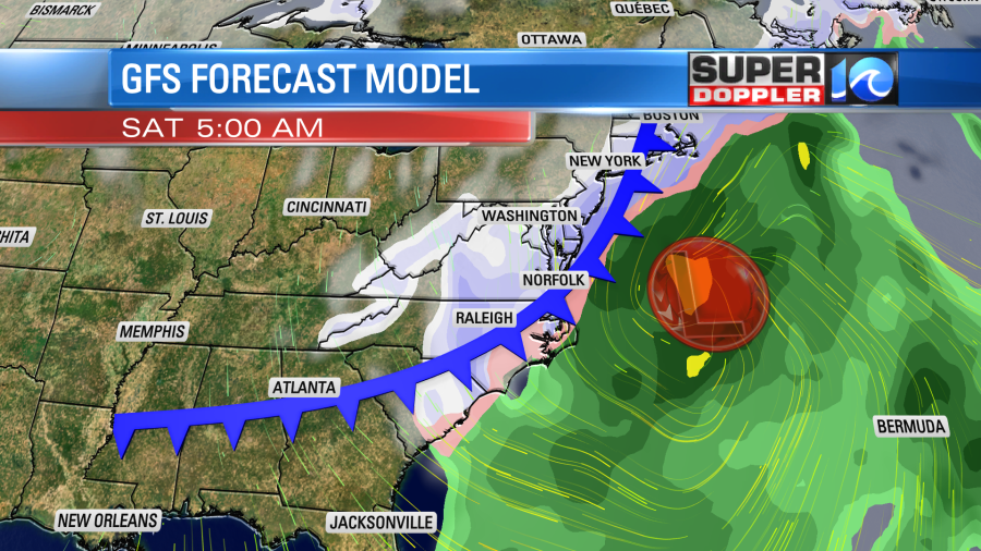
The offshore low is going to rapidly intensify between Friday and Saturday. It even looks like it will undergo “bombogenesis.” This is when an area of low pressure drops about 24 millibars or more in a 24 hour period. It will be strongest as it moves off the northeast coast, and that is where they could see more than a foot of snow.
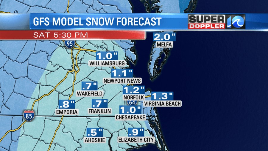
The tricky part here is that it will be moving away from us during that time. So the models are handling the precip timing and totals differently. For example the GFS model and our Future Trak model have a smaller window for snow. Our model has it from about 3am until 9-10 am. The GFS is from about 4am through about 10am with some flurries or a mix following. They are both fairly light as well. So they are coming up with lower snow totals.
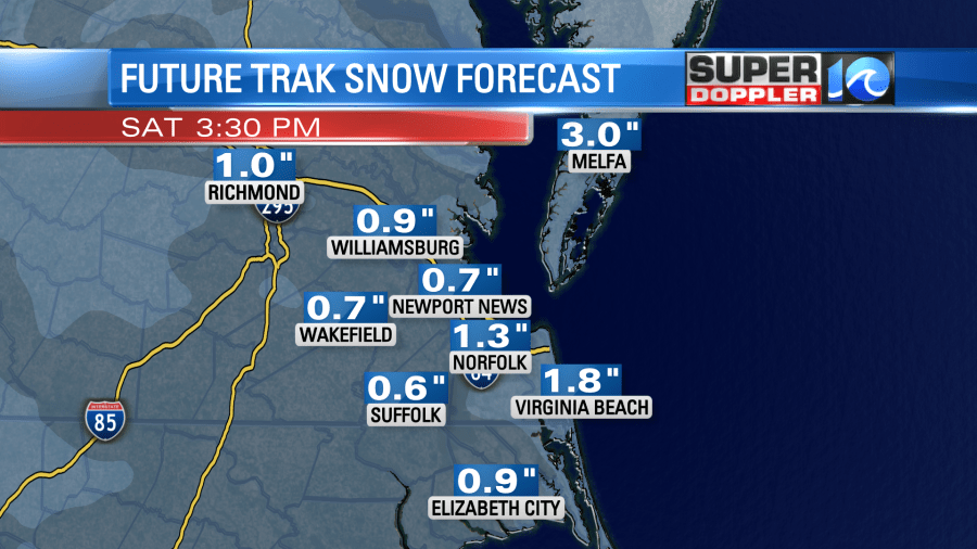
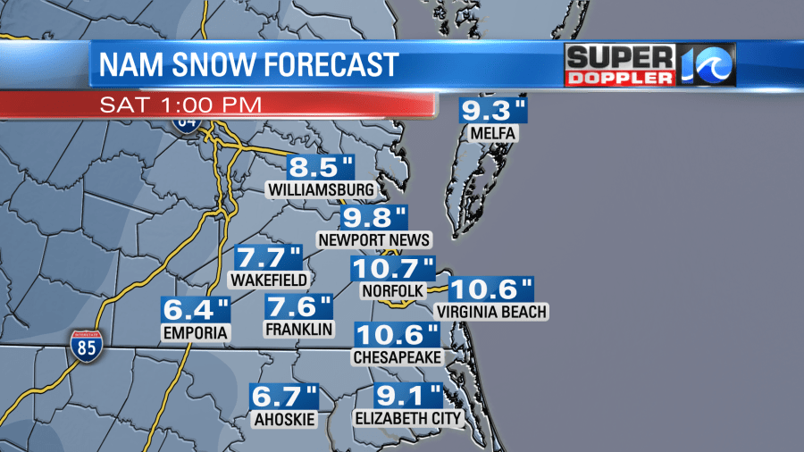
Meanwhile the NAM model has the snow going from about 4am until about 2pm in the afternoon.
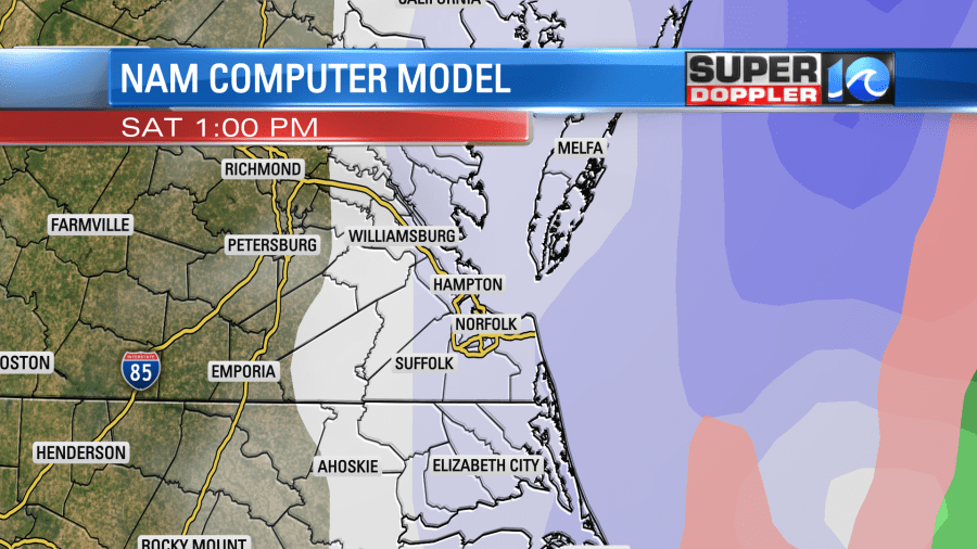
So it currently has the highest totals.
The European model has been a bit steadier. Right now it is the middle ground.

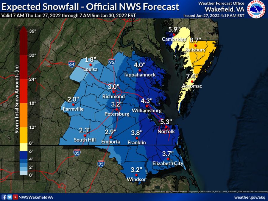
The National Weather Service’s forecast is also close to these numbers as of this morning:
Keep in mind that the NAM model doesn’t typically do well with coastal systems. (Most of the time). Once in a while it catches something that the others don’t, but I don’t think that’s the case this time. It’s interesting that the hi-res NAM (4KM) has less than the NAM model itself, but not by much.
Having said all that, I am playing the middle ground for now. Here is my latest snowfall forecast map:
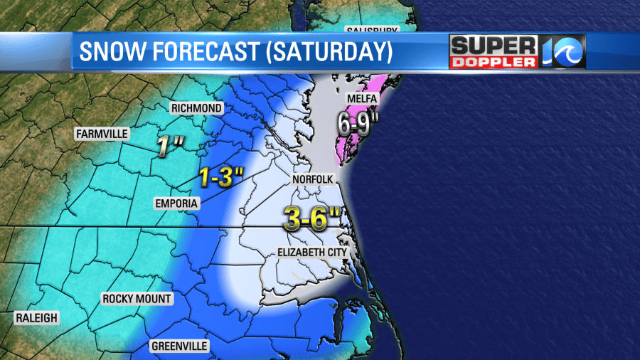
I know you’ve heard it a million times, but the forecast still could change. (A.) This is Coastal Virginia and North Carolina, and (B.) The models still have a pretty wide spread. I’m hoping that the models start to settle on a solution later today. This about the time that they did that during the last event. Keep checking back for updates!
Before I go. Wind gusts could be strong during the storm and after. We could get some gusts up to 40mph with a few higher gusts near the shore. That could create some minor tidal flooding on Saturday and possibly Sunday. More on that in tomorrow’s weather blog.
Meteorologist: Jeremy Wheeler
