For Sunday, our heat peaks with highs in the mid and upper 90s, challenging a record high of 99° set back in 2015.
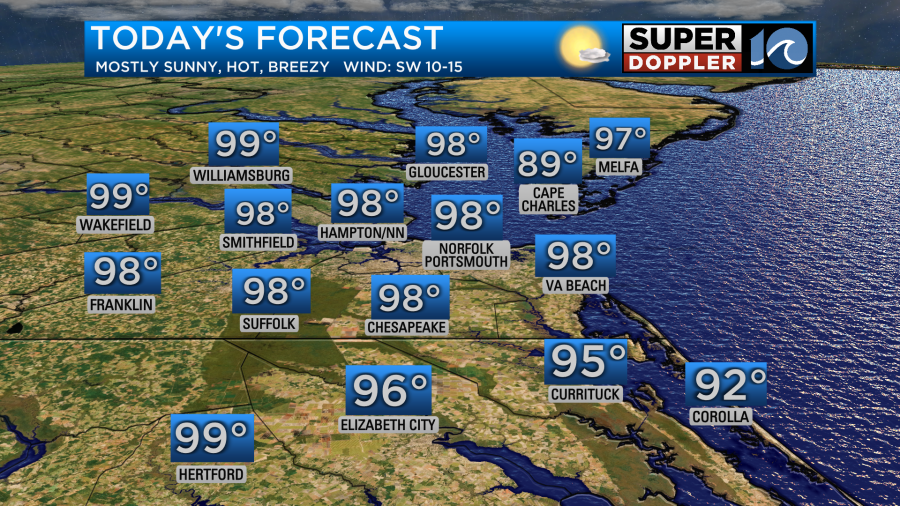
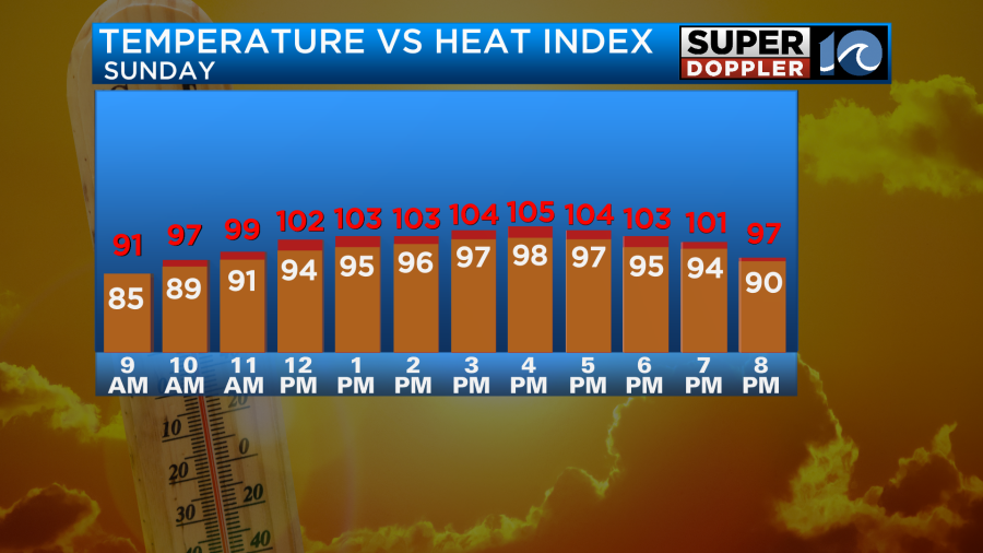
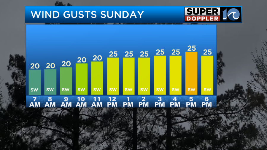
Heat index values Sunday will feel around 105° – 108°. It will be breezy at times, with a SW wind of 10-20 mph with isolated gusts to 25.
Highs will stay in the upper 80s and low 90s for the majority of next week. More heat returns Wednesday and Thursday, with heat index values once again over 100°F.
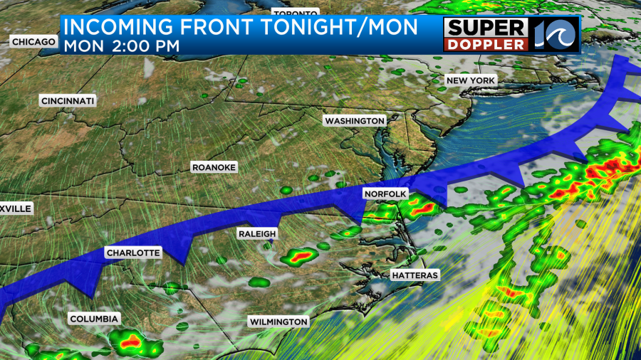
The best chance for rain is coming Monday. Overnight, Sunday into Monday, some showers and storms will try to move in along a front. On Monday, morning showers will be possible with t-storms not out of the question. A quarter to a half an inch of rain will be possible at the high end, with most areas seeing a tenth of an inch.
So overall, this won’t help too much with our rainfall deficit. We need 2 inches of rain just to catch up where we need to be this June. Drought conditions have developed across much of Virginia and NC, with abnormally dry conditions being reported on the drought monitor this week.