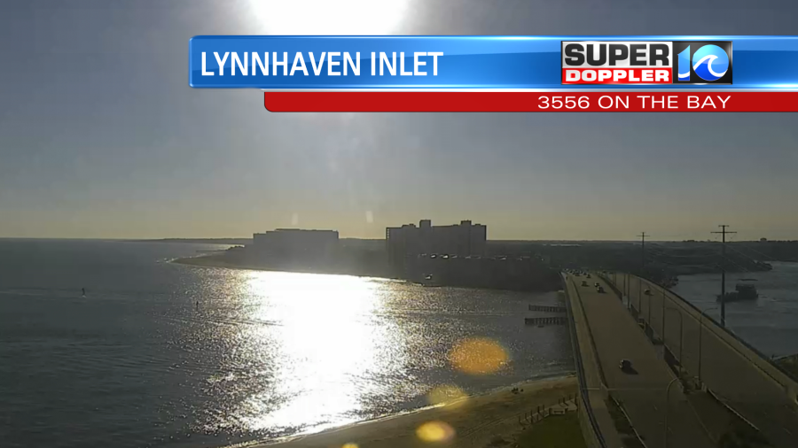
Finally, we are getting some sunshine back today.
We had several days in a row of cloudy or mostly cloudy skies. There was some rain too, but hey we needed that. In fact I want to take a minute to look back at rainfall for the past year and a half. Here is the monthly rainfall departure from average for the months and the year 2021.
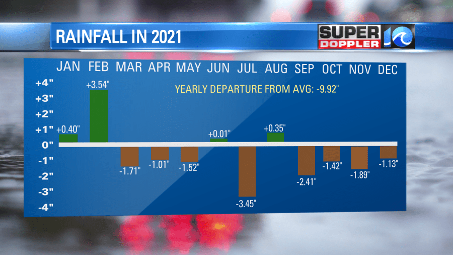
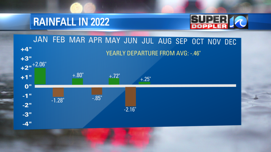
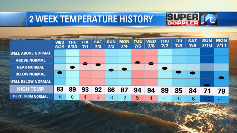
Many months were very dry. You can see that we finished the year with a deficit of close to 10 inches. So we came into 2022 with that. Then we had a couple more dry months since then.
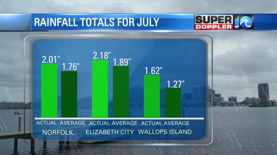
So the bottom line is that we’ve had an overall dry pattern over the last year and a half. We had a short-term catch-up over the last few days. Many locations went from well below average rainfall to above average within a couple of days.
We need the rain to keep coming periodically. So while we won’t have any rain today. We will have some more scattered showers and storms later this week.
Today we have high pressure sliding offshore. There is a stationary front falling apart to our south.

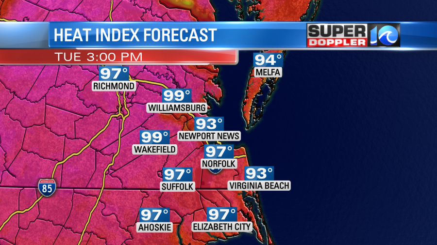
The cool northeast breeze has shut down. Now we’ll have the breeze picking up out of the southwest. This, along with the bright sunshine. will push the high temperatures up to the low 90s with some mid 90s inland. The humidity will also rise. So the heat index will be in the mid-upper 90s this afternoon.
At least the breeze will be there to help. I’m not expecting any rain here today, but there may be some isolated showers and storms overnight.
Tomorrow the cool front will move closer to the region, but it will likely…..wait for it……stall out! So that will create some scattered thunderstorms during the afternoon.
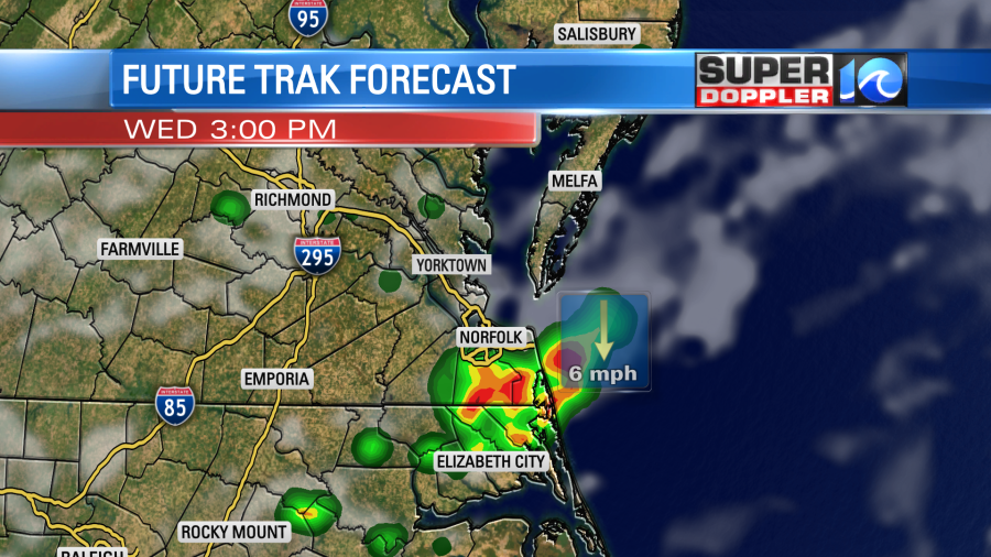
There could be some heavy downpours in a few areas. High temps should be able to reach to near 90 or the low 90s. The front will slowly drop to the south Thursday into the weekend. The motion will be super slow. So while it will be cooler (80s). It will still be humid. Also we’ll have some scattered shower and storms each day.
So the temperature pattern will continue where we get 2-3 hot days and then 3-5 cooler days.

The long term models are hinting at some stronger/longer heat in the 7-10 days, but we’ll see.
The rip current threat has gone down at the local beaches. It is moderate today. So between that and the sunshine it will be a MUCH better beach day.
Meteorologist: Jeremy Wheeler


