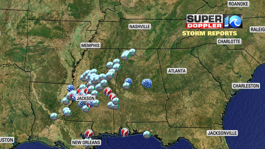
It was a rough day and night on Tuesday across parts of the Deep South. A very unstable air mass and strong upper level winds created an environment for severe weather from Louisiana into Alabama. There were multiple reports of tornadoes over that region.
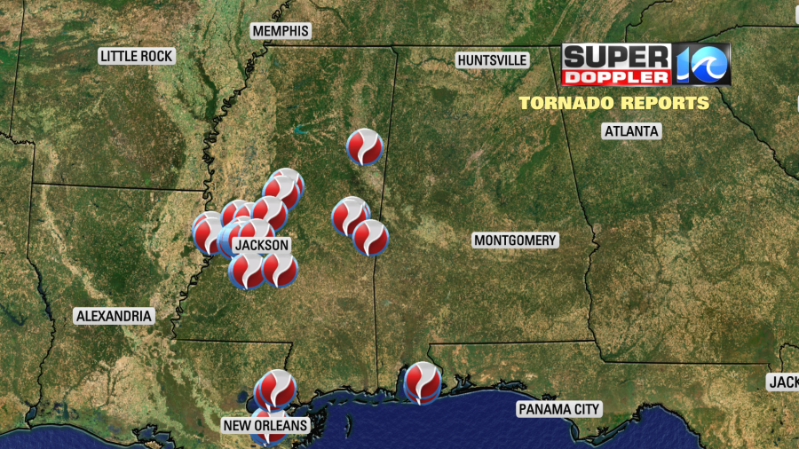
There was one deadly tornado that hit the New Orleans area. There were also lots of severe wind and hail reports from that region as well.
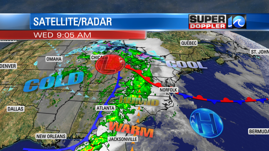
Remember …. they had a “moderate” risk for severe weather yesterday. That is a level 4 out of 5 risk. There was an area of low pressure centered north Louisiana, but it was a large and strong system. They also had a lot of instability. Now the low has moved more to the north. It has already lost a little bit of its energy. There is a warm front in Virginia that is slowly moving to the north. There is a strong cold front over the Tennessee River Valley.
We have increasing moisture in our region. We started off with a little bit of sunshine early. It was pretty actually.
However, clouds were already increasing by the mid-morning. We’ll be mostly cloudy today. There may be some isolated showers by midday, but there will be some scattered rain showers during the afternoon.
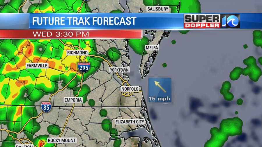
There will be a bigger area of rain to our west with a few thunderstorms out there. High temps will be in the upper 60s to near 70. Winds will be light and out of the southeast. The weather shouldn’t be too bad here during the daytime.
We’ll have some scattered rain showers and a few storms by this evening. There could be a couple of strong storms by the later evening hours.
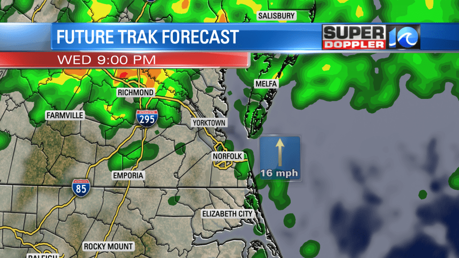
Scattered showers and a few storms will be possible tonight. There is a marginal risk for severe weather through that time for parts of the viewing area. Heavy downpours will be the main threat, with a few strong gusts of wind.
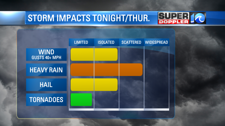
Tomorrow the cold front will move into the area during the late morning hours. There will be lots of rain along the front. There will probably be some heavy downpours along with some strong storms.
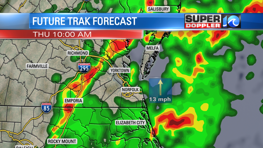
The wind will be a little gusty out of the south with higher gusts in the storms. Small hail will also be possible. We’ll dry out gradually into the afternoon behind the front. High temps will hit the low 70s by midday, but temps will fall to the 60s in the afternoon. After that rain showers should be spotty going into Thursday evening.
Overall the risk for severe weather will be lower than areas to the west. This is due to lots of clouds over the next 36 hours, the timing of the front in the morning, less heat and instability, and less wind shear. Still…a few strong to severe storms will be possible before the front moves offshore.
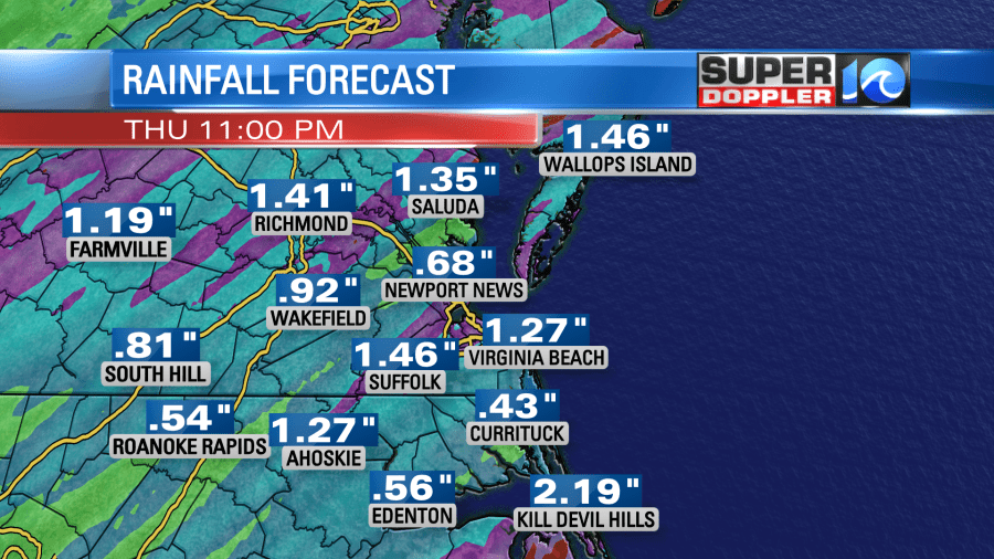
We could see a half inch to an inch of rain, and some areas could get up to an inch and a half.
We’ll be dry on Friday. Skies will be partly cloudy with high temps in the 60s. We’ll have similar weather on Saturday, but there may be some isolated rain showers. This will be due to a strong upper level low overhead, but fairly dry air at the surface.
We’ll be seasonably chilly going into Sunday and Monday. Low temps will be in the 30s and 40s by Sunday morning. Highs will be in the 50s. However, low temps will be in the 30s solid both Monday and Tuesday mornings. This could lead to some frost. We’ll be talking more about that over the next couple of days.
Meteorologist: Jeremy Wheeler


