We started off this morning with more chill and more frost in the region.
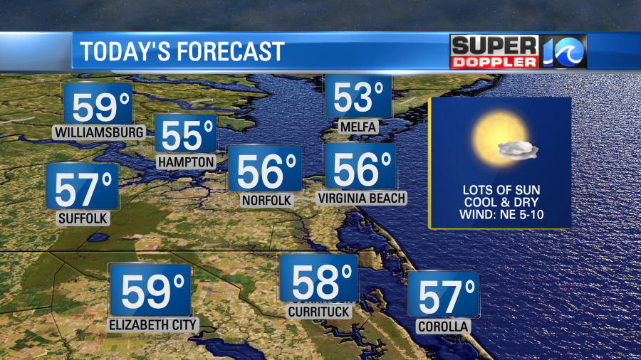
We also had a lot of sunshine. That will continue today. High pressure is overhead, but there is also a weak cool front that is coming in from the northeast.
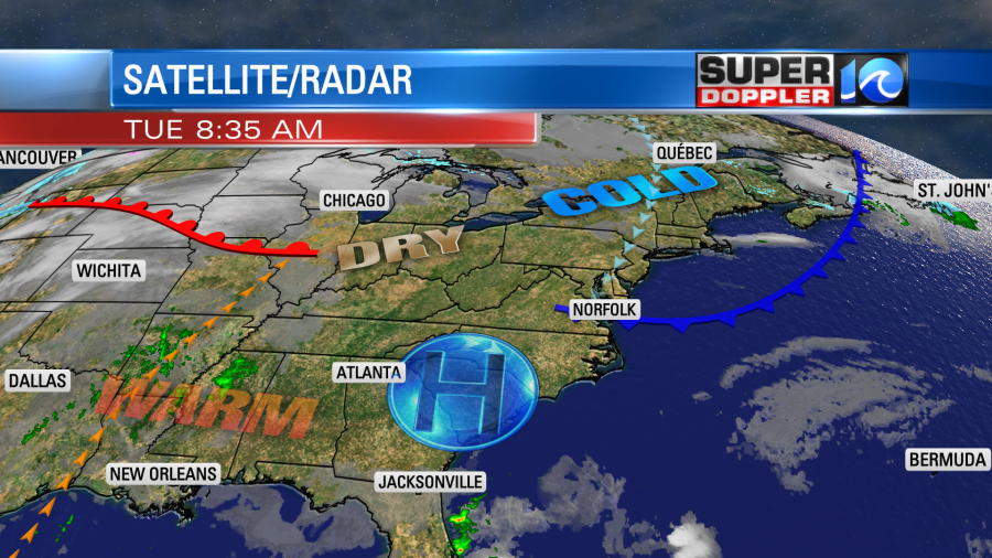
We call this a back door cool front since it’s coming in from the northeast and not the west, northwest, or north. It is dry though. So no rain is expected. It will turn our winds out of the northeast. It won’t be strong, but it will pull in the breeze off of the chilly water.
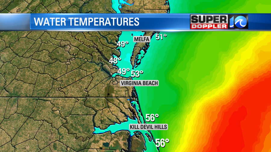
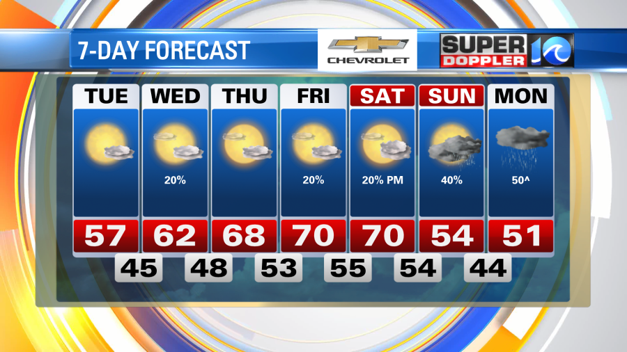
This will keep our high temperatures close to yesterday’s highs. We’ll be in the mid-upper 50s with cooler temps near the shore. I do think we’ll warm up in some inland spots to near 60 degrees. (away from the water).
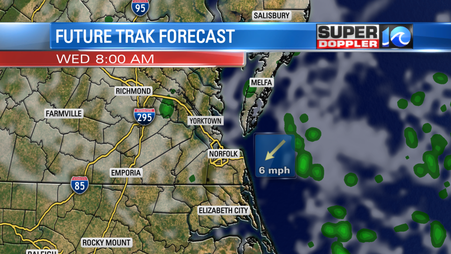
Tomorrow the boundary will slip north as a (mini) warm front. This might be enough to pull in a couple of isolated showers off of the ocean.
Otherwise, we’ll be partly cloudy with high temperatures rising into the low 60s. It should be a pretty nice day overall. We’ll have a southeast wind developing. The warmth will really build over the central U.S. (again). Temperatures there will be running about 25-30 degrees above average.

The warmth will slide east on Thursday. South/southwest winds will increase. So we’ll go for high temperatures in the upper 60s to near 70. Then we’ll likely have high temps near 70 between Friday and Saturday.
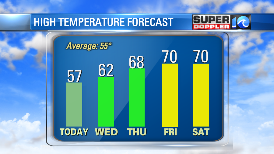
We’ll have partly cloudy skies with isolated showers on those days. The timing for precip over the weekend has changed. The latest models now look like we’ll only have some isolated showers on Saturday. They show some scattered rain showers on Sunday. Temps will finally drop closer to normal. We’ll be in the mid 50s. Some of the details of the weekend forecast could still change. So stay tuned for updates.
Meteorologist: Jeremy Wheeler