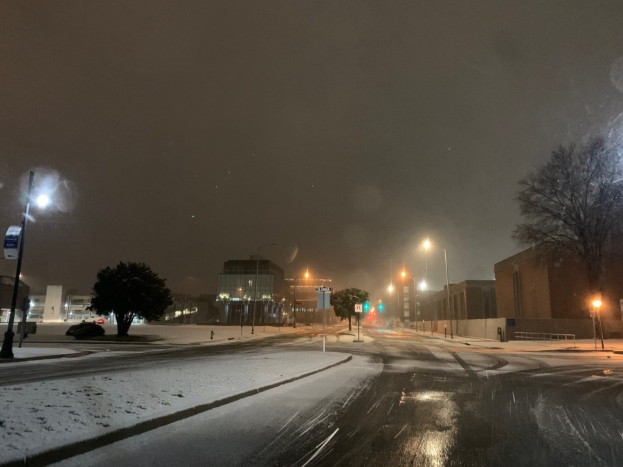
The snow started up last night. It started to stick a bit earlier than forecast.
So when I went to bed I was curious as to what I would wake up to. It was about what I expected, but there was one nice surprise! The roads had melted quite a bit. So there was a solid 3-4″ on the grass, but there was only about an inch or two of slushy snow on the road. Then I got on the interstates and they looked pretty good.

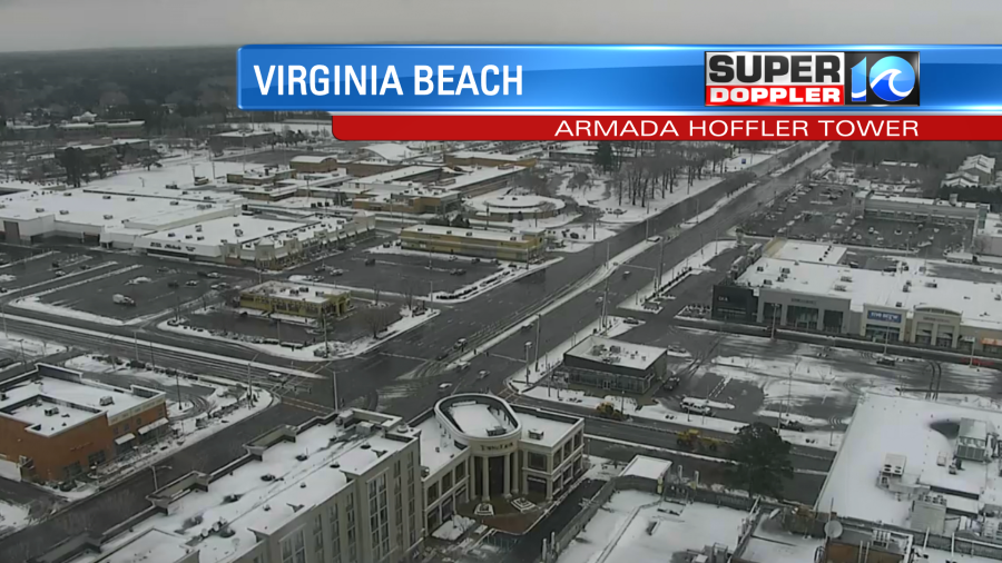
Even in downtown Portsmouth there was a lot of melting on the roads.
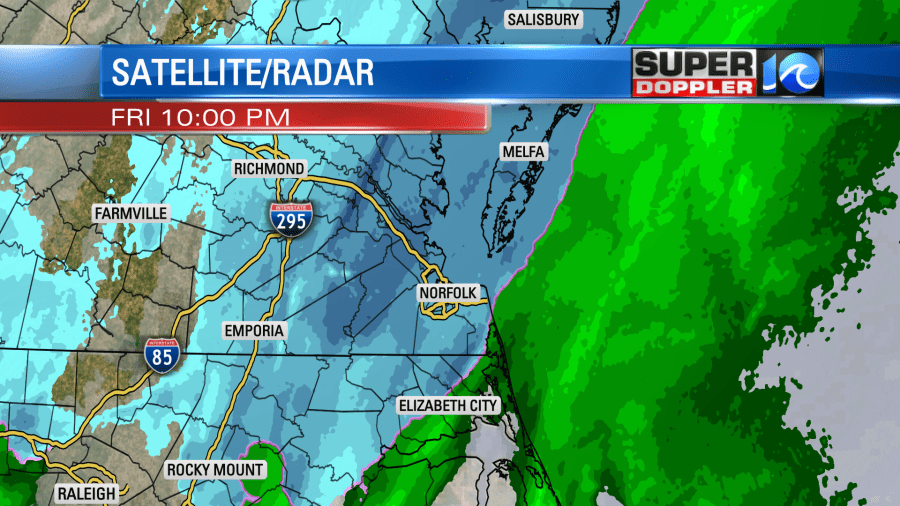
Snow was falling pretty good over much of the area this morning. Then it slowly started tapering off from west to east.
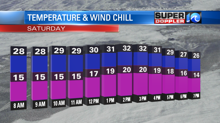
The snow showers will wrap up this morning. then we’ll have gradually clearing skies along with cold winds through the day. I’ll talk more about the winds in a minute. First, what about snowfall?
Here was my forecast from yesterday morning. (About 24 hours ago).
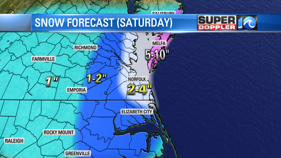
The forecast went pretty well overall, but there were some folks in Norfolk and Virginia Beach that were likely “let down”. We had varying reports of snow in Virginia Beach. Some only had about an inch of snow. Some others had about 3-4″. Here is the closer view of the snowfall map.
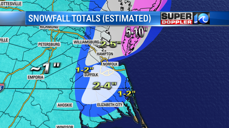
Part of Virginia Beach didn’t drop down to the freezing mark until about 8:30am. Norfolk dropped down to the freezing mark around 4am. So there was a lot of melting on the north end of those cities. The wind was strong out of the north in Norfolk and Virginia Beach. Which was off the water. Water temps on the bay are in the upper 30s to near 40 degrees. Meanwhile some locations away from the water did drop to the low 30s much sooner. So it was a sharp gradient. Here is the larger map. I’ve pieced it together, but I wish I had a couple more reports.
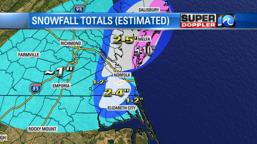
The Eastern Shore did get that 5-10″. The snow was blowing around as well. So the blizzard warnings there did verify. It was a little more than forecast on the Middle Peninsula. Again, overall, it was a pretty good one!
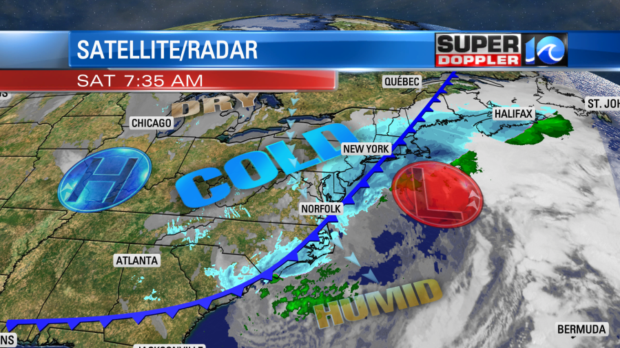
The weather pattern went as planned though the minor details varied. Low pressure did pass offshore. Now it is becoming a major nor’easter for the northeast states. The cold front did slowly move in from the northwest.
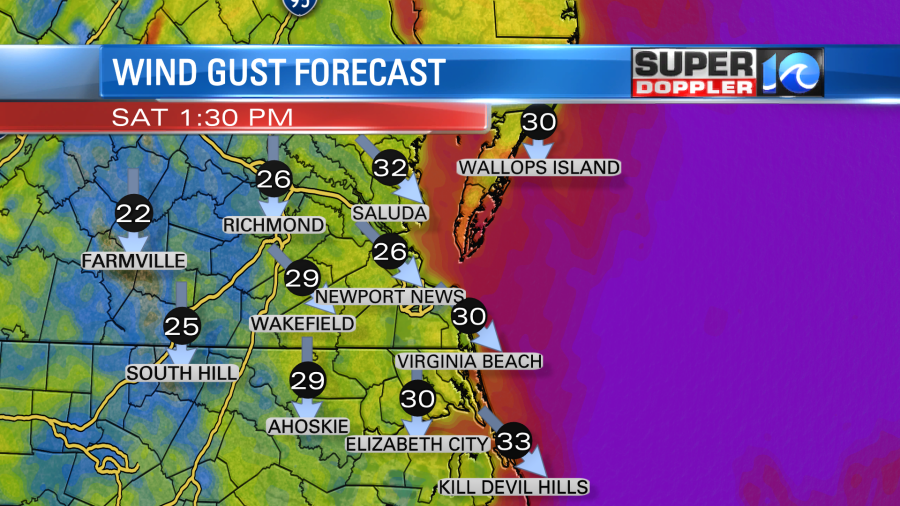
As we go through the day the wind will gust out of the north/northwest at 30-35mph. There will be a few gusts to 40mph near the shore.
Temperatures were in the low 30s this morning, but they will only be in the mid-upper 20s this afternoon. Wind chills will be in the teens and 20s.
Skies will gradually clear as drier air filters in and high pressure builds in. Tonight we’ll have mostly clear to partly cloudy skies. Winds will lighten up a bit. They will run out of the north at 10-15mph with gusts to 20mph. It will gust to 25mph near the shore this evening. These north with will pull down some Arctic air. So tomorrow morning temps will drop all the way down to the teens, and they may be in the single digits inland. Wind chills may be near zero degrees for some. Here’s our model forecast. I think it will be a little lower.
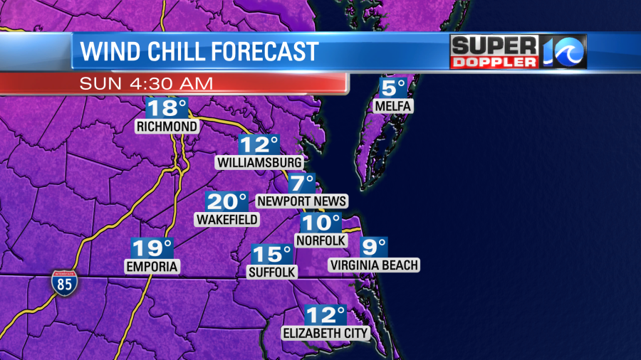
Along with dangerous wind chills these temps will cause problems with icing. Even treated roads that are wet today will likely re-freeze tonight with those temps. There will likely be patches of ice and black ice tomorrow morning across the area along with snow on the grass and walks. That will make it tough to head to Sunday services. Also, the air will be so cold tonight that most folks in the region should slow-drip the faucets. Keep cabinets open so that the milder air gets in under the sinks and mixes out.
Tomorrow we’ll be cold, dry, and breezy. High temps will be in the upper 30s. We’ll be partly sunny. So there should be some melting and drying. We’ll be in the 40s early next week. Then high temps will be near 60 by Thursday! Wow!
By the way…there was some minor tidal flooding this morning, but there won’t be much of that going forward. There may be a little sound-side flooding tonight with the northwest wind. It should be minor.
This system is hitting the northeast states hard today. Snow totals up there will be about 1-2 feet in some areas.
Meteorologist: Jeremy Wheeler