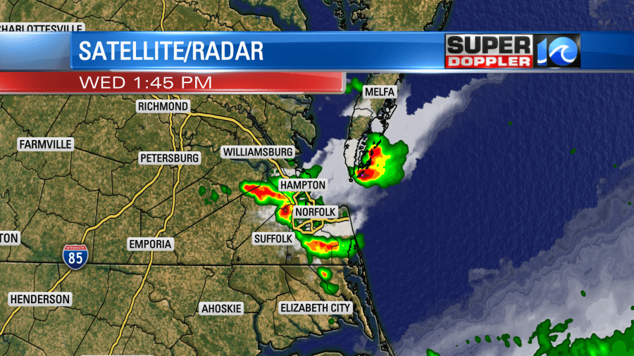
Yesterday, we had some showers and storms over the region. A sneaky cool front had made it a bit farther south than expected. This lowered our local surface pressure, but it didn’t move through.
We were already hot, humid, and unstable. The heat index was near 100. So some strong storms did develop, and we even had several warnings. Rain was heavy in some places, but not all.
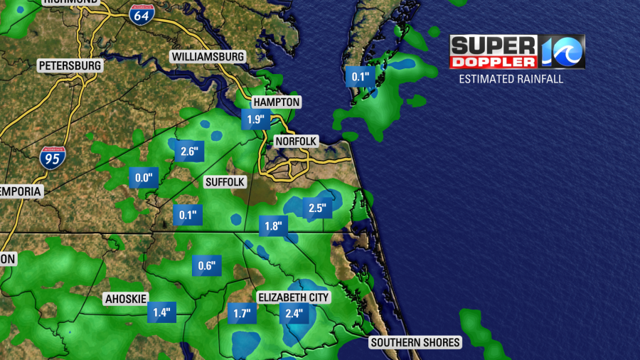
The rain not only cooled things down, but a little dry air got into the area as well. So this morning wasn’t a steam bath like other mornings.
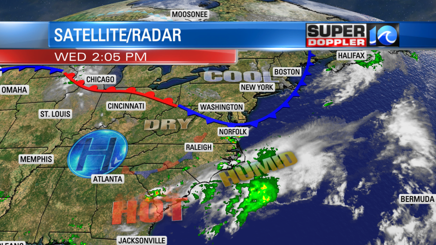
Today the front is starting to head back north as a warm front.
Heat and humidity are rising again. We’ll have some quiet weather locally today with lots of sunshine. Notice though that there is a cluster of showers and storms near Chicago. There is a potential that this cluster could turn into a Derecho (large organized storm with strong damaging straight-lined winds). If it does, then it would likely ride along the front to the east/southeast. That could produce some severe weather just to our north today, but I don’t think it would get this far south. Stay tuned for updates on that through the day in case it does change its track.
So if the forecast models pan out, then we’ll have lots of sun here today with only some isolated pop-up showers or storms in the region. High temps are aiming for the low 90s with heat indices in the upper 90s to near 100.
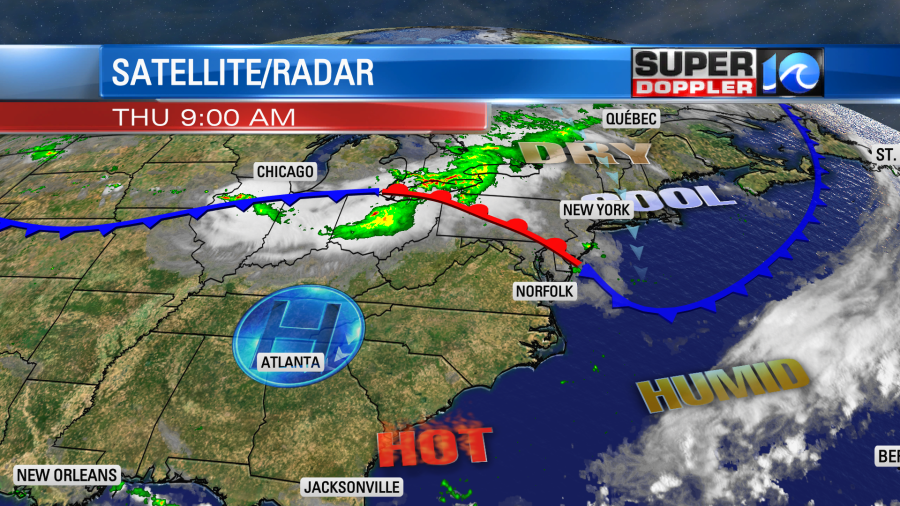
Tomorrow the cool front in the Midwest will drop down this way. We’ll still be hot and humid Friday. High temps will be near 90 with the heat index in the mid-upper 90s. However, drier air will filter into the region through the day. There will be some isolated showers or storms with a higher chance for rain in North Carolina in the evening. This will be as the front settles south.
By Saturday the front will sink a little more to the south. We will have a very cool and dry day for the last day of July. High temps will be in the low 80s. Dew points will drop down all the way to the mid 50s.
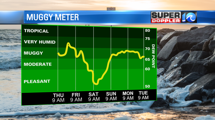
This will be a little taste of early Fall. Skies will be partly cloudy, and no rain is expected at this time. By Sunday the front will drift north slightly, but we should still be on the cool side of the boundary. However, this will put rain back in the forecast. We’ll have mostly cloudy skies with scattered rain showers. High temps will be in the low 80s, but some models suggest we’ll only top off in the upper 70s. We’ll see.
The pattern looks like it will be pretty stuck for at least the first half of next week. The front will stay stalled out over the east coast (including our region). We’ll have mostly cloudy skies with scattered to occasional showers and storms from Sunday through at least Wednesday.
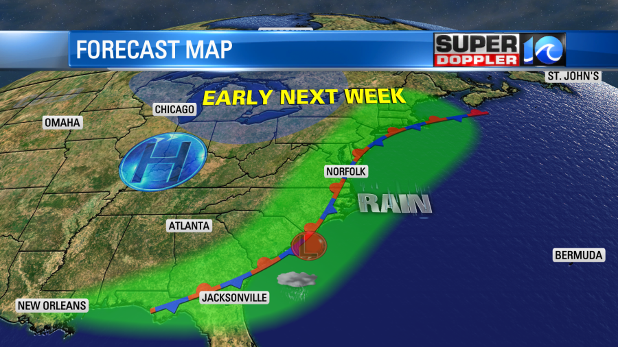
There will also be an upper level trough overhead through that time. Plus, there will be a lot of moisture along the front near the surface. These could possibly enhance the rainfall in the region. So stay tuned for updates on that.
Meteorologist: Jeremy Wheeler