
I think folks are ready to ship out this cold weather of late. Luckily we are going to do just that…AFTER this morning. High temps were only in the 40s yesterday. It was seasonably cold and breezy, but at least it was dry. Then we stayed dry this morning with temps dropping into the 20s and 30s. Today there is a large are of high pressure that is controlling the eastern 2/3rds of the country.
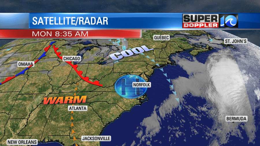
There will be a lot of sunshine in the region. Winds will be light and out of the northwest. With the strong March sun temperatures will warm to the low-mid 50s this afternoon. It should be pretty nice out.
Tomorrow the center of the high pressure zone will drift slightly to the east. This will let our winds turn out of the southwest. All of the warm temperatures that have been building to our west over the last couple of days will finally slide east. So our local high temps will bump up to the 60s.
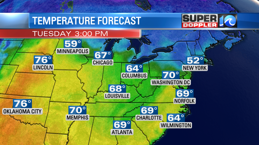
We’ll stay dry with lots of sunshine. So Tuesday will be an awesome day! It gets even better. We’ll be in the 70s Wednesday through Friday with lots of sunshine. This will be about 15-20 degrees above average. That’s great weather for outdoor activities, and it will give us more time for the ground to dry out. Our next chance for rain is next weekend. For now I’ve got it as a low chance, but I’ll go more into that in tomorrow’s weather blog.
One last thing…In national news I’ve been seeing more and more articles about the drought out west. Many states are in an “exceptional drought” including parts of California and Texas.

Luckily there will be some scattered rain and snow showers over the western U.S. over the next few days. It won’t be enough to fix the drought, but maybe it will make a small dent for some areas.
Meteorologist: Jeremy Wheeler


