We are going into a bona-fide heat wave this weekend. Luckily it won’t last too long. However, I think we are going to have a very hot Summer as I read the tea leaves….
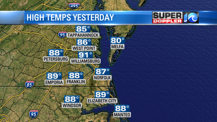
Yesterday we did start warming up, but the humidity still wasn’t too bad. Plus, there was a breeze.
Today will be a different story. We have a slow-moving warm front to our north with high pressure to the southeast.
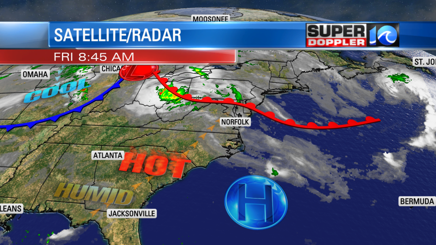
Meanwhile, over our heads the jetstream is rising far to our north. This “ridging” is going to limit the amount of rain and clouds in the region today.
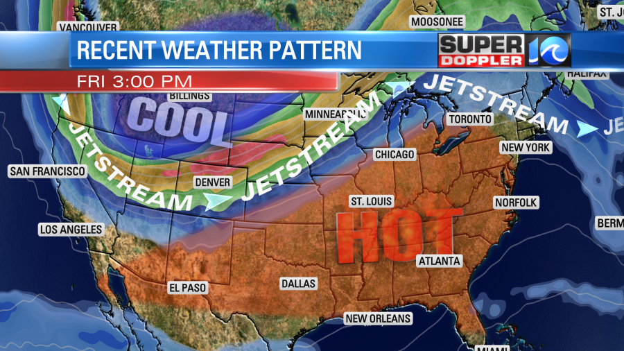
The recent heat that has been building over the central U.S. is pouring east. Keep in mind that it was hot over parts of the Rockies recently too, but they are actually expecting a snow storm around Denver. Here is an article with more information about that: Denver snow.
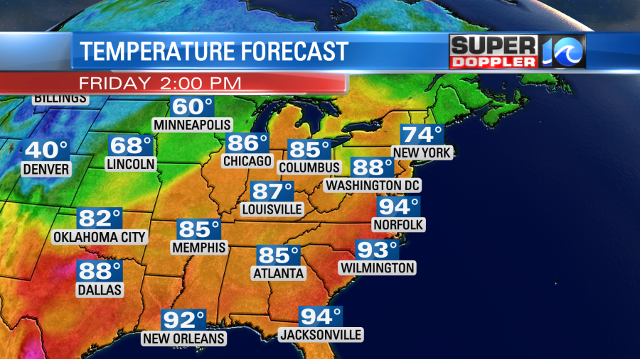
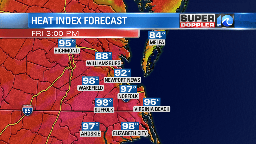
Back to our heat… We started off this morning with partly cloudy skies and temps in the 60s and 70s. We were already rising into the upper 70s by 8:30am. We will aim for the low-to-mid 90s this afternoon with some mid-upper 90s inland.
Dew points have risen to near 70 degrees.
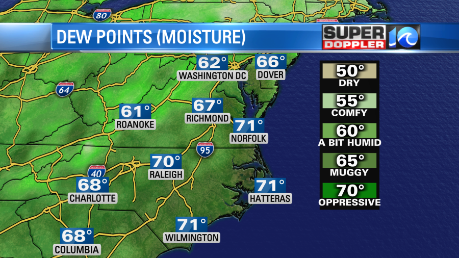
Remember, the higher the dew point the higher the humidity. When you combine the heat and humidity you get the heat index. Today our heat index will be in the mid-upper 90s.
The average high temperature for this time of year is in the upper 70s. The record high for today is 98 set back in 1996. So we likely will not tie or break that record. It won’t help that there will be a good amount of sunshine. Plus, there is much less wind. It will only be out of the southwest at 5-10mph.
Tomorrow the heat will build further. High temps will run more into the mid 90s. The heat index will probably be near 100.
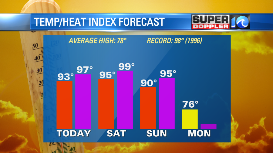
The record high temp for tomorrow is a little lower. It is 94 degrees (1996: Norfolk). So we probably will tie or break that record. We’ll have a near-repeat for the weather. Skies will be partly sunny with a light southwest wind. There may be a stray pm shower or storm. However, I to think there will be a few more showers and storms in the evening tomorrow.
We’ll be a little less hot on Sunday. High temps will be closer to 90 degrees, but the heat index will still be in the mid 90s. We’ll be partly cloudy with a few showers and storms late in the day. The chance for rain will increase Sunday night as a cold front moves into the area. This will really cool us down early next week. High temps will be in the 70s Monday and Tuesday with mostly cloudy skies. We’ll have scattered rain showers both days.
Be sure to treat the heat with respect. Don’t take it for granted. Stay hydrated! Take plenty of breaks in the shade. Keep the pets cool and hydrated too.
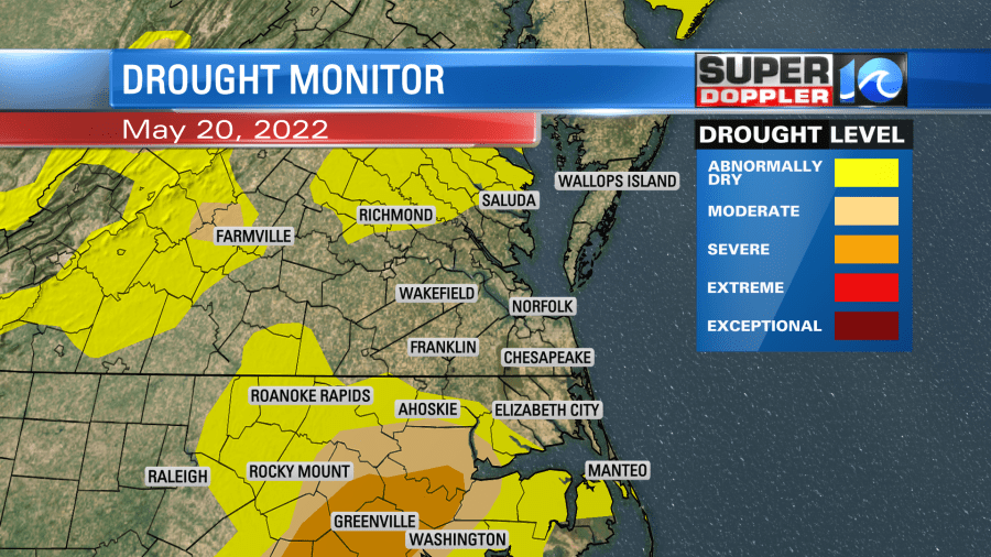
In regional news… We did knock down the ongoing drought in some spots this week, but it is still going strong (unfortunately), over parts of North Carolina.
We’ll have a decent chance for some more rain next week.
Meteorologist: Jeremy Wheeler