This weekend was rough! We had a lot of reports of flooding in the region. An area of low pressure was moving through the area, and the moisture was very rich and deep. There were several areas of heavy rain that stayed pretty static.
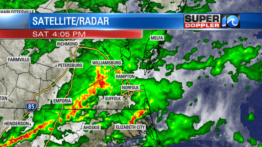
However, the area of rain that sat over Surry County just did-not-move!

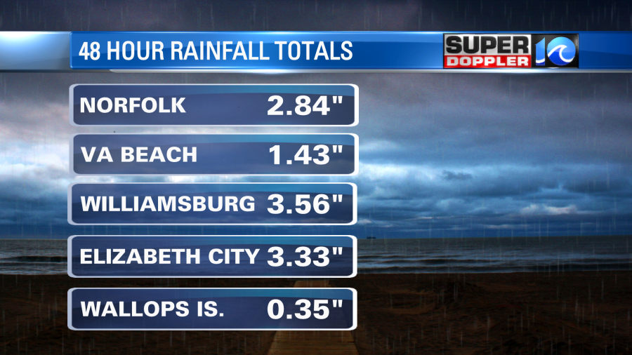
The radar estimates were around 10-11″ there. There were a few reports of rain totals close to 10″ in the northern part of that county. Here were the 48 hour rain totals from other areas.
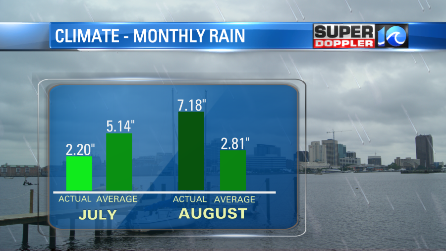
Norfolk had a dry first half of July, but then late July into early August the rainfall has been way above average
On Saturday we had the area of low pressure on top of us. However, on Sunday that system is slowly moving out to sea.
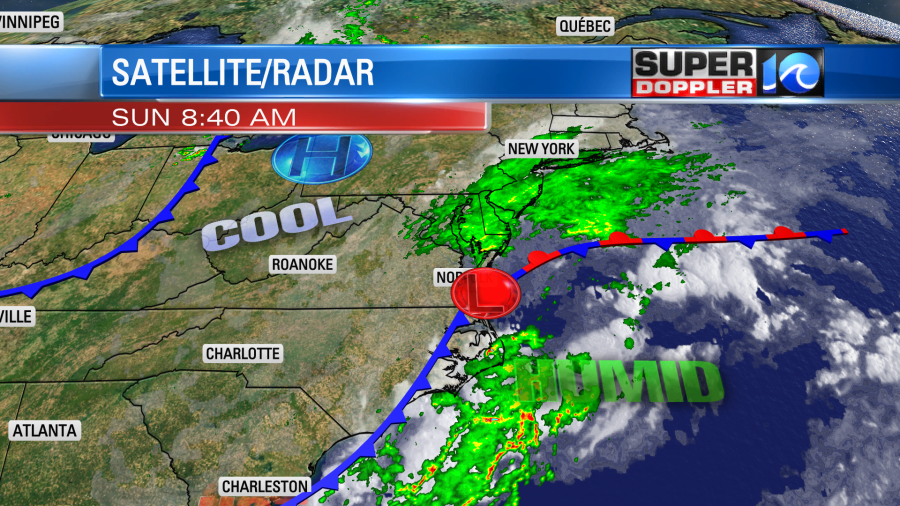
We’ll have some moisture wrap around on the back side of the low. However, the very deep layer of moisture that sat over us yesterday is sliding east today. So there will be scattered rain showers, but they won’t be as heavy nor as widespread as yesterday.
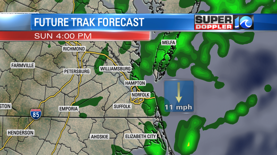
We’ll hopefully, dry up a bit inland this afternoon. Then we’ll dry out over the whole area this evening. Rain totals will vary. Much of the region will see about 0.25″-0.75″ of rain. Some locations still could see over an inch and a half, but these spots should be much more limited.
We’ll have a north/northeast breeze today. So at least we’ll be relatively cool again. High temps will be in the lower 80s. The wind will run at 8-12mph.
Tomorrow the low will be out to sea. We’ll be drier with partly cloudy skies. There will be some isolated showers possible. Another cool front will sweep through the region tomorrow evening. This will bring in a few scattered showers, but not much.
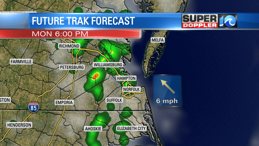
Behind that front we’ll dry out even more. High pressure will build in. So for now….I don’t have any rain in the forecast for Tuesday. There will be some moisture returning on Wednesday. So we’ll have more scattered showers and thunderstorms in the afternoon. The rain chances increase again Thursday and Friday. Can’t wait! (painful sarcasm).
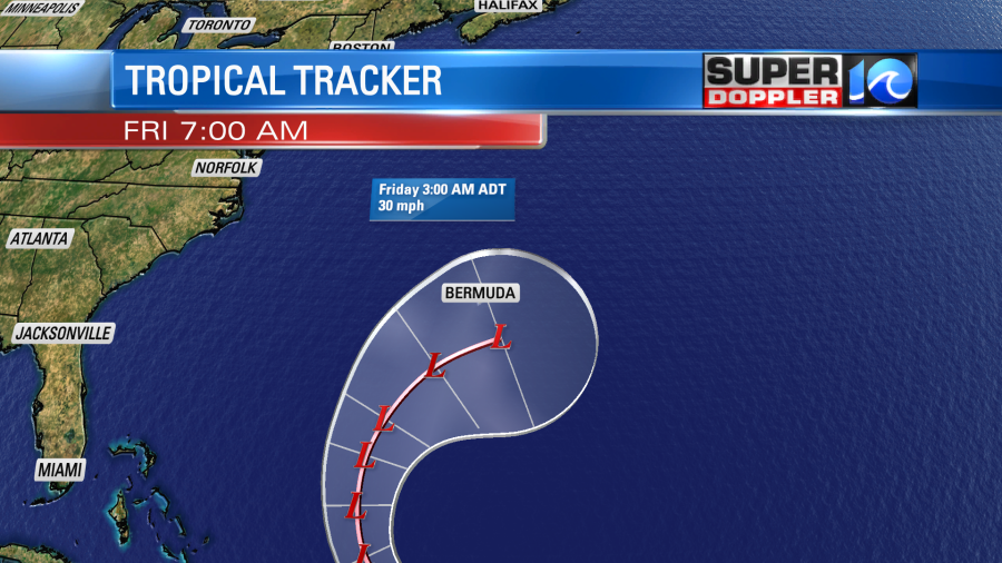
There is only one official tropical system this morning in the Atlantic. Tropical storm Kyle has fallen apart over the north Atlantic. Tropical storm Josephine is barely hanging on as a tropical system. It is forecast to move north and then northeast. It will become a weak non-tropical area of low pressure as it move close to Bermuda later this week.
They should have minimal impacts. There are two weak disturbances in the central and eastern Atlantic.
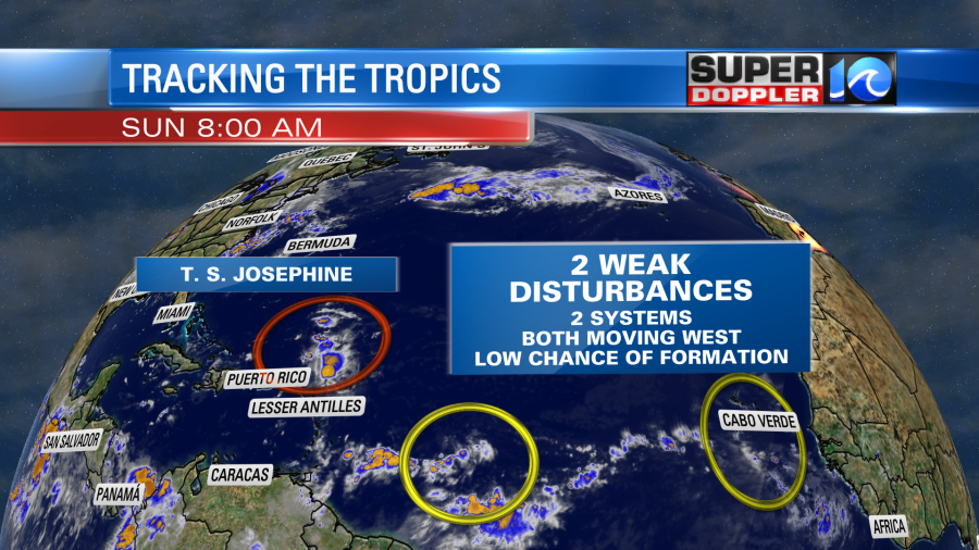
Both have a low chance of formation as they move west. However, we’ll have to watch the one that is farther out in the long-term.
Meteorologist: Jeremy Wheeler


