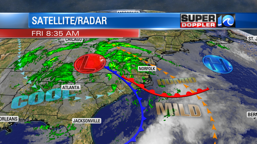
Today is definitely a windy and rainy day. We have a big area of low pressure off to our west. There are a couple of fronts to our south that are streaming northward, and high pressure is sliding farther offshore.
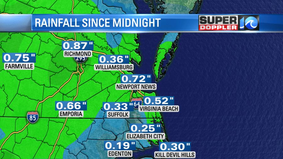
So far we’ve had about a quarter to a half an inch of rain since midnight.
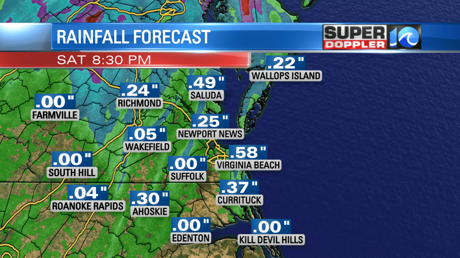
We will get another quarter to half inch of rain today into this evening.
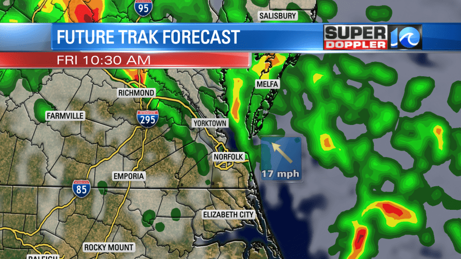
The rain will cover a large area this morning through noon. There could be a few thunderstorms by the late morning and midday.
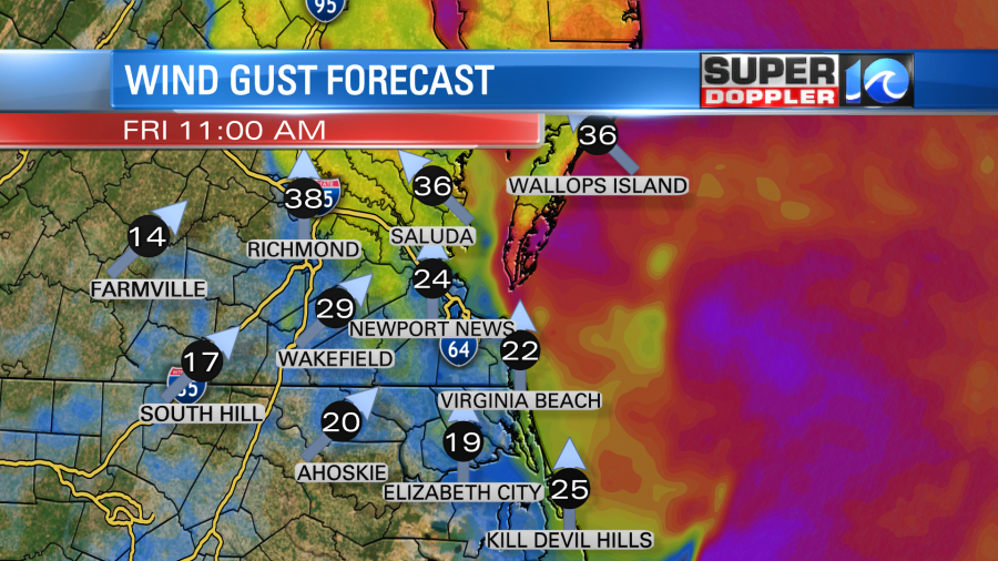
Winds will run out of the southeast at 10-20mph with gusts 25 to 35mph. There may briefly be a few gusts to 40mph near the shore.
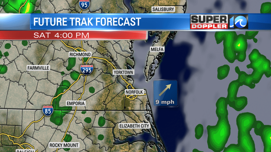
After the front moves through the wind will turn out of the southwest. This is rare, but not exceptional. Dry air will actually push in from the southwest. However, there will still be some strong upper level winds (shear). Plus, the upper level low will stay overhead for a while. So rain showers will become more scattered this afternoon. There will still be a few thunderstorms possible.
Winds will decrease this afternoon to 10-15mph out of the south/southwest with gusts up to 25mph. High temps will be in the low-mid 70s. We won’t really cool down behind the front, but drier air will filter in.
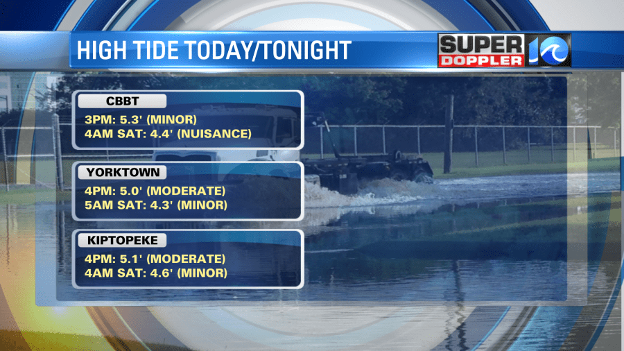
Tidal flooding will be an issue today. The strong southeasterly then southwesterly winds will push the water up into the northern Chesapeake Bay. So the worst of the tidal flooding will be between the Eastern Shore, Middle Peninsula, and Northern Neck. The lower Chesapeake Bay will only have minor tidal flooding this afternoon between about 3 and 5pm.
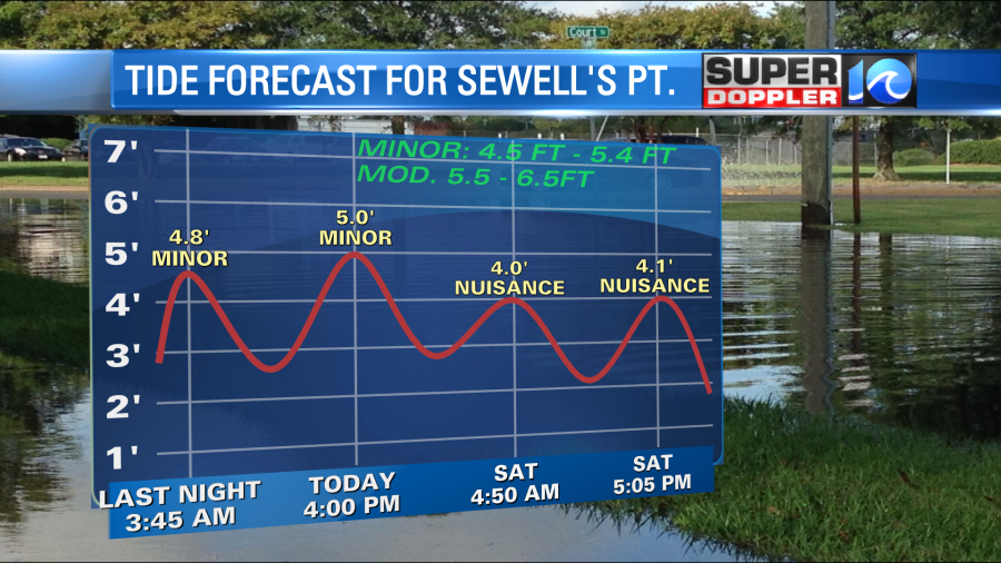
However, it will be solid moderate tidal flooding from Kiptopeke and Yorktown northward.
The tide will be less tonight and tomorrow, but some minor tidal flooding will linger. It will improve by Sunday. There are also some high waves along the shore. So there could be some minor beach erosion in some places.
We’ll dry out tonight with only some spotty showers and partly cloudy skies. Temps will drop to the 50s as the cool front lifts to our northeast.
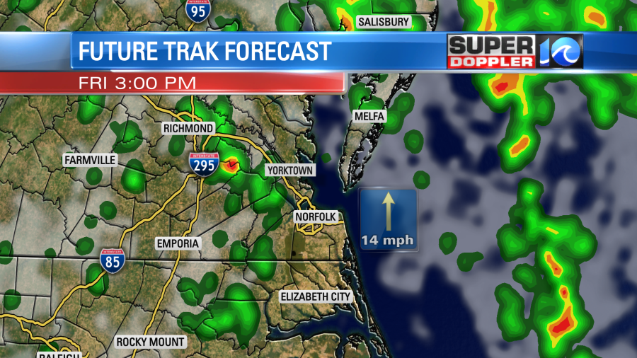
We’ll be cool and drier tomorrow. High temps will be near 70. We’ll have a mix of sun and clouds as the upper level low only slowly lifts to the north. Our Future Trak model suggests that clouds will briefly increase later in the day with some isolated showers.
Sunday is still looking good for Halloween. We’ll have partly cloudy skies. High temps will be in the upper 60s during the day. Temps will fall to the low-mid 60s in the evening.

The forecast could change a little. So check back for updates on that over the weekend.
Meteorologist: Jeremy Wheeler


