Locally, we are going to have a lot of rain and wind today….again. We had a lot of rain on Monday. Then it was dry and cold yesterday. Today the wet weather returns. There is an area of low pressure developing to our south. It is going to plow right through our region, and it is surrounded by a lot of moisture.
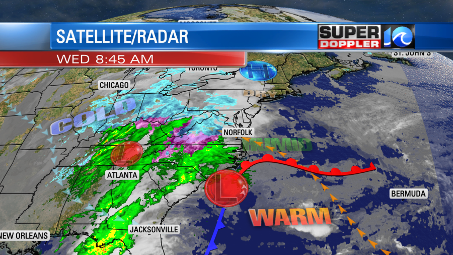
There is another smaller low over in the Tennessee River Valley, but it is actually weakening as it moves east. So far we’ve only had a few spotty showers. However, rain is forecast to become widespread by midday.

It may be light at first, but as the low pressure system creeps closer to Hampton Roads the rain intensity will increase. So widespread/heavy rain will be possible during the afternoon.
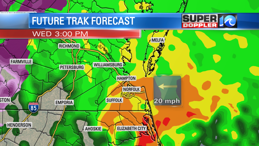
There may be a couple of thunderstorms in the area today. Especially towards the Outer Banks where it will be warmer and more humid. High temps will be in the upper 50s to near 60 degrees with plenty of 60s from Virginia Beach southward. Temps may only be in the upper 40s to low 50s north of the metro though. Winds will be out of the east/southeast. They will run at 10-20mph with gusts between 25-35mph.
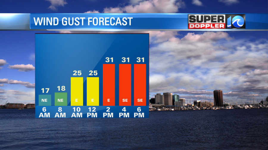
There will be some nuisance tidal flooding, but luckily the strongest winds will come around low tide this afternoon/evening. A few locations may have up to “minor” tidal flooding levels, but there shouldn’t be any big problems.
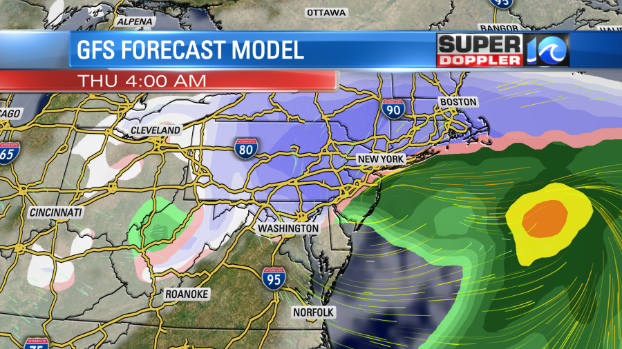
The low pressure system will move up into the northeast states tonight into tomorrow. We’ll dry out overnight, but they will start to rev up the snow machine there by tomorrow morning.
Before it wraps up we could see about a half inch to an inch and a half of rainfall.
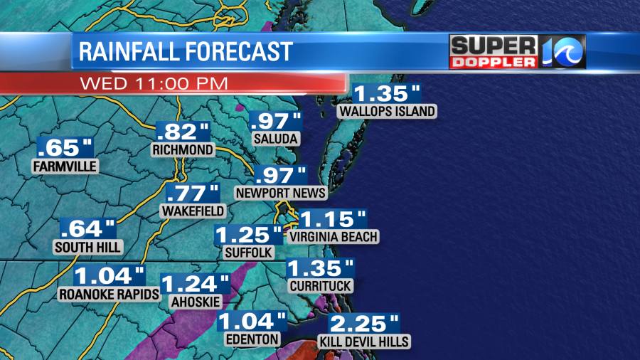
This isn’t too bad by itself, but it just rained on Monday. So poor drainage and a soaked ground could create some localized flooding.
We’ll be mostly dry, chilly, and breezy tomorrow as high pressure builds into the region. There may be a stray shower, but I think the bulk of the area will have a mix of sun and clouds. High temps will only be in the mid 40s.
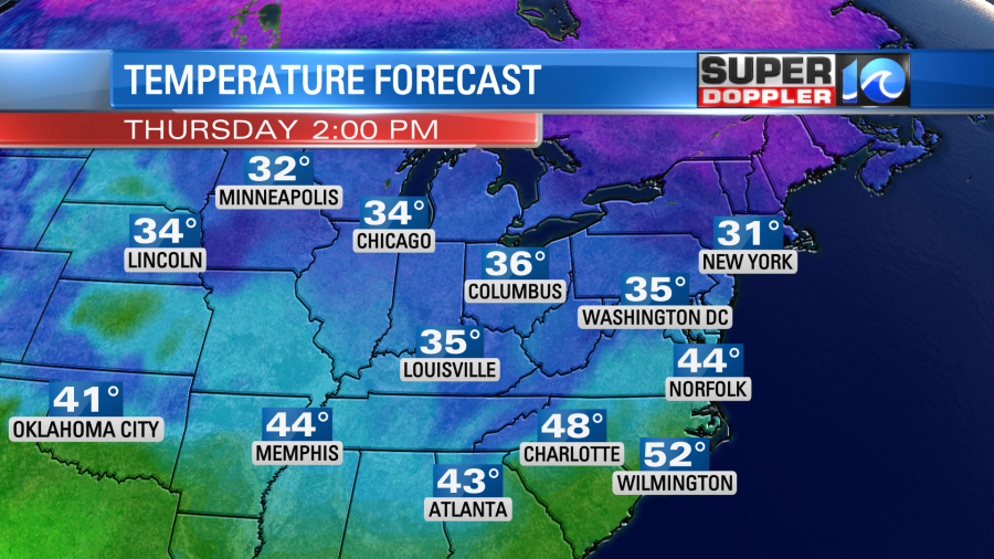
We’ll be dry and chilly again on Friday and Saturday. High temps will be in the 40s.
One last thing…Looking at some of the models there is a chance that we could have a couple of sprinkles or flurries tomorrow evening. An upper level low will be sitting on top of us. It will be dry at the surface though. So for now I think only sprinkles or flurries, but stay tuned for updates.
Meteorologist: Jeremy Wheeler


