
I thought that we had broken a record with the number of simultaneous tropical systems in the Atlantic the other day. There were 5 named systems at the same time yesterday. However, I saw on the internet that there were 6 at one time in 1971. 5 of them were named along with (I believe) a tropical depression as well. Still… this is a historic year. We will likely tap into the Greek alphabet soon, and I bet we tap into about 6-8 of those. We’ll see.
Rene has fallen apart since yesterday. So now we have 4 named systems. However, another one may be forming in the eastern Atlantic.
Hurricane Sally is the one that is threatening the U.S. It is off the Gulf coast this morning. It actually weakened a bit overnight.
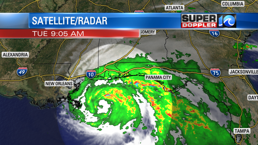
It was a category 1 hurricane this morning with sustained winds of 85mph. There may be some upwelling as the storm is not moving much. This is cooler water that gets pulled up from underneath the storm. Without much movement the cooler water can weaken the core. However, there is a lot of heavy rain that is moving onto shore already, and the storm has a way to go before it moves out of that region. Sally is forecast to make landfall tomorrow morning near Mobile, AL.

There could be a 9ft storm surge down there, and a lot of water is likely going to stack up in those waterways like Mobile Bay. There is still some uncertainty in the exact track as it is in an area of weak steering currents. That is partly why it is no longer aiming for New Orleans. After that point the system is expected to weaken as it moves to the north/northeast. It will likely turn more east in a couple of days.
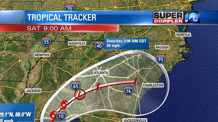
Then it will become either a depression or post-tropical low. The bulk of the models do keep it to our south, but they do pull up a lot of moisture from the system into our region. This moisture would get wrapped up into a cold front moving in from the north. This could bring us quite a bit of rain. Not as much as across Alabama. They are expecting about 10-15 inches from the storm. However, we may see a couple of inches in our region. Here is the GFS forecast for rainfall.

The European model keeps Sally (or the remnants of it) to our south as well, but it has the rain more Friday into Saturday morning. This would be a difference in the timing of the cold front as well as Sally itself. After that point we will have some nice/cool weather this weekend. High temps may be in the upper 60s to low 70s on Saturday. Low temps will likely be in the 50s and 60s this weekend.
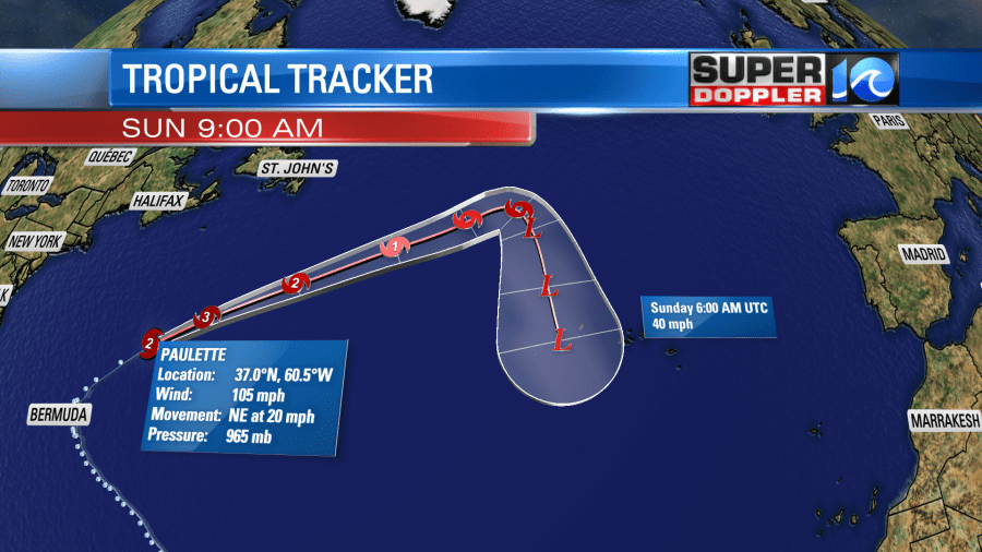
Now let’s talk about Paulette.
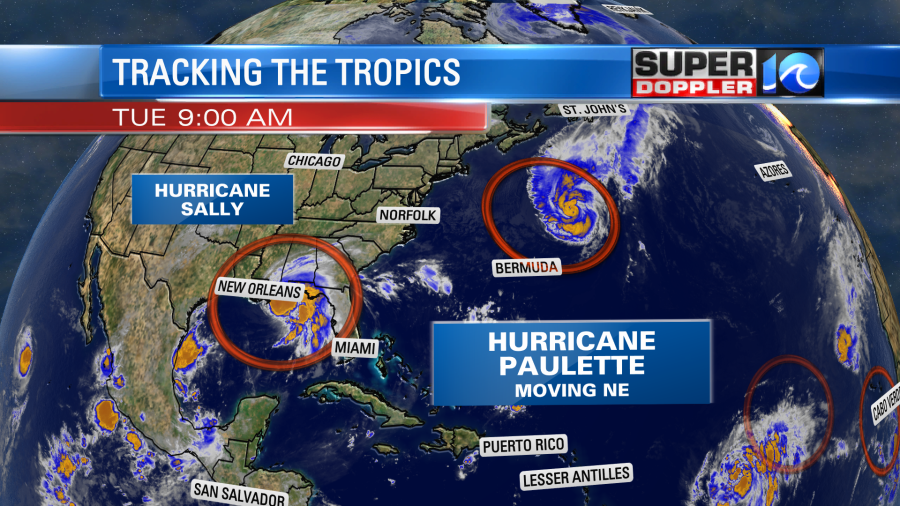
Paulette is moving fast to the northeast. It is moving away from us and away from Bermuda. However, we are getting some high waves today.
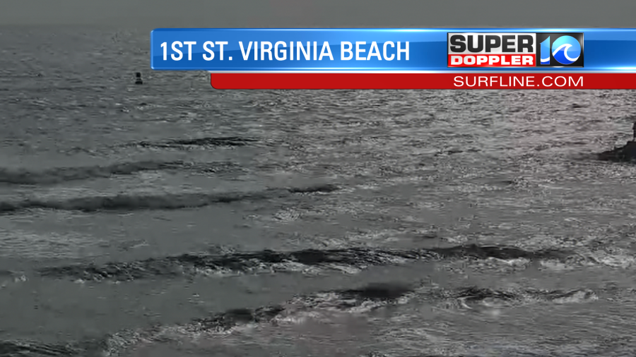
The waves may reach up to 6 feet along the shore in some places. Near shore a few waves could briefly reach up to 9ft. This is dangerous for swimmers. There is a high threat for rip currents and rough surf. Experienced surfers only today, and even then swim with a buddy and near a life guard. Luckily that is the only effects that we’ll have from Paulette. It is forecast to weaken to a depression or post-tropical low in a few days near the Azores islands
In the central and eastern Atlantic there are tropical storms Vicky and Teddy.

Vicky is weak, and it is expected to fall apart in a couple of days as it moves generally west. However, Teddy is forecast to strengthen as it moves to the northwest.
The track takes it closer to Bermuda in a few days. We’ll see if it stays on a northwest track, or if it will bend more to the north.
There is another tropical disturbance that just came off of Africa. It has a high chance of formation over the next couple of days as it moves generally west. There’s even a couple more disturbances out there, but they have a low chance of formation.
Locally, we have some nice weather in the region today. There is a big area of high pressure to our north. There is a stationary front to our south.
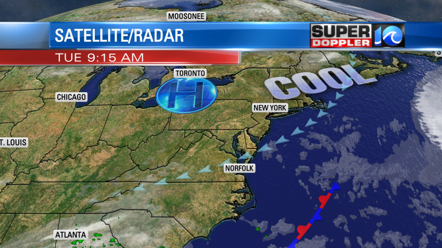
We’ll have fair skies today with high temps in the mid-upper 70s. We’ll have a northeast breeze at 10-15mph. There could be a sprinkle or two coming in off of the ocean, but it will be tough for it to reach the ground with all the dry air in place. Tomorrow, we’ll have much of the same. Then we will probably see rain moving in Thursday into Friday. However, remember, the timing may change on that. So stay tuned for updates.
Jeremy


